Highs Into The 90s Today Very Warm Humid Week Ahead
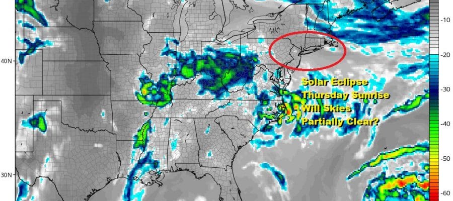
Solar Eclipse Outlook Not Promising

Weather in 5/Joe & Joe Weather Show Latest Podcast
Highs Into The 90s Today Very Warm Humid Week Ahead
Solar Eclipse Outlook Not Promising
Overnight lows barely broke the 70 degree mark in most places the the launching pad was set for blast off today. We have a satellite view that shows nothing but clear skies so that gives us sunshine in full force for today. The radars are quiet and we don’t expect any thunderstorm development in spite of solid daytime heating and dew points in the 60s. The atmosphere is just too stable.
SATELLITE

When it is all said and done, highs temperatures this afternoon will average in the lower 90s. Some places could see numbers push up to 95 or so while coastal areas will be cooler once the sea breeze takes hold during the afternoon. Dew points will reach the lower 60s on average which indicates moderate levels of humidity.
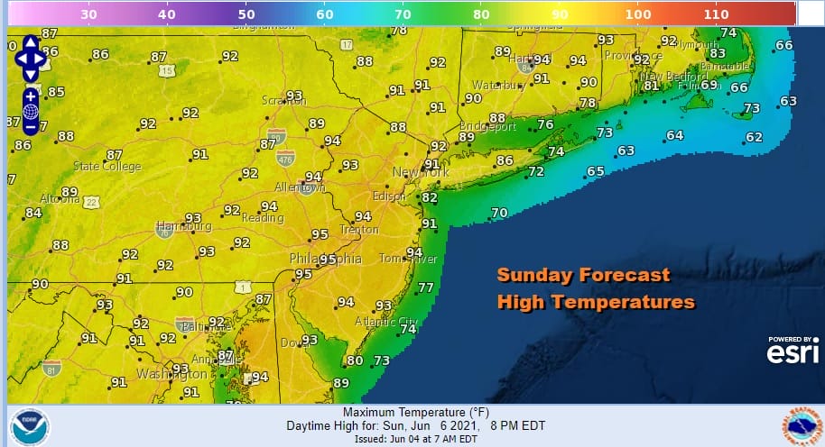
A warm night lies ahead under clear skies with lows again in the mid 60s to lower 70s. This sets us up for another hot humid day Monday with sunshine. The wind will be more south southwest which will make little difference for highs inland but south facing shorelines like Long Island and Southern New England will probably see highs mostly in the 80s. Inland highs will again reach 90 degrees or higher.

There is a slight chance for an isolated thunderstorm Monday evening. They will be few and far between but the atmosphere does become more unstable Tuesday bringing clouds and some sun and perhaps some scattered showers or thunderstorms. Less sun and more clouds will probably mean highs will be in the mid 80s to near 90 Tuesday afternoon. Humidity levels will be higher Tuesday reaching above 70 in many places making Tuesday a very uncomfortable day indeed.

A cold front drops south on Wednesday from Eastern Canada creating another hot humid day with the risk for late day thunderstorms. Temperatures will reach up near 90 degrees again or even low 90s inland if we get enough sun. The front should pass but it looks to slow down and stall out for Thursday morning.
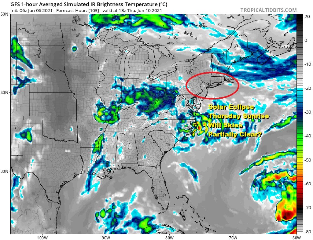
The front stalls out close by and it is weak. Thursday morning at sunrise we have an annular (meaning ring) solar eclipse which will create a rather spectacular view of an eclipse at sunrise. It will be a partial eclipse but nonetheless, the sun rising in a partial eclipse state will be something to see if skies partially clear behind the stalled front. The GFS simulated satellite suggests that there is a chance for at least some partial clearing Thursday morning before clouds roll in from the west. Timing is everything of course and this makes the situation for Thursday morning a bit tenuous. The front does nudge a little south as the day wears on leaving us in clouds and sun, and temperatures in the 80s. Fingers crossed that we get enough clearing to allow for viewing the eclipse but PLEASE do so safely with eclipse glasses.
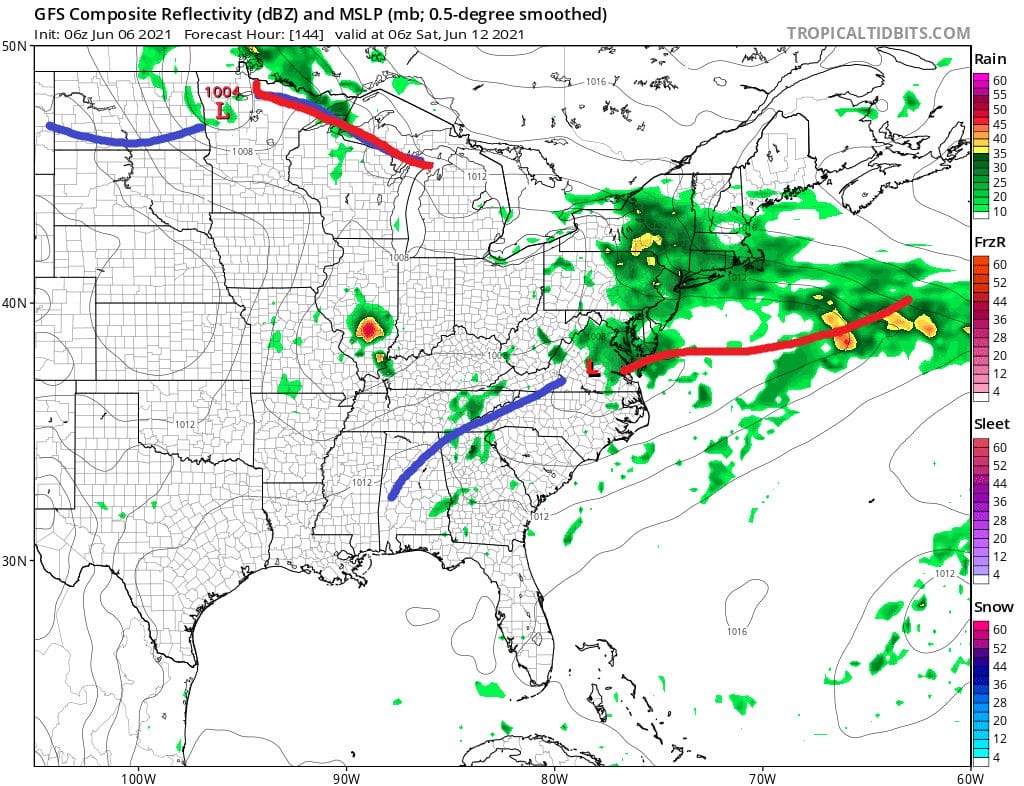
Models indicated some wave action Thursday night and for Friday bringing shower and thunderstorm risk for this timeframe with highs in the 70s. Low pressure should move away Satuday allowing for improvement and cooler and less humid conditions for next weekend.

BE SURE TO DOWNLOAD THE FREE METEOROLOGIST JOE CIOFFI WEATHER APP &
ANGRY BEN’S FREE WEATHER APP “THE ANGRY WEATHERMAN!
MANY THANKS TO TROPICAL TIDBITS FOR THE USE OF MAPS
Please note that with regards to any severe weather, tropical storms, or hurricanes, should a storm be threatening, please consult your local National Weather Service office or your local government officials about what action you should be taking to protect life and property.


