High Winds Severe Weather Possible Snow Chance Friday Saturday
High Winds Severe Weather Possible
Snow Chance Friday Saturday
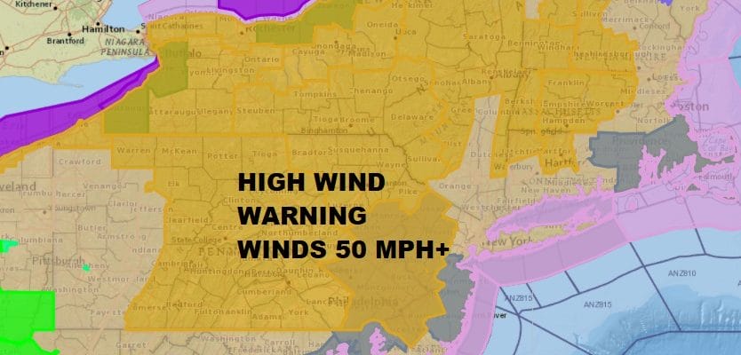
HIGH WIND WARNING INLAND AREAS NEW JERSEY & ALL OF PENNSYLVANIA
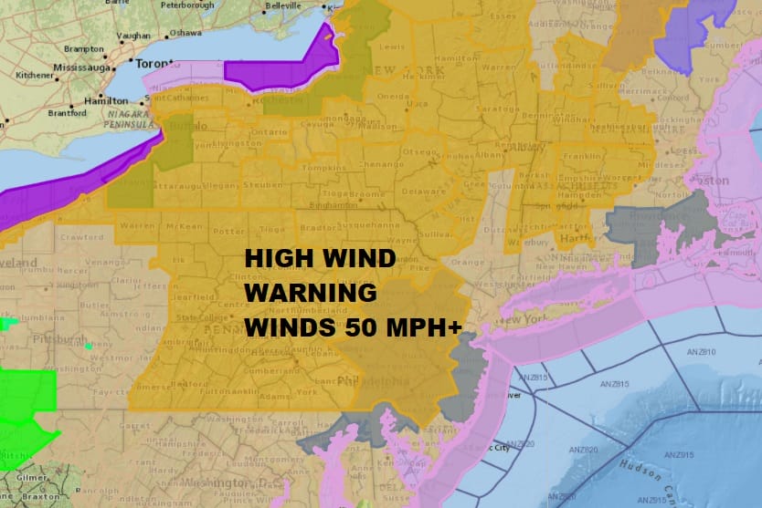
A strong cold front is approaching this morning as an intense storm heads up the Saint Lawrence Valley into Northern New England. Winds are already strong and gusty inland and a High Wind Warning is in effect for Western New Jersey counties and most of Pennsylvania and the Catskills. Winds will gust to 50 mph or more later this afternoon into this evening.
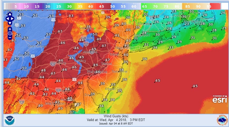
With the cold front comes thunderstorms today as temperatures ahead of it rise into and through the 60s in many locations away from the coast. The Storm Prediction Center of the National Weather Service has a marginal risk of severe weather reaching into Northern New Jersey with a general risk for thunderstorms everywhere.

Satellite and radars this morning show what is probably the beginning of a line of downpours and thunderstorms developing in East Central Pennsylvania and moving to the east. The main threat time will be from noon until 5pm as these thunderstorms move across with a cold front. Whether they get strong or not will hinge on how much daytime heating occurs into this afternoon. Low clouds are stubborn in places which may cut the heating down. On the other side, the upper dynamics are strong enough to support at least some thunderstorm development.
US SATELLITE

REGIONAL RADAR

LOCAL RADAR NEW YORK CITY

LOCAL RADAR PHILADELPHIA


Once these storms play through winds shift to the northwest, skies clear and it turns colder tonight with most lows by morning in the upper 20s to middle 30s. Thursday looks sunny but cold with highs just in the 40s. Then comes thr first shot of winter weather for late Thursday night and Friday morning as low pressure moves into Western Pennsylvania and Western NY.
NAM MODEL FRIDAY 5AM APRIL 6, 2018
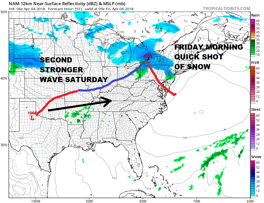
This amounts to a quick burst of snow Friday morning around daybreak and could leave a coating to an inch or so in some places in Northern New Jersey, the Hudson Valley & Connecticut. Once we get past mid morning it is done and what falls melts. The second and more important shot comes late Friday night into Saturday morning (kind of looks like what happened Monday morning) as a fast moving wave of low pressure passes by to our south. Once again, time of day and intensity of snow will determine what we get from this.
NAM MODEL SATURDAY 8AM APRIL 7TH
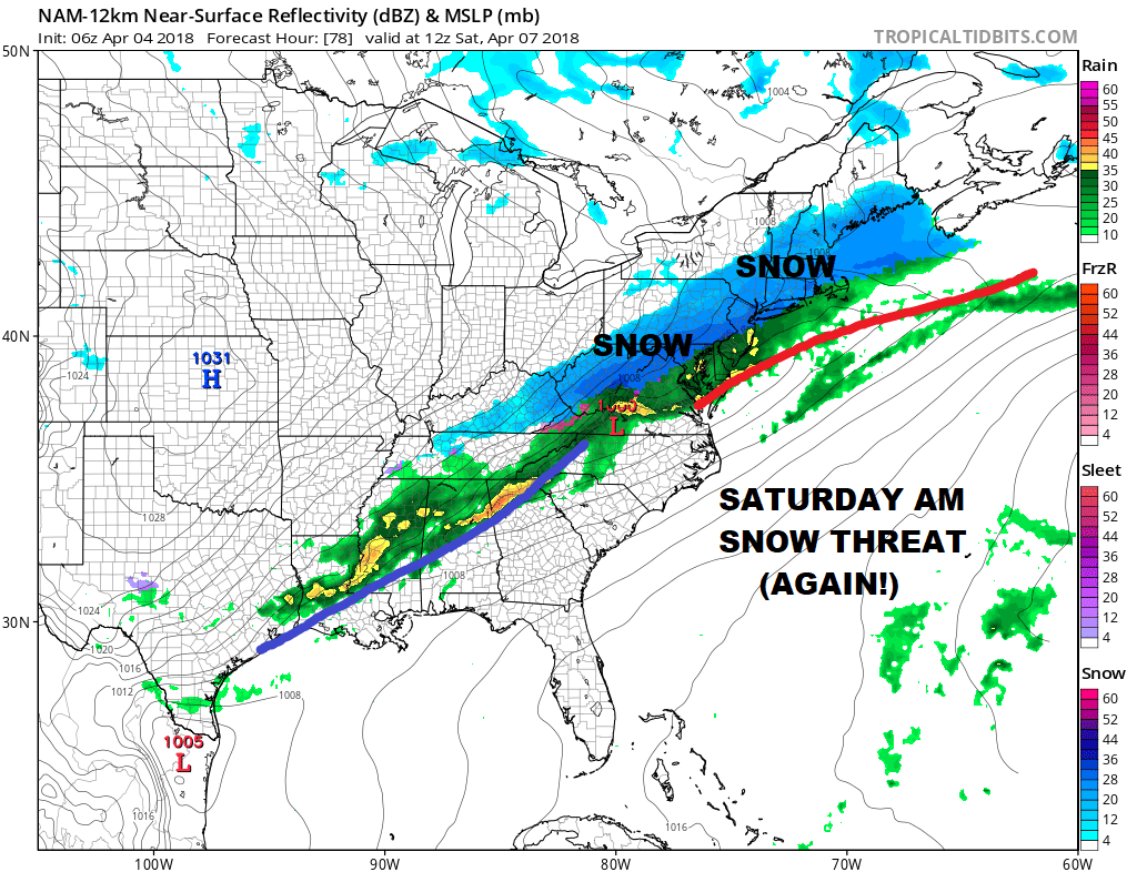
Right now I will say what I said the last time..what falls before 9am sticks to most surfaces including paved surfaces if it snows hard enough…after 9am probably confined to colder surfaces..several slushy inches are possible from an area bordering on Route 195 in Central New Jersey to the south and Route 84 to the north. This all ends early afternoon Saturday and then weather conditions improve for Sunday. A third system threatens early next week but as we always approaches these things one at a time we will address this after the first 2 are done.
 GET JOE A CIGAR IF YOU LIKE

FiOS1 News Weather Forecast For Long Island
FiOS1 News Weather Forecast For New Jersey
FiOS1 News Weather Forecast For Hudson Valley


