
It looks like we could be putting together a string of 90 plus days that will take us through the entire week. That’s a heatwave! The heatwave will begin in some areas today as not everyone will go over 90 and then the heatwave extends to the entire region the entire work week ahead. The upper pattern is pretty well locked in place with a ridge in the eastern half of the United States and a trough in the western states. The mean jet stream positions are pretty well locked up in place since nothing in the upper atmosphere appears to be moving at all. Everything seems bottled up thanks to ridging in the northeast Atlantic that is very strong and troughing in the western states which is very deep.
 Until we get something to break this all down we are locked in the long haul and other than perhaps a back door cold front late this week, temperatures will either be above or much above normal for the next 10 days. The string on 90 degree plus days should be at least 5 or 6 with perhaps a little break at the end of the week. Beyond the 10 day period it looks like it finally breaks down to some degree but we have a long hot weak and a half to get there.
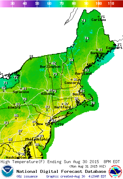
The day to day result this week will be sunshine by day with just a few clouds and some clouds at night. Highs will be near 90 today and into the 90s all week. Longer nights now mean the nighttime temps get to go down a little lower…60s to low 70s on average. No rain is in the forecast the entire week and I would not at all be surprised if we don’t see even an isolated shower or thunderstorms for the next 10 days or so. The dry pattern that we have been in since mid spring just shows no signs of letting go.


