Heatwave Day 5 Severe Weather Threat
[brid video=”55884″ player=”6390″ title=”Tropical Storm Darby”]
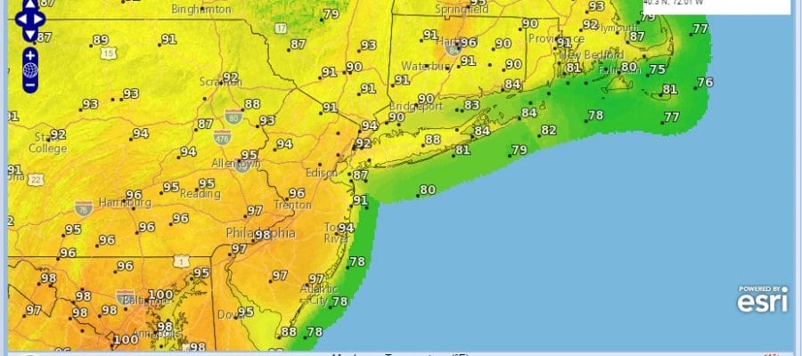
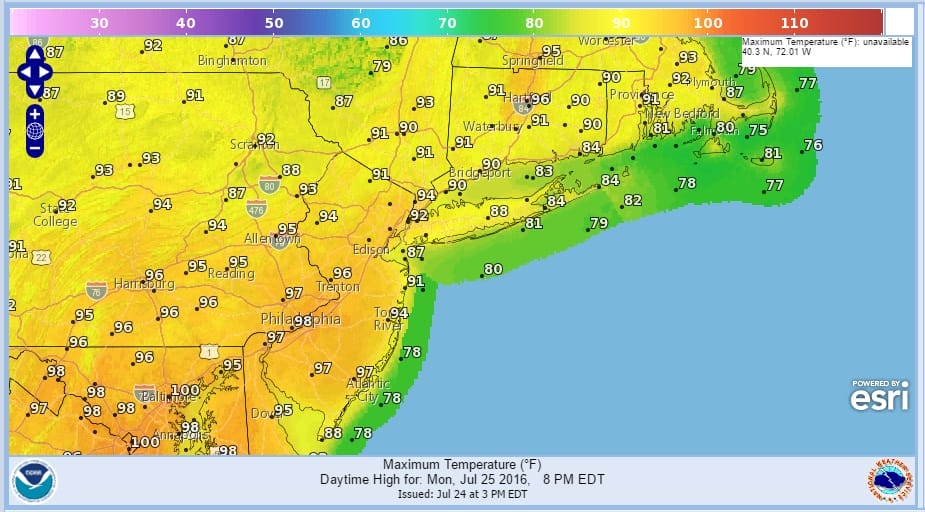
Monday will be Day 5 of our heatwave with temperatures rising to 90 to 95 in most areas though it will be in the 80s to near 90 along coastal areas of Long Island. Humidity will be coming back on Monday and there will be the risk for scattered thunderstorms in the morning as the humidity comes in and in the evening when the cold front arrives.
HEATWAVE DAY 5 MONDAY FORECAST HIGHS
HEATWAVE DAY 5 MONDAY FORECAST DEW POINTS
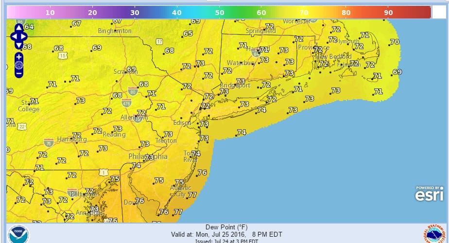
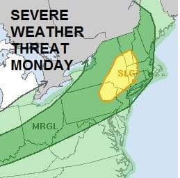
The dew points really shoot up on Monday which means the air will be saturated with tropical air and it will feel like Florida. The high dew points and instability in the atmosphere has prompted the Storm Prediction Center of the National Weather Service to put Northwest New Jersey, Eastern Pennsylvania, and the Hudson Valley in a slight risk for severe weather. The risk area also extends into Northwest Connecticut. Marginal risk for severe weather exists everwhere else in New Jersey Pennsylvania to NYC, Long Island and the rest of Southern New England.
HEATWAVE SEVERE WEATHER THREAT MONDAY STORM PREDICTION CENTER
The new NAM model just issued has backed off from much thunderstorm action in the morning which is not a surprise. Anything that is around in the morning looks to be scattered in nature and other than a few passing scattered downpours, does not appear to problematic other than it will add to the humidity in the air.
HEATWAVE NAM MODEL FORECAST 8AM MONDAY

So the next question will be what will it look like in the evening when the front approaches. Friday’s cold front saw the models produce bullish action only to see much of the thunderstorm activity fall apart. Everything would suggest some thunderstorms moving through but the drought continues to intensify. It would appear that widespread rains are a bet against at this point. It would appear that the threat may come after the evening commute is done given the timing of the front itself which will be coming through during the night instead of the late afternoon or evening.
HEATWAVE NAM MODEL FORECAST 8PM MONDAY

Tuesday shapes up to be a repeat of Saturday which means sunshine and hot conditions but it will be less humid with highs in the low to mid 90s. With a little luck Wednesday will see sunshine with temperatures near or just under 90 degrees.

MENTION JOE CIOFFI AND GET A 5% DISCOUNT
FiOS1 News Weather Forecast For Long Island
FiOS1 News Weather Forecast For New Jersey
FiOS1 News Weather Forecast For Hudson Valley
NATIONAL WEATHER SERVICE SNOW FORECASTS
LATEST JOESTRADAMUS ON THE LONG RANGE
Weather App

Don’t be without Meteorologist Joe Cioffi’s weather app. It is really a meteorologist app because you get my forecasts and my analysis and not some automated computer generated forecast based on the GFS model. This is why your app forecast changes every 6 hours. It is model driven with no human input at all. It gives you an icon, a temperature and no insight whatsoever.
It is a complete weather app to suit your forecast needs. All the weather information you need is right on your phone. Android or I-phone, use it to keep track of all the latest weather information and forecasts. This weather app is also free of advertising so you don’t have to worry about security issues with your device. An accurate forecast and no worries that your device is being compromised.
Use it in conjunction with my website and my facebook and twitter and you have complete weather coverage of all the latest weather and the long range outlook. The website has been redone and upgraded. Its easy to use and everything is archived so you can see how well Joe does or doesn’t do when it comes to forecasts and outlooks.
Just click on the google play button or the apple store button on the sidebar for my app which is on My Weather Concierge. Download the app for free. Subscribe to my forecasts on an ad free environment for just 99 cents a month.
Get my forecasts in the palm of your hand for less than the cost of a cup of Joe!


