Heatwave Begins Saturday 90s Through At Least Next Tuesday
The next 3 weeks mark the three warmest weeks of the year and we will start this period off with the hottest weather of the month and it might even be the hottest of the summer. We won’t know that until after we get through August. Today was no part of the sequence of 90s as we will have a weakening weather front moving through tonight. We had a few showers earlier today as a warm front went by. The cold front going through tonight is falling apart so there isn’t much in the way of showers and thunderstorms this evening. So it is on to the weekend.
SATELLITE

REGIONAL RADAR

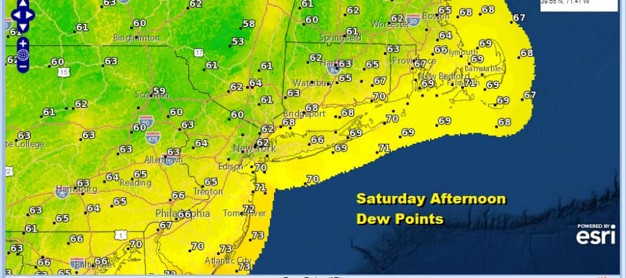
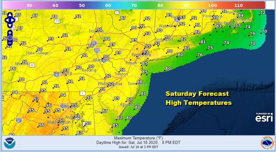
There are no changes in the overall outlook we painted yesterday. 90s are in our future for the next 4 days starting Saturday. The one plus for Saturday is that the humidity will be actually down from today so it will be moderate. Sunshine will take temperatures up into the lower 90s away from the ocean. No showers or thunderstorms are forecast.
Dew points will drop into the lower 60s and even a few upper 50s from NYC northward making for a rather comfortable afternoon however some areas in South Jersey and Southern Pennshylvania, the humidity will be higher though mostly bearable.

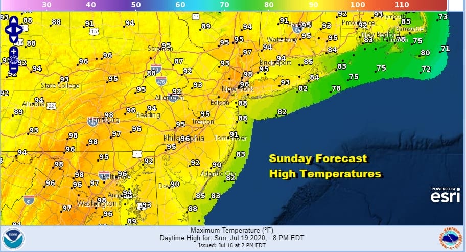
Sunday and Monday look to be 2 very hot and humid days. We are looking at highs reaching the middle and upper 90s both days. We will throw in the chance for a scattered shower or thunderstorm on Monday and leave it out of the forecast for Sunday. Temperatures will be a little cooler along the shore which is a good place to be given the heat.

The peak of the heat should be Monday which means that while Tuesday should see highs into the 90s they should be a few degrees lower from Sunday and Monday. There will be a chance for some scattered thunderstorms late Tuesday and Late Wednesday. A stronger cold front will finally arrive late Thursday with some showers and thunderstorms. Highs will be in the upper 80s and lower 90s for both Wednesday and Thursday so there is a chance many areas could run the streak of 90 to 5 or possibly 6 days.
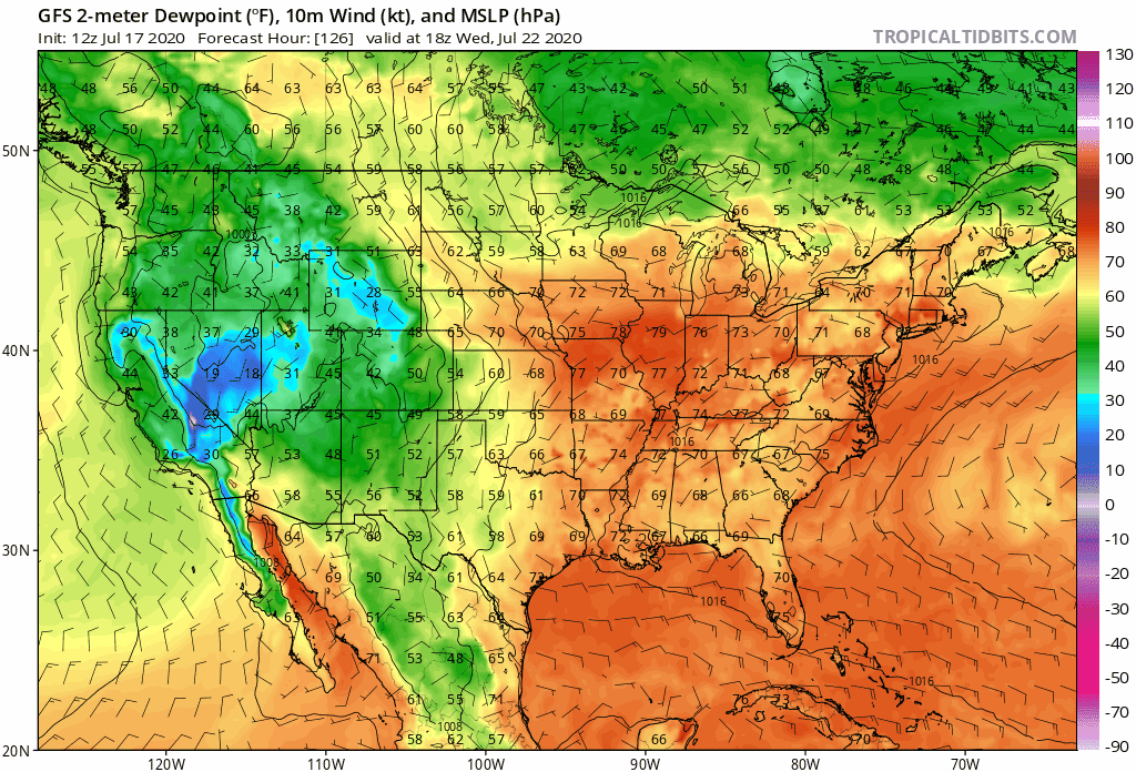
If you are looking for real humidity relief it may come late next week after Thursday’s cold front moves through. Notice that the yellow and green representing drier Canadian air makes a meaningful penetration into the Northeast and Northern Mid Atlantic at the end of next week.
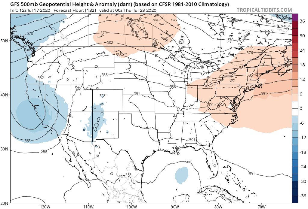
You can thank the upper high across the Southern US and Southwest Atlantic breaking down as the jet stream lowers from Southern Canada and drops into the East in a meaningful way. This should cut the heat and humidity off and make things more bearable down the road. No major rain events are forecast for the next 7 days and that will lead to rather dry conditions developing again in many areas. The tropics are quiet and will likely remain that way until the end of the month.
BE SURE TO DOWNLOAD THE FREE METEOROLOGIST JOE CIOFFI WEATHER APP &
ANGRY BEN’S FREE WEATHER APP “THE ANGRY WEATHERMAN!
MANY THANKS TO TROPICAL TIDBITS FOR THE USE OF MAPS
Please note that with regards to any severe weather, tropical storms, or hurricanes, should a storm be threatening, please consult your local National Weather Service office or your local government officials about what action you should be taking to protect life and property.


