Heat Humidity Thunderstorms Late Monday Real Relief Tuesday Through Thursday
The weekend is finally upon us and the well advertised heat and humidity will play out according to plan. It is really a fairly easy forecast for both today and Sunday. Other than blow off clouds to the northwest from some Midwest thunderstorms, we will see plenty of sunshine both today and Sunday. Highs both days will range between 95 & 100. Heat indices will reach 110 or higher. Tonight will be a steam bath with most lows in the mid 70s to lower 80s. About the only chance for a thunderstorm would be of the pop up variety that will be quite isolated and if it does form wouldn’t last more than 10 or 15 minutes. That pretty much covers it through Sunday afternoon. It is July. It is hot. It actually it is very hot. This is not exactly a groundbreaking event.
SATELLITE

REGIONAL RADAR

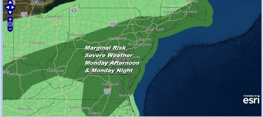
There will be a stair step process that will bring relief here starting Sunday night with a weak cold front that moves through. There won’t be much with that front other than a shower or thunderstorm but it will take the temperatures down about 10 degrees for Monday with highs just in the mid to upper 80s. Then a second stronger cold front will approach Monday afternoon and Monday night. This is going to happening as low pressure moves across Upstate NY.
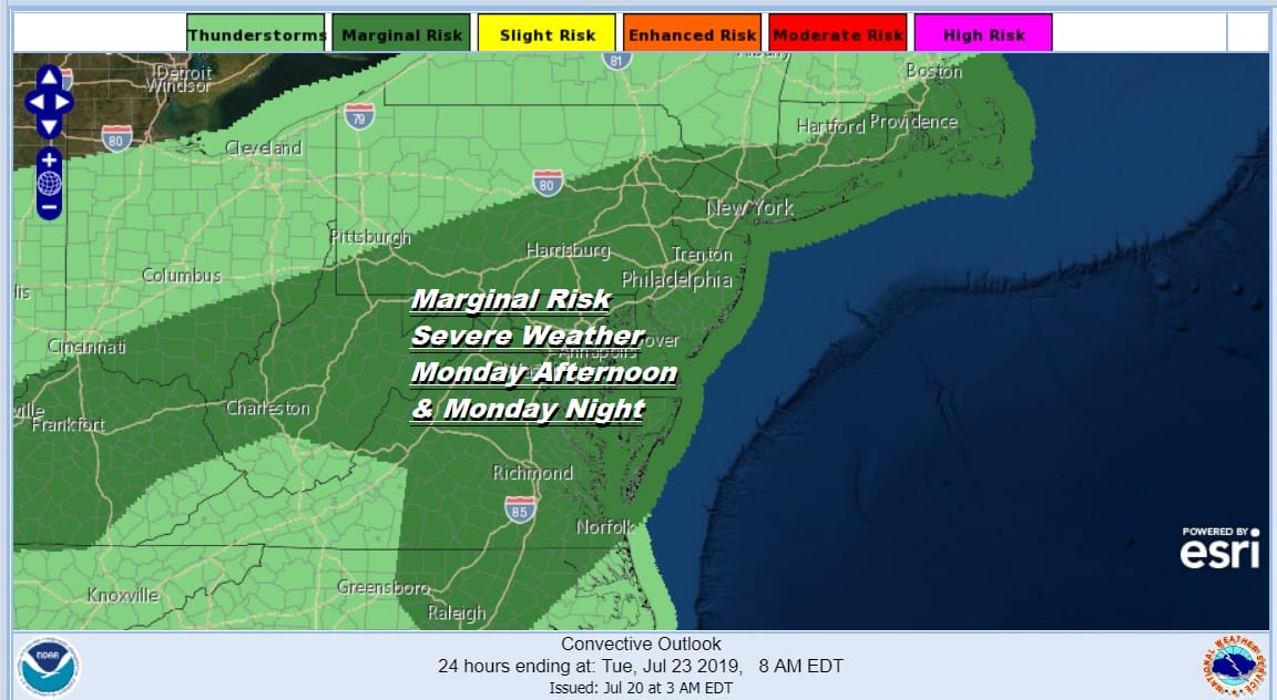
Dew points will still be into the 70s and there is risk for severe weather late Monday afternoon into Monday night as the cold front passes. The Storm Prediction Center has already indicated severe weather risk for Monday and like we saw a few days ago, I think we could see this area of risk be increased to slight risk by the time we get to Monday.
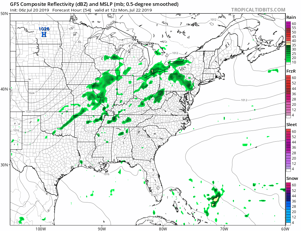
The front will get temporarily hung up on Tuesday making clearing a slow process. There could be some lingering showers in the morning as the GFS model suggests but we should start to see improvement Tuesday afternoon with highs just into the 80s. Dew points will start to drop. Sunshine returns Wednesday Thursday & Friday with reasonable humidity and temperatures into the low and middle 80s which is about average for the last 10 days of July.
MANY THANKS TO TROPICAL TIDBITS FOR THE USE OF MAPS
Please note that with regards to any tropical storms or hurricanes, should a storm be threatening, please consult your local National Weather Service office or your local government officials about what action you should be taking to protect life and property.


