Heat Humidity Arrive Thursday
Heat Humidity Arrive Thursday
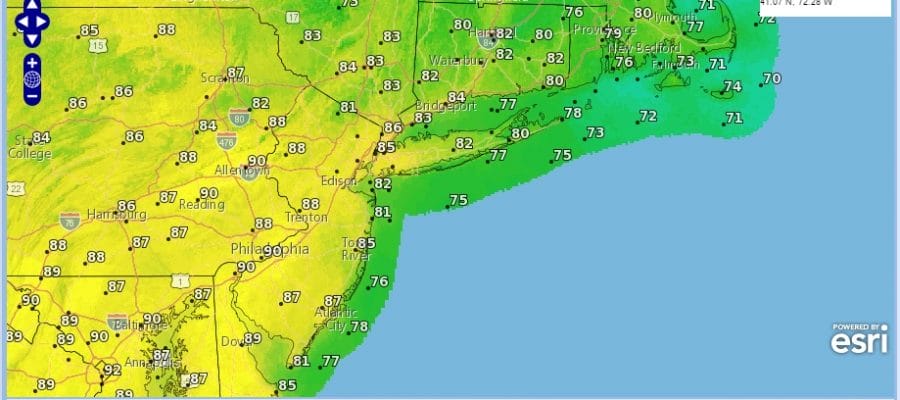
Heat Humidity and late summer weather arrive on Thursday but before it gets here we have to get rid of the low cloud swirl that is Hermine. This has brought the western edge of clouds back into Western New Jersey, the Hudson Valley and Connecticut while skies are generally clear throughout much of Eastern Pennsylvania and Southwest New Jersey as we start this Wednesday.

You can see the edge of the circulation on the radar which is still bringing in a few bands of rain over parts of Long Island and Connecticut. The rain in some cases is very low to the ground and the radar is not picking it up well. The movement is counterclockwise around the coastal low. Hermine should finally be gone tonight as it gets kicked away to the northeast. The concern today will the the stubborness of clouds at least into early or even mid afternoon.


Where there is sunshine today temperatures will approach 90 and that would be mainly west, well inland of the coast and away from clouds. 80s and 70s to the east as you get into a deeper cloud cover.
Heat Humdity Thursday Friday
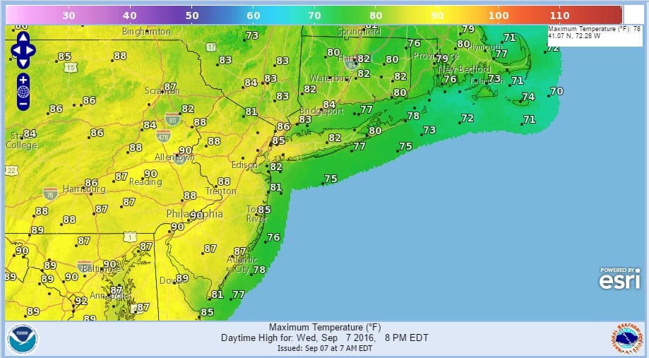
The next 2 days will be hot and humid with highs in the upper 80s to lower 90s on Thursday. A very weak front will be moving through Thursday evening with a very small chance for an isolated shower or thunderstorm. Friday and Saturday look like 2 good days with highs again in the upper 80s to lower 90s…some middle 90s in a few spots with record highs can’t be ruled out. Another front approaches on Sunday with the risk for a thunderstorm and slightly lower temperatures. Overall it should be a good weekend. Hopefully beaches will reopen over the next few days but it may take awhile for the surf to drop off.
FiOS1 News Weather Forecast For Long Island
FiOS1 News Weather Forecast For New Jersey
FiOS1 News Weather Forecast For Hudson Valley
NATIONAL WEATHER SERVICE SNOW FORECASTS
LATEST JOESTRADAMUS ON THE LONG RANGE
Weather App

Don’t be without Meteorologist Joe Cioffi’s weather app. It is really a meteorologist app because you get my forecasts and my analysis and not some automated computer generated forecast based on the GFS model. This is why your app forecast changes every 6 hours. It is model driven with no human input at all. It gives you an icon, a temperature and no insight whatsoever.
It is a complete weather app to suit your forecast needs. All the weather information you need is right on your phone. Android or I-phone, use it to keep track of all the latest weather information and forecasts. This weather app is also free of advertising so you don’t have to worry about security issues with your device. An accurate forecast and no worries that your device is being compromised.
Use it in conjunction with my website and my facebook and twitter and you have complete weather coverage of all the latest weather and the long range outlook. The website has been redone and upgraded. Its easy to use and everything is archived so you can see how well Joe does or doesn’t do when it comes to forecasts and outlooks.
Just click on the google play button or the apple store button on the sidebar for my app which is on My Weather Concierge. Download the app for free. Subscribe to my forecasts on an ad free environment for just 99 cents a month.
Get my forecasts in the palm of your hand for less than the cost of a cup of Joe!

MENTION JOE CIOFFI AND GET A 5% DISCOUNT


