
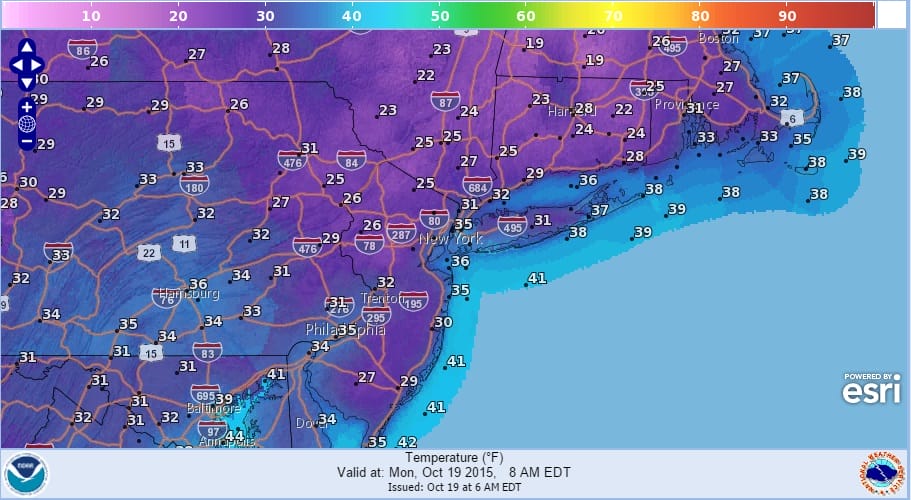
We have a cold hard freeze this morning in many areas as temperatures in some locations have bottomed in the middle 20s this morning. The only spot that seemed to hold above 32 were areas in and around New York City which seemed to have bottomed around 35 or so. But inland lows down as low as 25 are rather common this morning. Hopefully you took the long lead time warning to get plants indoors that needed to go indoors.
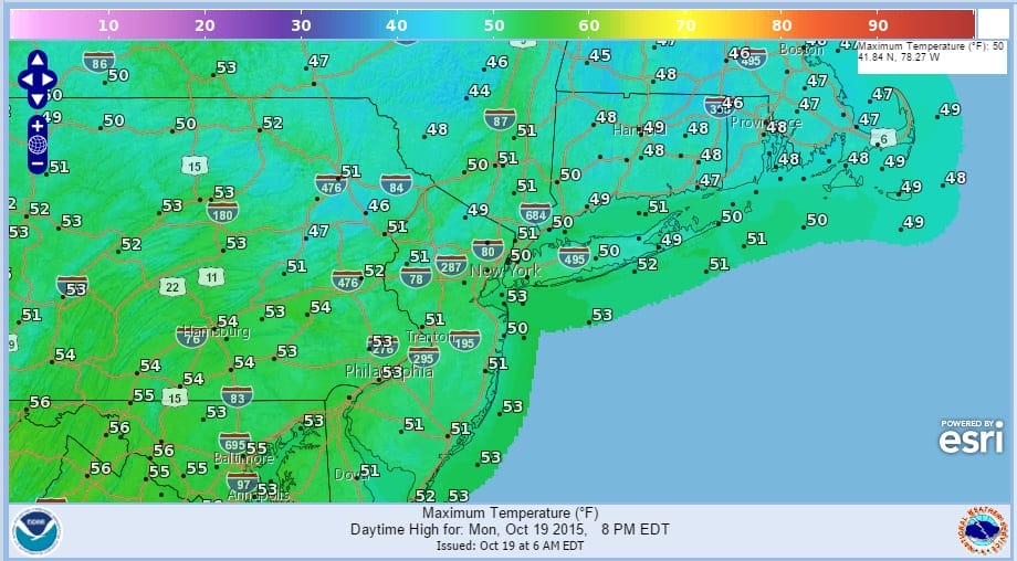
With regards to the highs for today, even though the core of the cold air is moving out this morning it will take a little while for the bottom of the atmosphere to warm up. We should break 50 this afternoon with a good deal of sunshine and it will certainly feel less harsh with less wind then yesterday.
 Over the next several days temperatures will rebound nicely as we head into the 60s on Tuesday and well into the 60s to near 70 on Wednesday. There is a cold front coming for Thursday with cooler air for the end of the week but it is not like this air mass and will be much more moderate in nature. A quiet week is ahead of us from the standpoint of rain as it looks mostly dry right through Friday. The long range pattern still remains unresolved with all sorts of options in all different directions as JOESTRADAMUS talked about yesterday. A quick look at the overnight guidance shows another round of flipping in all directions. One thing that seems to be consistent in all of the models is the strengthening of the Pacific jet and the increasing activity into the west coast that will be occuring which is signature el nino. This should bring at least a few shots for rain here as we head toward months end.
Be sure to download my app and subscribe to my forecasts. The app is free and a subscription is just 99 cents a month.