Halloween Winds Howl Along The Coast Severe Thunderstorms Possible Tonight
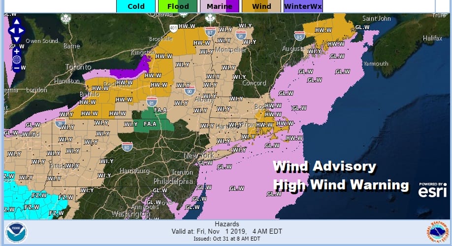
We had some rain overnight and we are now transitioning to the warm sector. Low pressure is developing on a frontal boundary to the west along the Appalachians and that low will strengthen as it heads toward the Eastern Great Lakes and eventually the Saint Lawrence Valley. We have wind advisories posted from NYC east and northward. The wind will be increasing along the coast during today and the south wind will pick up to 30 to 40 mph or higher in gusts this evening and the first part of tonight ahead of the cold front.
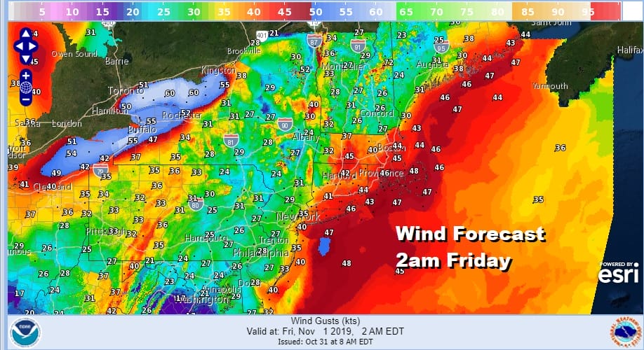
The wind speed map below reflects highest gusts that are being forecast and I took the 2am time frame to average out the arrival of the cold front so obviously the peak wind time will vary. At this point the front will likely be right along the immediate coast or just barely offshore.
Now as far as today is concerned, we had some overnight and early morning rain ahead of the warm front and those rains have moved to the northeast. We should see a break in the action other than a passing shower or two in scattered places this afternoon and into this evening. Temperatures will be heading into the upper 60s and lower 70s making for a very warm muggy Halloween.
SATELLITE

REGIONAL RADAR

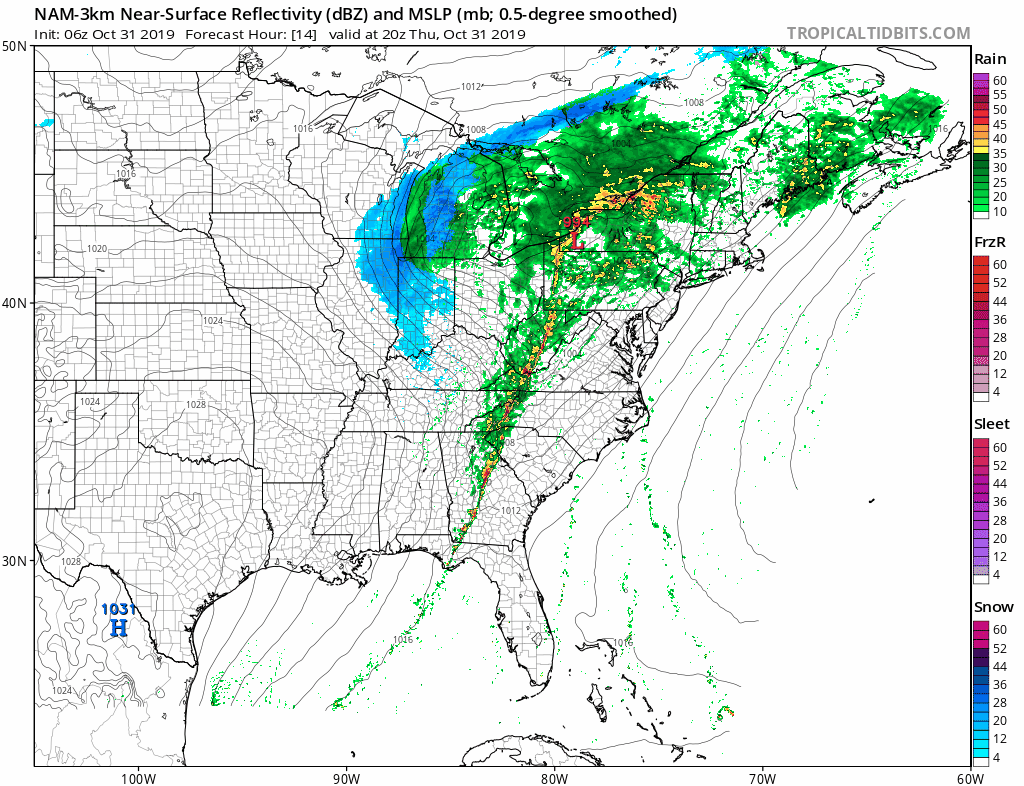
On the regional and local radars we are seeing the less organized patchy areas of showers that are moving northeast in the warm sector while the showers and thunderstorms that are coming for tonight have not yet developed.
LOCAL RADAR NEW YORK CITY

LOCAL RADAR PHILADELPHIA


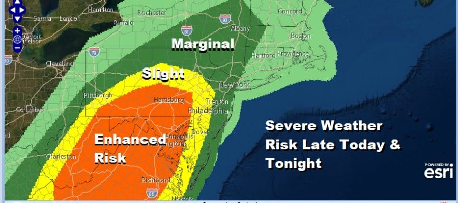
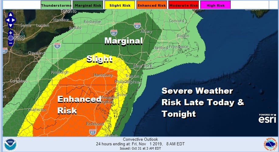
The main action comes tonight as the cold front swings eastward. The Storm Prediction Center has not changed the risk area for today from its forecast form late yesterday and overnight. The greatest threat for severe weather will be from the Pennsylvania New Jersey border west and southwest which would fall in the slight risk and enhanced risk zones. Marginal risk extends to the coast which likely points out the fact that thunderstorms will reach their peak intensity inland and then start to weaken somewhat (but not completely) they head to the coast.
Winds will be at their strongest tonight into early Friday morning. Once the front moves through weather conditions will improve rather quickly. We will see sunshine return. Temperatures will settle into the 50s Friday afternoon on gusty northwest winds. The weekend looks good to me overall with a mix of sun and clouds on Saturday and sunshine for Sunday. It will be chilly starting Saturday morning as we bottom in the 30s to near 40 in warmer urban areas.
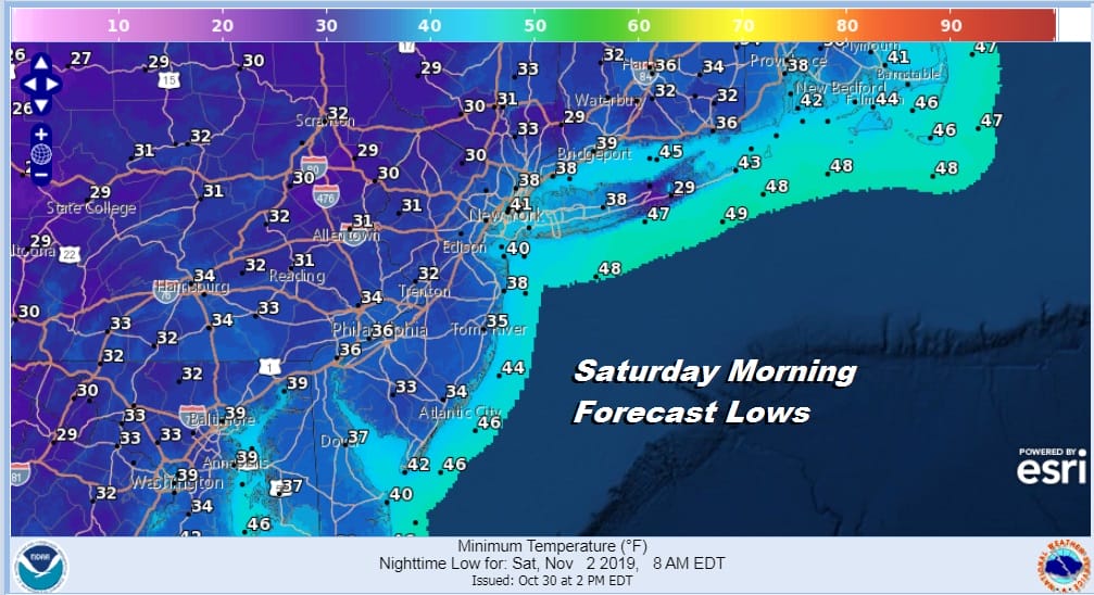
Saturday and Sunday highs will be in the low to mid 50s. Sunday night into Monday morning will likely be the coldest night of this stretch of chilly weather before the next round of cold fronts begin their approach. This will be the last strong storm that we will be dealing with as we go into a relatively relaxed pattern for the next week or so.
BE SURE TO DOWNLOAD THE FREE METEOROLOGIST JOE CIOFFI WEATHER APP &
ANGRY BEN’S FREE WEATHER APP “THE ANGRY WEATHERMAN!
MANY THANKS TO TROPICAL TIDBITS FOR THE USE OF MAPS
Please note that with regards to any severe weather, tropical storms, or hurricanes, should a storm be threatening, please consult your local National Weather Service office or your local government officials about what action you should be taking to protect life and property.


