Frost Freeze Tonight Inland Milder Late Week
Frost Freeze Tonight Inland Milder Late Week
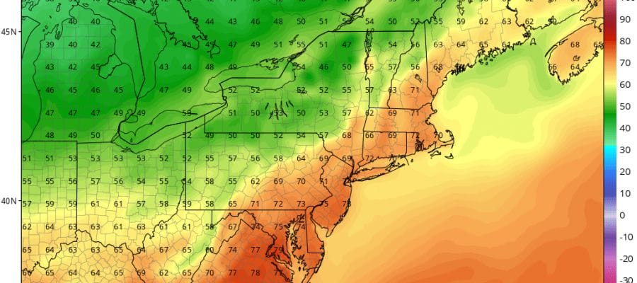
The upper air pattern continues to relax from the extremes of the weekend. Halloween will be a nice dry day for the trick or treating types that may be running around. Sunshine should dominate though there could be some patchy midday clouds as a reinforcement of dry cool air comes in later this afternoon and tonight. Highs today will just be in the 50s. The satellite loop shows the rotation of clouds being dominated by a broad circulation in Southern Canada.
.SATELLITE LOOP

REGIONAL RADAR

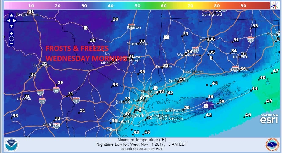
Radars will be quiet through Wednesday morning at least. Skies tonight will be mostly clear and morning lows will be in the 30s to around 40 in most areas with 20s in the cold spots inland. Various frost freeze warnings are posted.
FROST FREEZE WEDNESDAY MORNING FORECAST LOWS
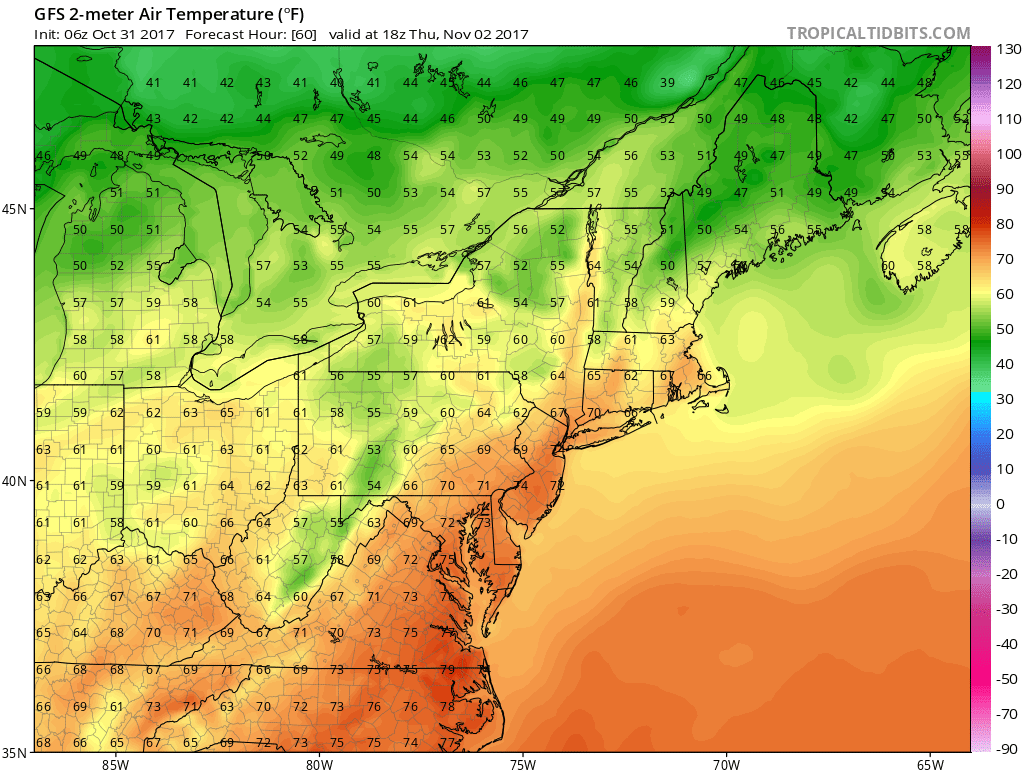
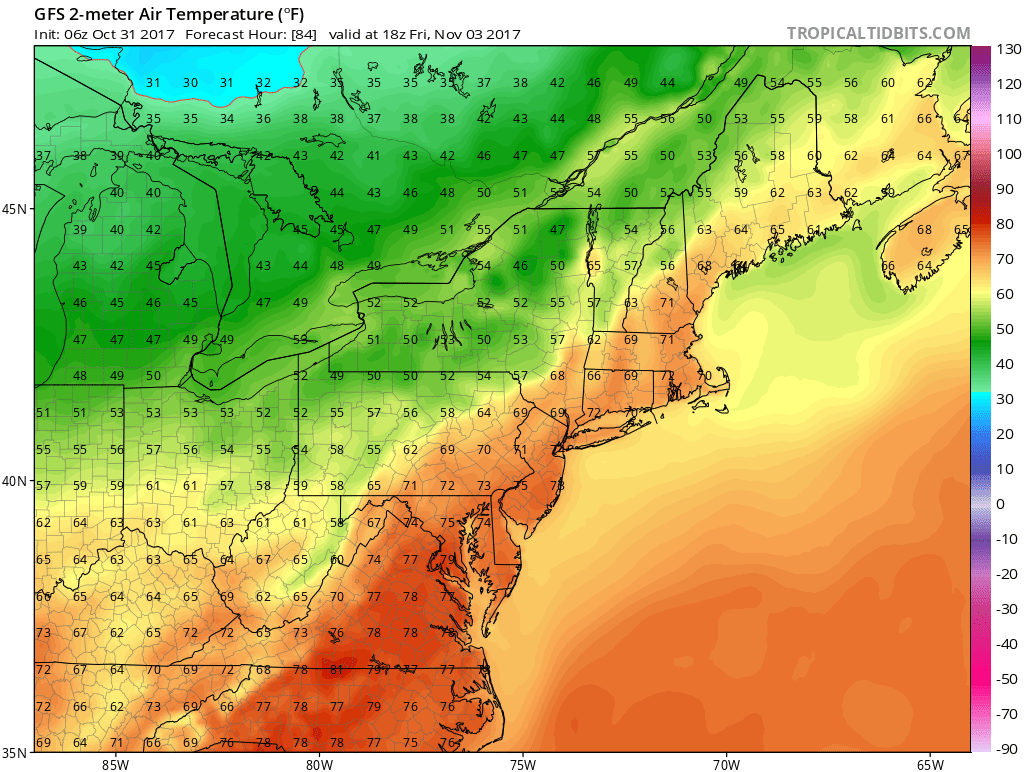
Wednesday we will start with some sunshine but clouds will arrive and increase with highs in the 50s. A warm front cold front combination will be moving through with the chance for a shower Wednesday night. Thursday will be mild with clouds and the risk for a shower with highs back into the 60s to near 70. A cold front will approach on Friday with the risk for a shower but Friday will be the one warm day with highs reaching into the 70s in some places.
THURSDAY FORECAST HIGH TEMPERATURES
FRIDAY FORECAST HIGH TEMPERATURES
Once the front goes by high pressure and cooler air will be building in from the north over the weekend setting us up in an onshore flow. We will likely have lots of clouds around both Saturday & Sunday with highs just in the 50s. There could be the risk for some showers with Sunday being the best chance for some wet weather.
 GET JOE A CIGAR IF YOU LIKE

FiOS1 News Weather Forecast For Long Island
FiOS1 News Weather Forecast For New Jersey
FiOS1 News Weather Forecast For Hudson Valley


