
DOWNLOAD MY NEW FREE JOESTRADAMUS WEATHER APP FOR ALL DEVICES
THE APP IS ABSOLUTELY FREE TO ALL BUT CONSIDERING SUBSCRIBING TO PATREON FOR A WEATHER EXPERIENCE FREE OF ADS, EXCLUSIVE VIDEOS FOR MEMBERS ONLY AND MUCH MORE…STARTS AT $2 A MONTH..MESSAGE ME AT ANY TIME
Gusty Winds This Evening Red Flag Warnings Continue
Rain Friday Decent Weekend
Our offshore well developed cyclone continues to spin away and now that the northern part of the jet stream is swinging east winds are picking up here and should remain gusty into tonight. The cyclone is obvious on the satellite loop but just to the west is the upper trough in the northern jet stream that is lifting it up to the northeast and kicking up the winds here. Bone dry air is arriving and will make for clear skies tonight. Winds will drop off after midnight as temperatures head for the 30s to nea 40. To the west we have clouds setting up in the Rockies & Southern Plains and that is our weather system for Friday. We will at least squeeze out a nice day on Thursday before the onshore flow develops Thursday night and we experience a raw and rather wet Friday.
SATELLITE

REGIONAL RADAR

At least Thursday is sunny for a good chunk of the day though some high clouds will start to arrive later in the day and then the lower clouds will come in as the onshore wind kicks in. Thursday’s highs will be cooler than today’s with highs in the 50s along the coast and some lower 60s inland before clouds take over and temperatures fall.

Friday morning a cold high in New England will insure we will be in the upper 30s and lower 40s in the morning and a cold rain develops. Some precipitation runs out ahead and if it arrives fast enough some cold spots could see some sleet in the mix at the start. It is a last winter gasp for breath as the atmosphere warms. Then a steadier rain comes in later in the day and it should be gone during Friday night. Temperatures Friday will just be in the 40s.
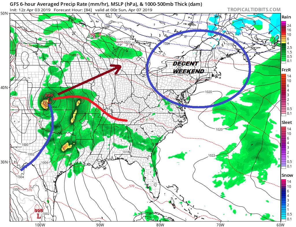
Right now I am optimistic that the weekend will be okay. Another system from the Plains is getting set to kick out to the northeast but the rains from this shouldn’t get here until Sunday night or Monday morning. That gives us 2 decent days for Saturday and Sunday with some sunshine and clouds. Saturday now looks to be the warmer of the two days with highs in the 60s (maybe 70 inland) with the usual sea breeze issues along the coast. Sunday will be cooler with highs in the low to mid 60s again with the usual sea breeze issues.
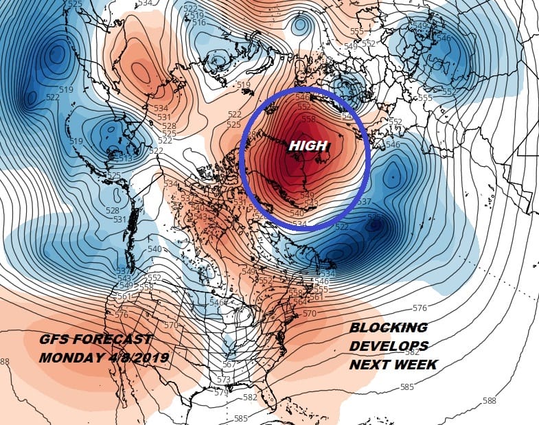
The onshore flow will set up again for Sunday night and Monday and more rain is in the cards. Blocking is developing in the North Atlantic and that will likely complicate things for the first part of next week where we get into one of those long dreary raw chilly periods that the spring is noted for.
MANY THANKS TO TROPICAL TIDBITS FOR THE USE OF MAPS
Please note that with regards to any tropical storms or hurricanes, should a storm be threatening, please consult your local National Weather Service office or your local government officials about what action you should be taking to protect life and property.


