Gusty Winds Continue Overnight Rain Ends
Dry Cold Thursday Friday Showers Saturday
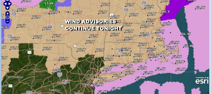
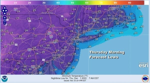
Wind Advisories continue this evening mainly from NYC north and northeast. Winds have gusted from the southwest this afternoon to over 50 mph in some places. Now we see the winds shifting to the northwest as the front passes and moves offshore. Rain ends from west to east. Skies will clear tonight from west to east as the satellite loop shows dry air moving quickly eastward. Northwest winds overnight will gust to 30 to 40 mph at times and lows by morning will be in the 20s inland and lower 30s near the coast and of course the wind will make it feel colder.
SATELLITE
WEATHER RADAR
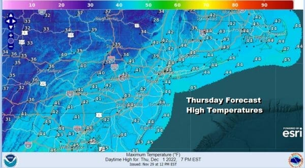
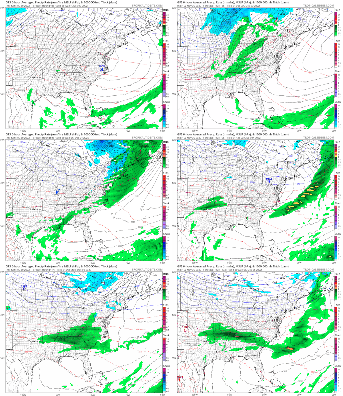
Thursday will be a cold and windy day with sunshine but highs will struggle back into the 40s by afternoon and by Friday morning we will be down in the 20s except for near or over 30 in warmer urban settings. The wind will begin to ease some Thursday night as high pressure builds in.
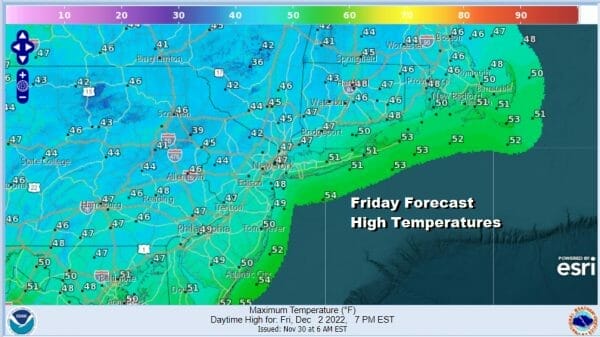
After a cold start sunshine on Friday should take highs back into the mid and upper 40s. High pressure will be overhead so wind won’t be much of an issue. No rain or snow is forecast for either Thursday or Friday.
The dry high pressure area moves out to the east Friday night and Saturday and that sets up the next cold front which will be third front in 7 days. This front is not quite as robust as today’s but it will be breezy and warm Saturday with showers moving in from west to east during the morning and ending from west to east in the late afternoon and evening. It will be warm Saturday with highs in the 50s to around 60 in some places.
Sunday will be cold but dry with sunshine and highs in the 40s. Another weaker front will approach with the chance for a few showers early on Monday and then it turns dry and cold for Tuesday. The next low will start to form in the Southern Plains and that could bring some precipitation Wednesday of next week.
BE SURE TO DOWNLOAD THE FREE METEOROLOGIST JOE CIOFFI WEATHER APP &
ANGRY BEN’S FREE WEATHER APP “THE ANGRY WEATHERMAN!
MANY THANKS TO TROPICAL TIDBITS & F5 WEATHER FOR THE USE OF MAPS
Please note that with regards to any severe weather, tropical storms, or hurricanes, should a storm be threatening, please consult your local National Weather Service office or your local government officials about what action you should be taking to protect life and property.

