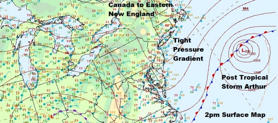
Gusty Winds At The Shore Coastal Flooding Possible Dry Into Friday

It was a rather brisk day along the coast and winds did gust to 40 mph at times along the New Jersey shore and over 30 mph at times on Long Island. We have coastal flood advisories up for various areas of the shoreline from Long Island to Chesapeake Bay. Northeast winds around the flow of Post Tropical Storm Arthur and under a strong high over New England are the drivers.

We have two satellite views tonight. The wide picture shows Post Tropical Storm Arthur with 60 mph winds well out to the east. The last advisory was issued at 11am today. Over the Northeast some clouds developed late this afternoon. Part of this is due to the ocean flow and the rest is blow off from showers of heavy rain in the Central Appalachians. The motion on the regional radar below is mostly north or northwest. That is all rotating around an upper low dropping south into Tennessee. No eastward movement is fOrecast until Friday. In the meantime we remain dry.
SATELLITE

REGIONAL RADAR

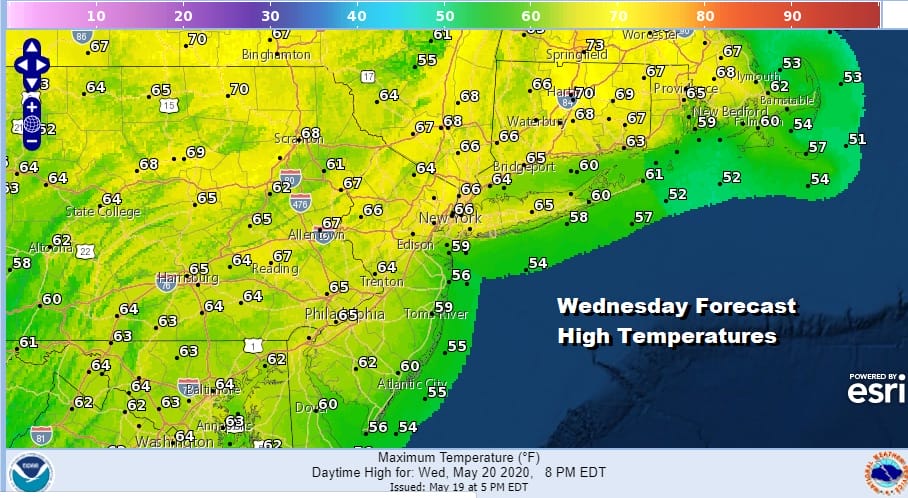
This leaves us with patchy clouds tonight with most lows in the upper 40s and lower 50s. Wednesday we will see some sunshine though clouds will be around especially as you go south of NYC. Most highs will be in the low to mid 60s but it will be in the 50s along the immediate coast thanks to the northeast wind.
It looks like the high hangs on for Thursday with highs in the 60s. Finally Friday the upper low opens up and begins to move to the northeast. The onshore flow relaxes. Highs could making it into the 70s in some places but there is the chance for some showers Friday afternoon into Friday night.

Guarded optimism holds for the Memorial Day weekend though Saturday is a bit dicey with the remnant upper low, weak as it is, will cause clouds to linger and even a few showers are possible mostly north and east of NYC with not much to worry about south and west. Saturday’s highs will be in the low to mid 70s except 60s along the coast. Sunday and Monday we will call it a mix of sun and clouds both days with highs in the 70s but again cooler 60s at the shore. One thing that is certain is it will be too cool to call it a beach weekend.
MANY THANKS TO TROPICAL TIDBITS FOR THE USE OF MAPS
Please note that with regards to any tropical storms or hurricanes, should a storm be threatening, please consult your local National Weather Service office or your local government officials about what action you should be taking to protect life and property.


