Great Summer Weather Moderate Humidity Severe Weather Risk Late Saturday
All is on course after a great day of wall to wall sunshine and highs in the upper 80s to around or just over 90 degrees in most locations. Even coastal areas saw readings reach near 90 thanks to a northwest wind for much of the day. Last night we had severe weather move across NY State and the Hudson Valley but not the case tonight as the satellite shows nothing of consequence and no disturbances moving through. Just a nice warm night with lows in the 60s to near 70.
SATELLITE

REGIONAL RADAR

There are no changes at all to the earlier outlook. Friday will be hot but humidity levels will still be contained. We will have wall to wall sunshine in most places. Highs will reach the upper 80s and lower 90s. The humid air lies to our west and south and that won’t be coming in until the early morning hours on Saturday. At that point there could be a shower or thunderstorm before daybreak in one or two spots.
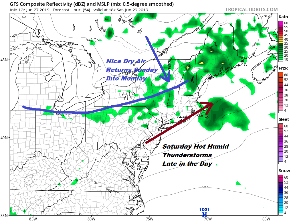
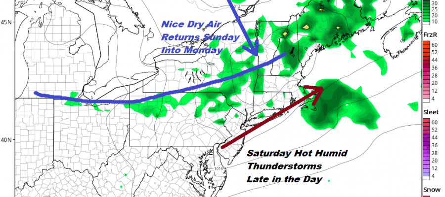
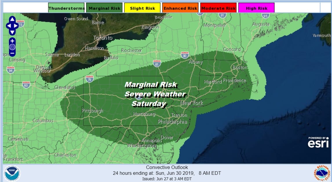
Saturday will be the one day in this stretch that will be truly uncomfortable Look for sun and clouds with highs reaching the upper 80s and lower 90s. A cold front will be dropping southward from Canada and upstate NY triggering off some thunderstorms late in the afternoon and evening. The Storm Prediction Center has much of our area in a marginal risk of severe weather for late Saturday.
Behind the front we will see the humidity drop off on Sunday but it will take a second front to bring in a solid shot of dry air for Sunday night and Monday. Sunday we will see a mix of sun and clouds. Highs will be in the 80s. Some 90 degree highs are probable in South Jersey and Southeastern Pennsylvania.
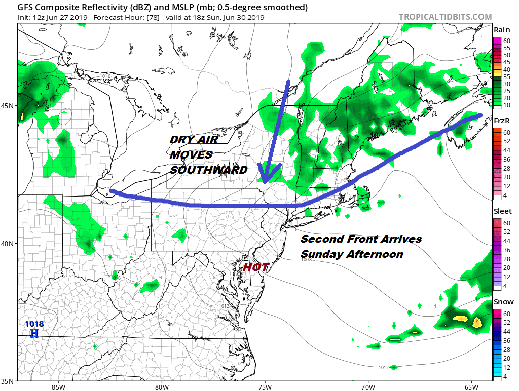
The front comes through dry Sunday afternoon. Monday will be dry with sunshine and most highs in the upper 70s to some middle 80s. Another front moves through Monday night with the chance for showers or a thunderstorm. The air behind that front is warmer than the air ahead of it Temperatures rise as we move through next week and the humidity will be coming up as well. Tuesday Wednesday and Thursday will be very warm to borderline hot and it will be somewhat humid with scattered thunderstorms possible Wednesday and Thursday which is the 4th of July. Highs will be in the mid 80s to near 90 each day with cooler temperatures along the shore. Much of the time next week it will be rain free.
MANY THANKS TO TROPICAL TIDBITS FOR THE USE OF MAPS
Please note that with regards to any tropical storms or hurricanes, should a storm be threatening, please consult your local National Weather Service office or your local government officials about what action you should be taking to protect life and property.


