Grazing of Rain Coast Tonight Warmer Temperatures Next Week
We have come to an end of a quiet week of weather not just here in our neck of the woods but it has been quiet across the US with an absence of major storms. Even the minor systems have produced minimal impact on weather conditions. Most of the nation is seeing little in the way of snow or other forms of wintry precipitation. That isn’t going to change much this weekend.
SATELLITE
REGIONAL RADAR
We are starting the day with sunshine however clouds will be increasing as the day goes on. Highs will reach up into the 40s in most places. Low pressure will be riding up the southeast coast of the US and passing to our south and east later tonight or early Saturday morning. We wills start to see some rain on the radar later today in North Carolina and Eastern Virginia. There could be a grazing of rain from Delaware to Long Island tonight but it won’t amount to much at all.
Weather conditions Saturday will feature clouds and temperatures into the 40s. Sunday we should see clouds and some sunshine with highs in the low to mid 40s. Then we set up for a solid warm up on Monday.
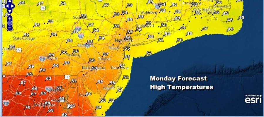
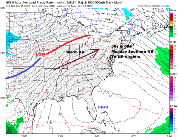
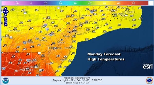
High pressure will be off the Florida east coast on Monday with a west wind and some sunshine here. That will take temperatures up at least into the 50s. 60s will reach Southern New Jersey and Southern Pennsylvania. 70s are possible in Maryland. With a little luck we could push the 60 degree line further north to about NYC if we can manage enough sunshine.
The next cold front and series of waves will be moving in beginning later on Tuesday with showers arriving. Tuesday’s highs will be in the 50s. Wednesday and Thursday we will see waves of low pressure on a stalled frontal boundary so where that boundary is will mean everything regarding the actual weather to expect. We will delve into the long range later today. Enjoy your Friday and the weekend.
BE SURE TO DOWNLOAD THE FREE METEOROLOGIST JOE CIOFFI WEATHER APP &
ANGRY BEN’S FREE WEATHER APP “THE ANGRY WEATHERMAN!
MANY THANKS TO TROPICAL TIDBITS FOR THE USE OF MAPS
Please note that with regards to any severe weather, tropical storms, or hurricanes, should a storm be threatening, please consult your local National Weather Service office or your local government officials about what action you should be taking to protect life and property.


