Gloom & Doom More Rain Tonight And Again New Year’s Eve
Winter Pattern Long Range
Gloom & Doom More Rain Tonight And Again New Year’s Eve
Winter Pattern Long Range
We are in the land of gloom and doom today with lots of low clouds, dense fog, and patchy light rain. Couple that with the warmish temperatures and it has the feel of a miserable springtime day. Temperatures have risen overnight as warm tropical air surges up the East Coast. We are going to see this last all day long with temperatures today in the mid 50s to lower 60s from north to south. Radars are picking up some of the patchy light rain but the heavier rain to the west won’t come into view until later this afternoon.
SATELLITE WITH LIGHTNING STRIKES
WEATHER RADAR
An intensifying low in the Ohio Valley is heading to the Great Lakes. It has produced widespread severe weather across the Gulf States and today that severe weather shifts to the Carolinas south to North Florida. Heavy rain is pushing northward through the Ohio Valley and Great Lakes and tonight the associated cold front will head east and bring rain, some heavy, overnight into early Monday morning.
After the front passes we are left with improving weather conditions for Monday and it will be dry into Tuesday before another storm system heads our way for Tuesday night into Wednesday morning. This means rain for New Year’s Eve and the arrival of 2025. It also means that after this second storm system goes by, we will begin a descent into a very wintry pattern across much of the US that will probably last for a few weeks at least.
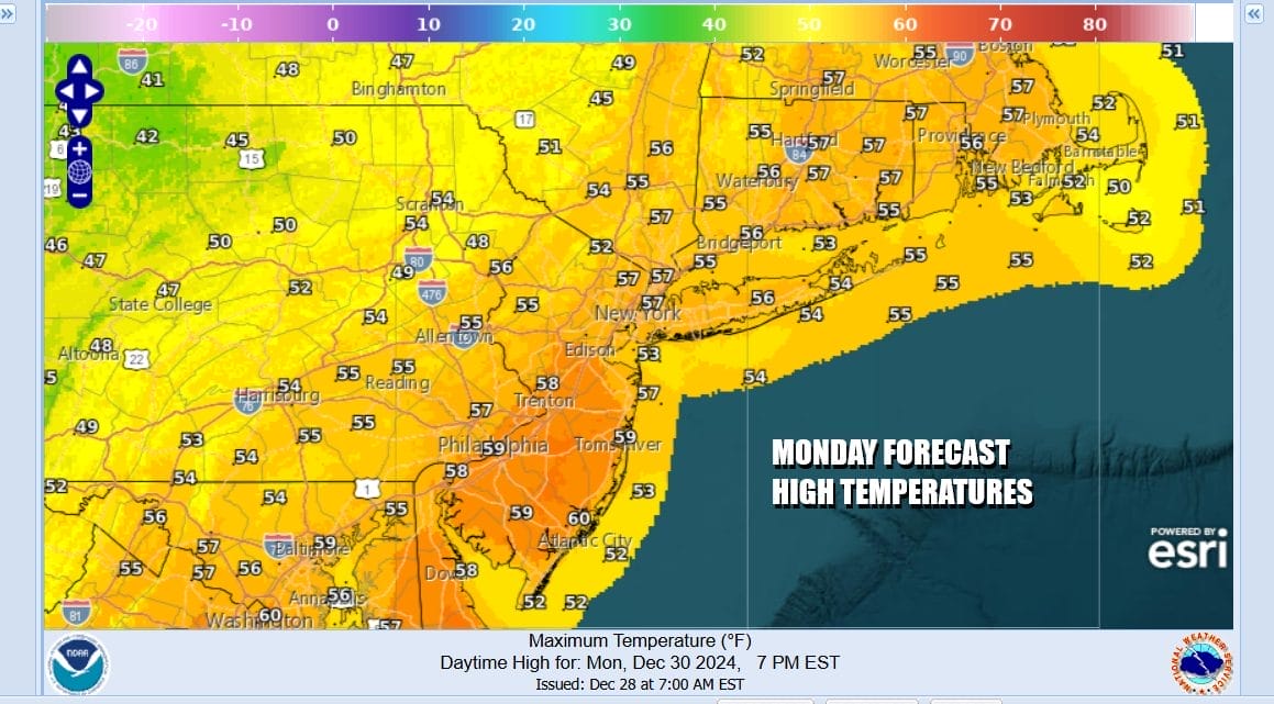
Rainfall from tonight and Monday morning could amount to about an inch on average plus or minus a quarter of an inch. Then as we move through Monday leftover clouds will give way to some developing afternoon sunshine. Temperatures will be cooler than today but still up there in the warm 50s. Some of those warm highs will be leftover from overnight.
Moving ahead to Tuesday look for sunshine giving way to arriving clouds with highs in the 50s. Then the rain comes Tuesday night into Wednesday morning. That looks to be something along the lines of a quarter to a half inch. Then once that low passes we will see temperatures ease and by the time we get to Friday we will be back in the 30s for highs and 20s for lows. As the new wintry pattern takes hold it could be setting us up for a thumping of snow a week from today as low pressure heads to the Great Lakes and a warm front sets up to the south.
BE SURE TO DOWNLOAD THE FREE METEOROLOGIST JOE CIOFFI WEATHER APP &
ANGRY BEN’S FREE WEATHER APP “THE ANGRY WEATHERMAN!
MANY THANKS TO TROPICAL TIDBITS FOR THE USE OF MAPS
Please note that with regards to any severe weather, tropical storms, or hurricanes, should a storm be threatening, please consult your local National Weather Service office or your local government officials about what action you should be taking to protect life and property.