GFS MODEL Sunday Next Important Rain Threat
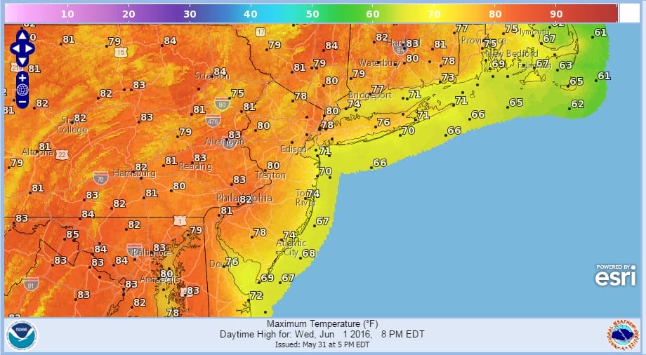
With the return of dry air this afternoon the rest of the weekend and into Saturday will have some issues but there will be some nice periods as well. Certainly the rest of today through Wednesday looks good with lots of sunshine setting up for Wednesday and highs in the 70s to near 80.
WEDNESDAY AFTERNOON FORECAST HIGHS
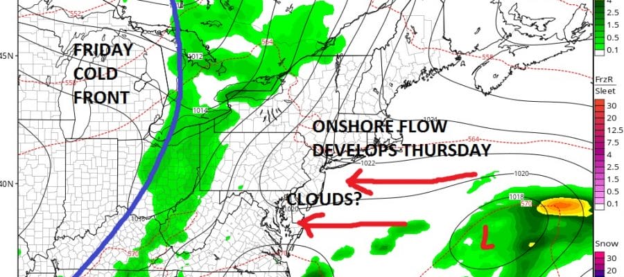
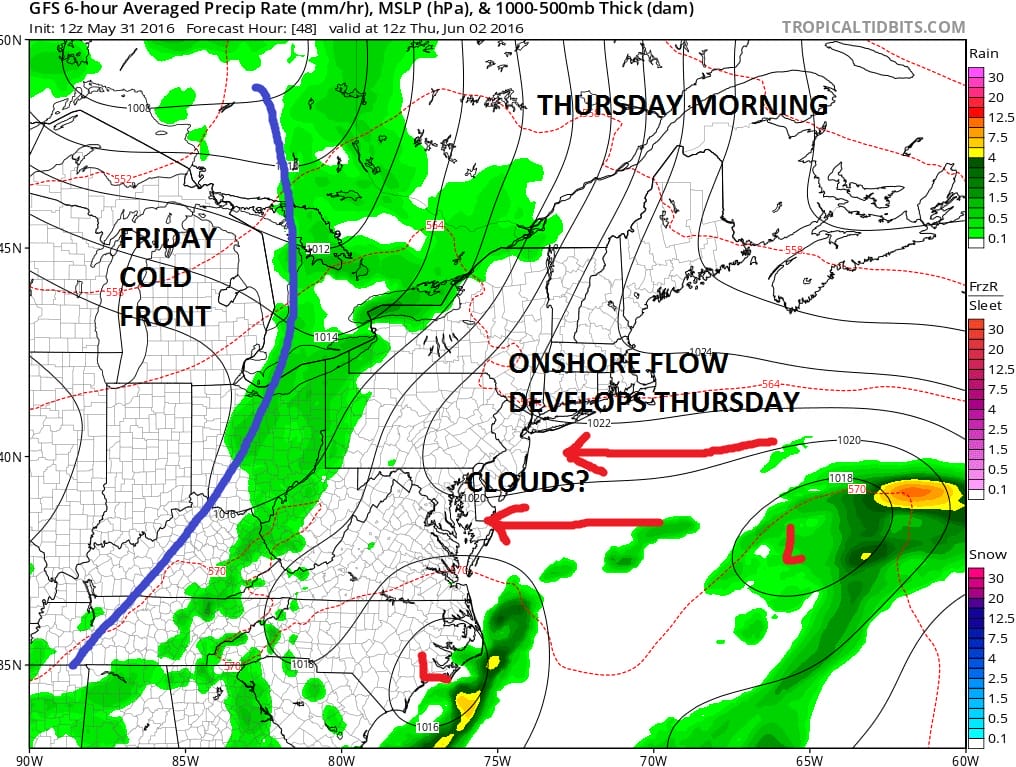
Thursday we have some issues for the coast. High pressure building down from the north and a weak offshore wave will set up an onshore flow for Thursday. This might mean we could have a set up like Sunday where ocean low clouds begin sweeping in from the east during the day. What is at question is how far inland do the clouds go? Sunday they were confined to the coast. This time we could see the clouds move in further inland. Still I would think we would see some sunshine in the mix before any clouds develop.
GFS MODEL THURSDAY MORNING
The front to the west will come through Friday but it looks like support for this front falls apart. Other than a few passing showers, Friday does not look like a big deal. Saturday will be nice with a mix of sun and clouds. Then Sunday a more important front and storm system approach.
GFS MODEL SUNDAY MORNING SURFACE
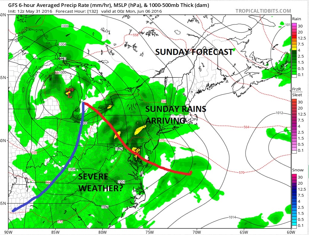
GFS MODEL SUNDAY MORNING UPPER AIR
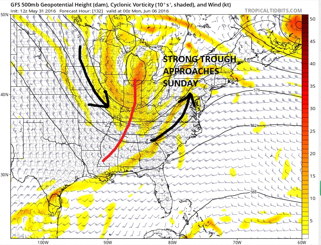
The upper air support for Sunday’s system is pretty impressive. This should open up good moisture inflow from the south and bring rain our way. Timing would suggest rain developing Sunday during the day with the warm front approaching. Then with the warm sector in here next Monday there will probably be the chance for some showers and thunderstorms.
Hurricane Season begins to tomorrow and here is the HURRICANE FORECAST OUTLOOK courtesy of JOESTRADAMUS who invited an expert to lend his opinion.

MENTION JOE CIOFFI AND GET A 5% DISCOUNT
FiOS1 News Weather Forecast For Long Island
FiOS1 News Weather Forecast For New Jersey
FiOS1 News Weather Forecast For Hudson Valley
NATIONAL WEATHER SERVICE SNOW FORECASTS
LATEST JOESTRADAMUS ON THE LONG RANGE
Weather App

Don’t be without Meteorologist Joe Cioffi’s weather app. It is really a meteorologist app because you get my forecasts and my analysis and not some automated computer generated forecast based on the GFS model. This is why your app forecast changes every 6 hours. It is model driven with no human input at all. It gives you an icon, a temperature and no insight whatsoever.
It is a complete weather app to suit your forecast needs. All the weather information you need is right on your phone. Android or I-phone, use it to keep track of all the latest weather information and forecasts. This weather app is also free of advertising so you don’t have to worry about security issues with your device. An accurate forecast and no worries that your device is being compromised.
Use it in conjunction with my website and my facebook and twitter and you have complete weather coverage of all the latest weather and the long range outlook. The website has been redone and upgraded. Its easy to use and everything is archived so you can see how well Joe does or doesn’t do when it comes to forecasts and outlooks.
Just click on the google play button or the apple store button on the sidebar for my app which is on My Weather Concierge. Download the app for free. Subscribe to my forecasts on an ad free environment for just 99 cents a month.
Get my forecasts in the palm of your hand for less than the cost of a cup of Joe!
![]()