
We have updated this to include all the additional areas in New Jersey and Southeast NY that have been added since the original watch went out.
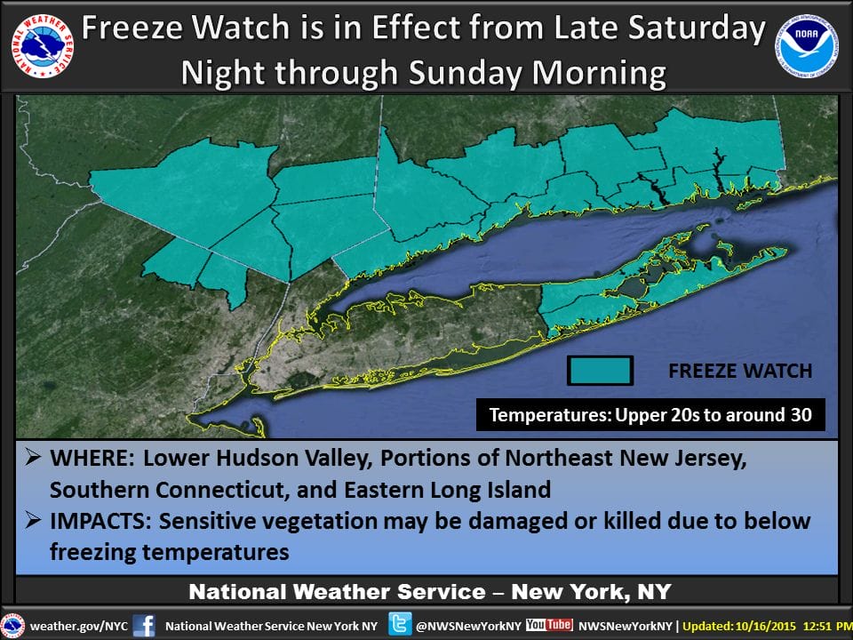
A FREEZE WATCH has been posted for the Lower Hudson Valley, Suffolk County Long Island, & All of New Jersey except urban areas in and around Newark and the Southwestern counties south of Trenton. The watch is up for Sunday morning. There are no watches for tonight or Saturday morning as all areas will see temperatures well above freezing tonight.
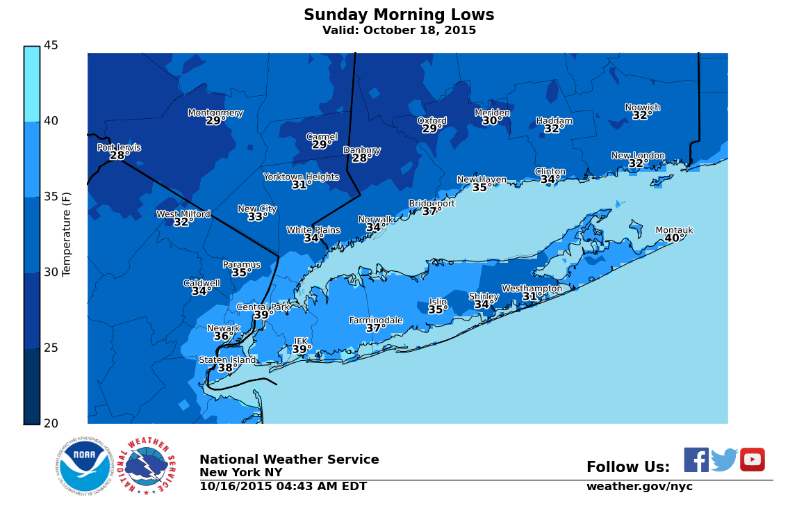
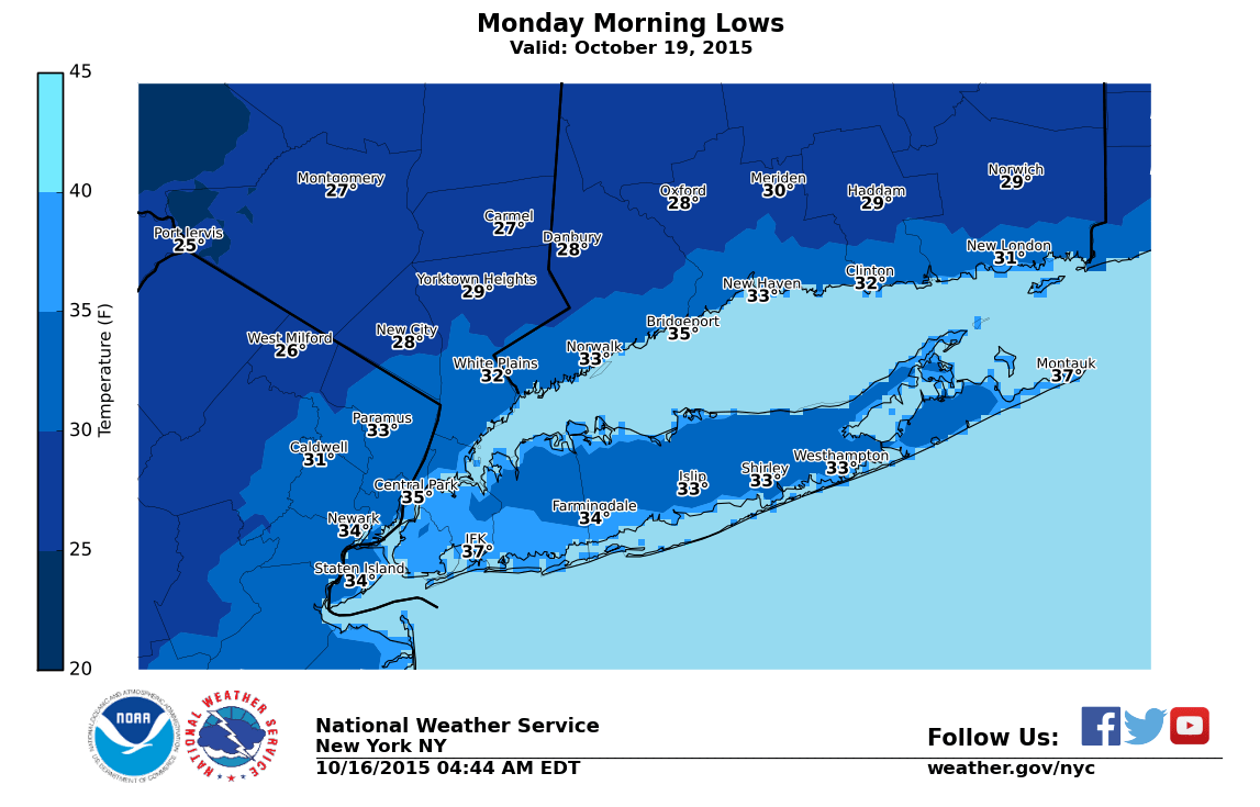
Sunday night and Monday morning there will be another round of cold temperatuers and there may be a larger area of sub 32 degree temps Monday morning. Sunday night we will see clear skies and light winds over a large part of the area and this will probably produce extensive frost Monday morning. The cold air mass is coming in faster and is going to pull out a little faster. This opens the door for Sunday night to be more of a radiational cooling type of night and therefore more frost.
This will also be a great weekend for fall foliage viewing as colors are approaching peak over the next week in places just north of New York City so you won’t have to go far to get some great scenic viewing. Looking ahead to next week, Monday we should move through the 50s and then by Wednesday and Thursday of next week we should climb back toward 70. No rain is in the forecast into Wednesday. There is a front that will approach next Thursday but right now it looks to pass through relatively dry.
Be sure to download my app and subscribe to my forecasts. The app is free and a subscription is just 99 cents a month for NY NJ PA and Southern New England. This includes the Hudson Valley and Long Island. For android and IPhone. And don’t forget to watch me on FiOS1 News.