Fred Departs Tropical Storm Henri Next Up For Parts of Northeast US Sunday

Weather in 5/Joe & Joe Weather Show Latest Podcast
Fred Departs Tropical Storm Henri Next Up For Parts of Northeast US Sunday
The remnants of Fred played out as generally advertised and now we transition to a very warm and humid Thursday on the back side. Usually we get a humidity break behind these sorts of set ups but there is no dry Canadian air to be had at the moment so we just bask in very warm and humid conditions today with highs in the mid to upper 80s. There will be some sunshine and there is the chance for a pop up shower or thunderstorm this afternoon and evening.
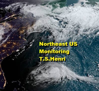
SATELLITE

The energy from Fred moving through the New England is leaving a less unstable air mass behind it. The radars are showing showers and thudnerstorms in New England and Northeast NY moving northeastward. Some areas in New England will see heavy rains and flash flooding but local radars from NYC to Northern Virginia should be on the quiet side today and also Friday.
WEATHER RADAR

A warm humid night tonight with lows in the upper 60s and lower 70s will be followed by another very warm and humid Friday with some sun and the risk for a scattered shower or thunderstorm with highs in the 80s. Then attention turns to the weekend and what by then will be Hurricane Henri.

The National Hurricane Center forecast is a jog slightly to the right of yesterday’s forecast and expect to see these jogs back and forth as models tighten up. We have been emphasizing the importance of a strengthening upper high in New England and an upper low in the Ohio Valley. Henri will be sandwiched in between and the high to the north and northeast effectively shuts off a track well offshore.
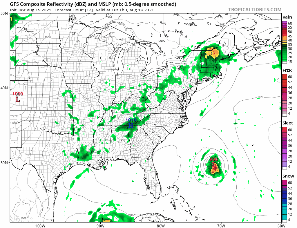
We can confidently say a few things at this point. First off there are no issues Saturday as it will the same story though there will be an increase in clouds along coastal areas from Coastal NJ eastward to Southeastern New England as Henri approaches.
- Henri will pass far enough offshore so impacts for the Northern Mid Atlantic coast will be confined to rough surf, rip currents, and higher than normal tides.
- The Highest risk for any direct impact with wind and rain will be from Eastern Long Island to Southeastern New England based on what we are seeing at the moment.
- No weather issues Friday or Saturday. Along the track and either side by about 75 to 100 miles weather conditions deteriorate Saturday night and Sunday.
- No weather issues (rain wind) for New Jersey Eastern Pennsylvania, the Hudson Valley, Delaware, Maryland, Coastal Virginia.
- Highest risk appears to be Southeastern New England for a direct impact Sunday.
- The Northeast should continue to monitor the progress on Henri.
BE SURE TO DOWNLOAD THE FREE METEOROLOGIST JOE CIOFFI WEATHER APP &
ANGRY BEN’S FREE WEATHER APP “THE ANGRY WEATHERMAN!

MANY THANKS TO TROPICAL TIDBITS & F5 WEATHER FOR THE USE OF MAPS
Please note that with regards to any severe weather, tropical storms, or hurricanes, should a storm be threatening, please consult your local National Weather Service office or your local government officials about what action you should be taking to protect life and property.


