
Recon Finds Florence Strengthening Rapidly 130 MPH
That didn’t take long. Florence is moving into that zone north of the Greater Antilles & South of Bermuda where water temperatures are exceptionally warm in the mid to upper 80s. Combine that with ideal conditions aloft and you have a rapidly intensifying hurricane. The Air Force plane found that the pressure has fallen 2 millibars an hour in its first 2 passes and winds between 113 & 137 knots.
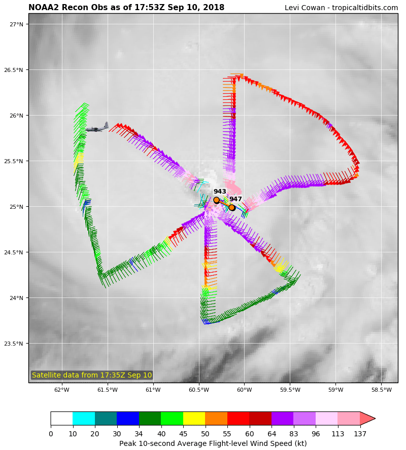
The satellite presentation is excellent as the eye has become extremely well defined and the hurricane continues to acquire that symmetrical look. It is likely that the rapid deepening phase here is not done and we will likely see Florence get even stronger this afternoon.
WIDE ATLANTIC TROPICAL SATELLITE

WESTERN ATLANTIC TROPICAL SATELLITE

Florence continues to behave according to plan and weather models have done quite well with how they have handled this hurricane both in track and in strength. As the storm strengthens it will likely start gaining some latitude (moving a bit further north) as it responds to steering winds higher up in the atmosphere. A strong upper high is building to the north of the hurricane so that should keep it on a west northwest course for the next few days as it approaches the North Carolina coastline on Thursday.
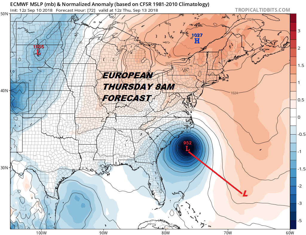
The European model has been the most consistent with Hurricane Florence regarding track so we will stick with that model verses the others which seem to adjusting east or west every few hours. They all are concentrating on the North Carolina coast regarding landfall. The European is faster than the other models in its track to the coast. However Hurricane Florence will likely slow as it makes its final approach on Thursday making for a long duration event regarding landfall.
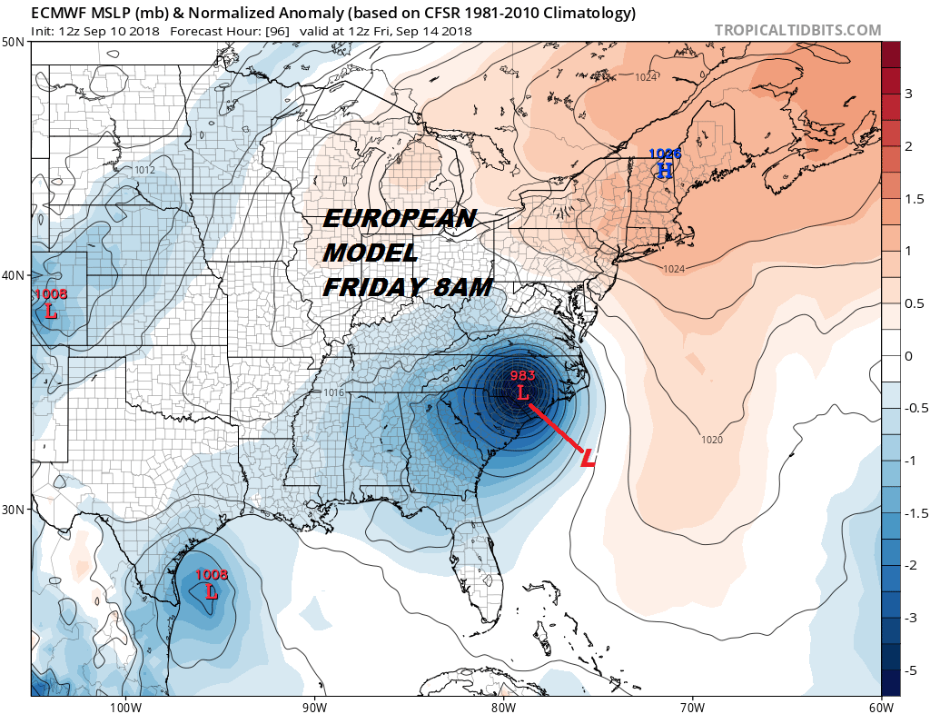
With steering currents forecast to collapse once Florence is inland we could be facing a long duration excessive rain even for North Carolina and Virginia. The forecast gets dicey after landfall. Weather models all either loop or stall it inland with no push in the upper atmosphere from any direction. This could be setting up for a serious flooding situation in some areas with continuous rains lasting for several days.
THANKS TO TROPICAL TIDBITS FOR THE USE OF MAPS
Please consult your local National Weather Service office at weather.gov for the latest information on any tropical or storms or hurricanes that could be a threat to your area. Consult your local government officials regarding action you may need to take to secure life and property
FiOS1 News Weather Forecast For Long Island
FiOS1 News Weather Forecast For New Jersey
FiOS1 News Weather Forecast For Hudson Valley