Flash Flood Watch Severe Weather Risks Wednesday Nice Dry Late Thursday Friday

Weather in 5/Joe & Joe Weather Show Latest Podcast
Flash Flood Watch Severe Weather Risks Wednesday Nice Dry Late Thursday Friday
Everyone is on tender hooks at the moment as we just went through the destructive rains from the remnants of Ida. The ground is saturated and now we have a cold front approaching for Wednesday. If the threshold for flooding was low before Ida it is now even lower.
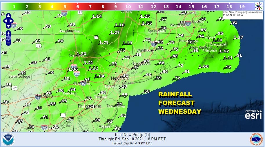
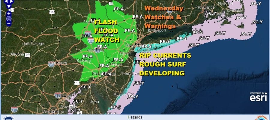
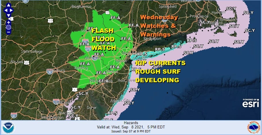
Normally these thunderstorms for late Wednesday and Wednesday night would not be a huge issue but if we get one or two that put down even an inch of rain, flooding will occur so the National Weather Service has put Flash Flood Watches up for Eastern Pennsylvania, Northern New Jersey and in the lower Hudson Valley west of the Hudson River.
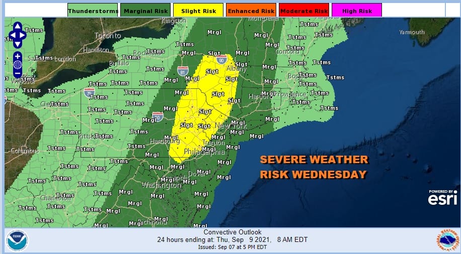
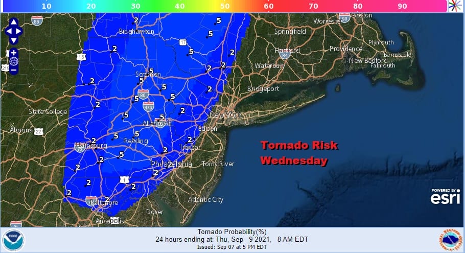
The cold front and upper trough has grown more vigorous for Wednesday and the Storm Prediction Center has upped the risk from marginal to slight risk for severe weather in Eastern Pennsylvania and Northwest New Jersey with marginal risk surrounding that zone extending further west and east. In addition there as it tornado risk and SPC has indicated another 5% risk for tornadoes in the slight risk zone with 2% in the surrounding area west and east of that zone.
In the meantime we have a quiet clear night and it should stay that way overnight with lows in the 60s. Humidity levels will start rising late tonight and Wednesday ahead of the front it will be warmer and more humid. We will have some sun and daytime heating taking highs into the 80s. before thunderstorms start popping up in the afternoon and the becoming more numerous in the evening.
SATELLITE


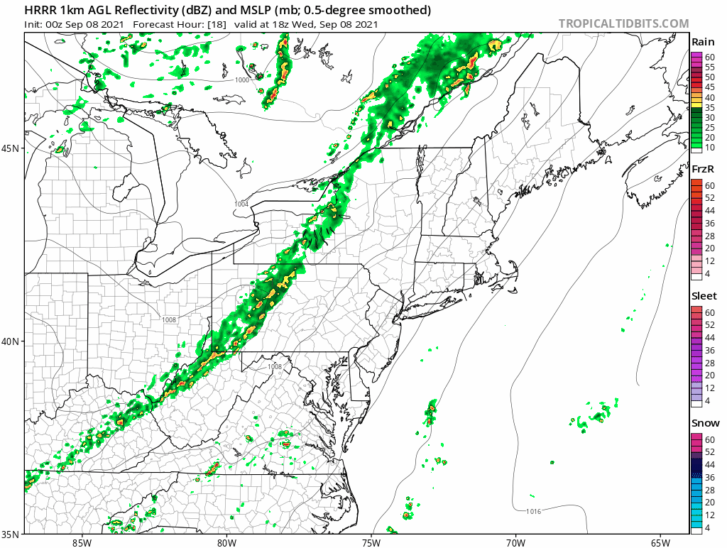
The main line of thunderstorms waits until after sunset to move west to east. You will notice on the HRRR loop that it is one solid slow moving line of storms. This is the risk that storms will take their time moving west to east and all it will take will be a quick inch of rain to send rivers over their banks. For now the National Weather Service is keeping the flood risk inland and west of NYC but this bears watching. If those storms hold together we could see flash flood watches extended eastward on Wednesday.
The slower moving front means that showers could linger along the coast Thursday morning before the front pushes far enough offshore and weather conditions improve later in the day Thursday. We will review the situation closely Wednesday morning and attempt to be more specific regarding the outcome of this event. Once this front gets out of the way it should be a nice day Friday and a nice dry cool start to the weekend. Also we should point out that Hurricane Larry will be passing well offshore over the next 2 days but it will be close enough to produce rough surf and rip current risk for coastal Long Island and New Jersey in case you are beach bound so tread carefully in the coastal waters.
BE SURE TO DOWNLOAD THE FREE METEOROLOGIST JOE CIOFFI WEATHER APP &
ANGRY BEN’S FREE WEATHER APP “THE ANGRY WEATHERMAN!

MANY THANKS TO TROPICAL TIDBITS & F5 WEATHER FOR THE USE OF MAPS
Please note that with regards to any severe weather, tropical storms, or hurricanes, should a storm be threatening, please consult your local National Weather Service office or your local government officials about what action you should be taking to protect life and property.


