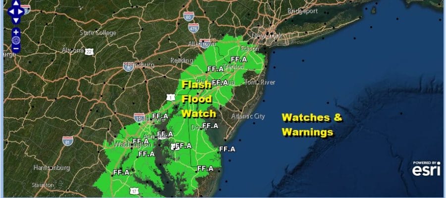
Flash Flood Watch Heavy Rains Possible Today
Weather Improves Friday Saturday Showers Sunday
We are reaping all of the Atlantic moisture that moved in from off the ocean yesterday and last night. This is resulting in tropical downpours today with some areas getting heavy rains. Flash flood watches are up from Eastern Virginia to Central New Jersey and we have already seen some flash flood warnings occur both inside and outside the watch area.
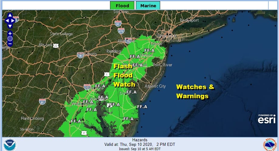

Average rainfall amounts are forecast to be in the 1 to 2 inch range but some areas could see most of this come in a short period of time, or you might wind up with some areas getting higher amounts. Either way either it is the rain that has come up from the south, or the cold front that arrives tonight enhancing showers even more. It is going to be a rather nasty day for most of you UNLESS you are far enough north and west of the coast to avoild all this. That would be in Northeast Pennsylvania and the Hudson Valley north of Route 84.
SATELLITE

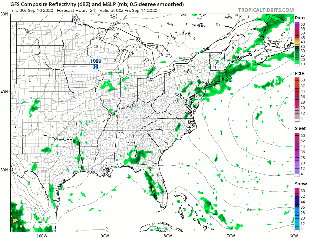
REGIONAL RADAR

Radar shows patches fo heavy downpours moving northward this morning and most of the heavy rain was east of I-95 in general. Some of these downpours are quite heavy as they move slowly north northeastward.
LOCAL RADAR NEW YORK CITY

LOCAL RADAR PHILADELPHIA


This is one of those days where location is everything. Some areas get clobbered and others not so much. The threat for showers continues tonight as a cold front approaches and finally moves through and offshore. This should help weather conditions improve toward morning. Highs today will be in the 70s to near 80 and lows tonight will be in the 60s.
We are still on course for a nice Friday and for at least part of Saturday with some sunshine forecast for both days along with temperatures in the 70s and low humidity. Later Saturday as the onshore flow takes over look for clouds to come in later in the day and at night setting us up for a cold front Sunday and the chance for showers and thunderstorms. You will notice on the GFS loop above Tropical Storm Paulette comes into range passing south of Bermuda but turning northward east of 70 west. The cold front Sunday and the upper trough that comes with it provides the alley way for Paulette to turn out to sea,
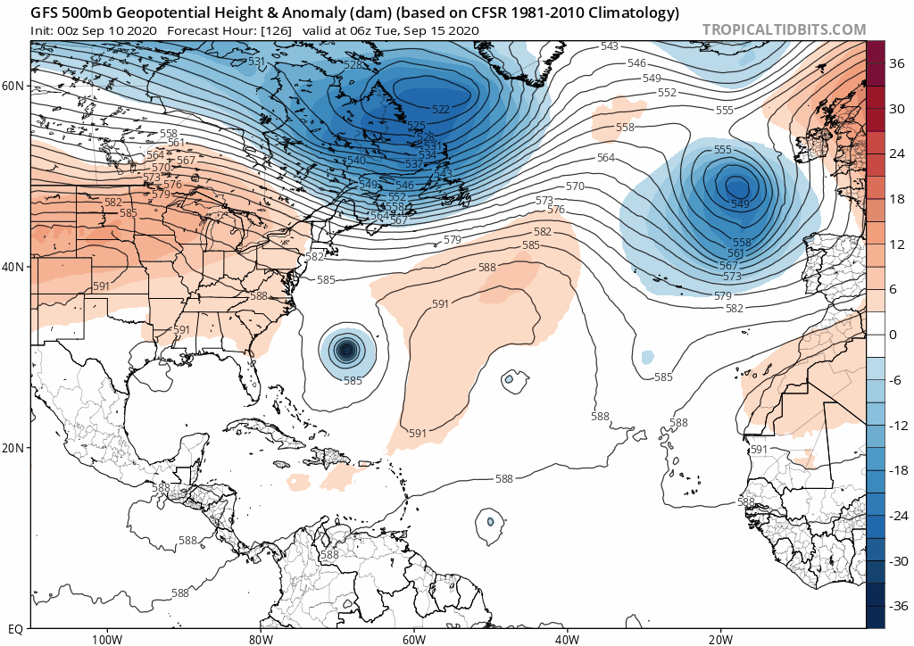
Paulette gets caught in the upper trough moving through the Northeast however the resulting ridge that builds behind it across the Southern US and in the Western Atlantic may wind up steering other systems in the Tropical Atlantic westward. These will be the “S” & T” storms and not Tropical Storm Rene which turns northward over the next few days far out in the Atlantic and will ultimately get absorbed by Paulette in the North Atlantic.
BE SURE TO DOWNLOAD THE FREE METEOROLOGIST JOE CIOFFI WEATHER APP &
ANGRY BEN’S FREE WEATHER APP “THE ANGRY WEATHERMAN!
MANY THANKS TO TROPICAL TIDBITS FOR THE USE OF MAPS
Please note that with regards to any severe weather, tropical storms, or hurricanes, should a storm be threatening, please consult your local National Weather Service office or your local government officials about what action you should be taking to protect life and property.


