Flash Flood Watch Canceled Beautiful Weekend Ahead
Flash Flood Watch Canceled Beautiful Weekend Ahead
The last band of showers and some thunderstorms are moving through the area right now and since the radars remain relatively unimpressive, the area wide Flash Flood Watch has been cancelled. There are still some heavy downpours and a few heavier thunderstorms showing up in a few areas in Coastal New Jersey where some heavy downpours can still be an issue.
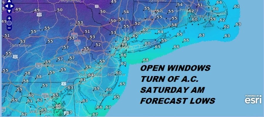
Other than that we look ahead to the dry air on the satellite loop that is beginning to push southeastward and should begin to arrive from west to east late this afternoon and this evening. Skies will clear out tonight. Temperatures will drop into the 50s except in the warmer urban areas which will bottom in the lower 60s. and humidity levels will drop rapidly.
EASTERN SATELLITE

REGIONAL RADAR

LOCAL RADAR NEW YORK CITY

LOCAL RADAR PHILADELPHIA


Saturday and Sunday are going to be two very nice days. Saturday’s highs will be in the 70s to near 80 and Sunday’s highs will be a little higher into the 80s. Humidity levels however will remain low through Sunday. By Monday temperatures will start to climb into the middle and upper 80s and Tuesday we could see highs back to 90 degrees before the next cold front approaches late in the day with a shower or thunderstorm.
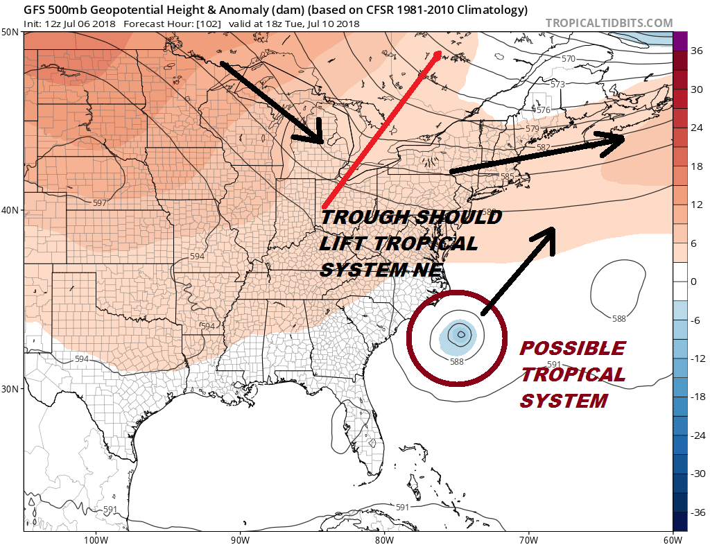
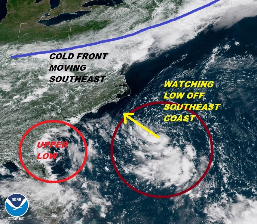
With regards to the possible tropical system off the Southeast Coast of the US, it will likely get trapped for a few days off the Carolina coast before the next cold front and upper trough arrive on Tuesday. This should kick this system away to the northeast with no issues for us however there is some uncertainty here regarding how this tropical system reacts to an upper low to the west of it.
Should the trough to the north be less deep or not as far south it could cause the system off the coast to move more westward toward the Southeast US coast early next week. Odds favor this not being an issue at this point but there is some uncertainty. The presence of a westerly flow over us would argue against this coming up too close to the coast at this stage of the game.
Here is the latest on Hurricane Beryl in the Eastern Atlantic
Here is more on the low off the Southeast Coast of the US
 GET JOE A CIGAR IF YOU LIKE

LATEST JOESTRADAMUS ON THE LONG RANGE


