First Round of Rain Done More Rain Saturday Weather Improves Sunday
Overnight we had some rain move through and that first batch is done. It didn’t produce a whole lot of rain in terms of volume. Amounts were on the order of a quarter of an inch or less and in some places much less. There are still a lot of clouds on the satellite picture this morning that extend back into the Ohio Valley and south into Maryland and West Virginia. I don’t expect much rain today until the second batch to the west moves eastward and that will bring in some more rain overnight into Saturday morning.
SATELLITE

REGIONAL RADAR

Regional and local radars show the rain from overnight that has moved to the east and the second area of rain that has moved into Western Pennsylvania. Local radars show the lead area of rain from overnight mostly offshore and sliding to the east.
LOCAL RADAR NEW YORK CITY

LOCAL RADAR PHILADELPHIA


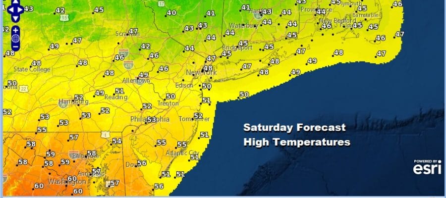
As for temperatures today don’t expect much with cloud cover. We will likely hold in the upper 40s and lower 50s on average for most places and then hold there overnight as round 2 of the rain goes by. Saturday could see a wider range of highs as warm air tries to push northward and colder air holds a grip over New England. You can see the ranges here from the 40s in Southern New England to the 60s in Northeast Virginia.

Once the last round of rain goes through on Saturday I don’t see any issues regarding snow on the backside which was based one very over zealous European model run and a number of screaming snow weenies who have no clue how weather works. Parts of upstate NY & New England (I-90 north) will see some snow from the this on the order of 1 to 3/2 to 4 inches but other than some wet snow mixing in at the end for everyone else this is a big zero. Weather improves somewhat on Sunday with gusty winds and some sunshine and arriving clouds again. Highs will be mostly in the 30s. There is a bit of a warm front that moves through Sunday night with some snow showers ahead of it. That might whiten the ground in spots from Northeast PA to Northern New Jersey to the Hudson Valley and Connecticut. It might produce a quick snow shower for NYC and Long Island as well but this is nothing of concern.

While the weather pattern will be busier in the next couple of weeks as weather systems move along, the upper air pattern remains unfavorable for any major snows for the I-95 Corridor or for that matter, any snow at all unless you get a situation where shots of cold air time out perfectly with weather systems moving through. The first such weather system is late Tuesday into Wednesday and I’m not particularly bullish on this. The second may come next weekend. I think that might have a greater chance.
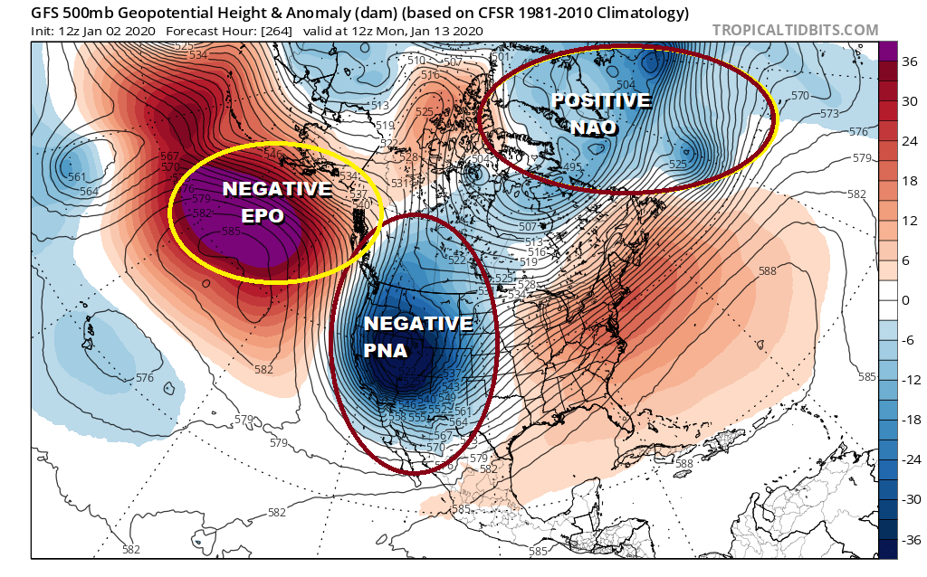
The upper air pattern is about as bad as it gets for the next 10 days to 2 weeks however there are some signs it could break down after mid month. We spoke of this yesterday in our long range JOESTRADAMUS post which is available for app users and patreon members.
BE SURE TO DOWNLOAD THE FREE METEOROLOGIST JOE CIOFFI WEATHER APP &
ANGRY BEN’S FREE WEATHER APP “THE ANGRY WEATHERMAN!
MANY THANKS TO TROPICAL TIDBITS FOR THE USE OF MAPS
Please note that with regards to any severe weather, tropical storms, or hurricanes, should a storm be threatening, please consult your local National Weather Service office or your local government officials about what action you should be taking to protect life and property.


