
Fall Foliage Spectacular With Another Day of Sunshine
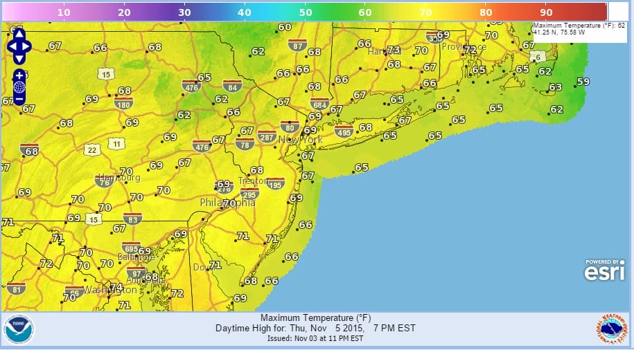
Just in case you missed out on an absolutely beautiful day of sunshine and fall foliage on Tuesday get set for another winner today as we will have another glorious day of sunshine, crisp clean air, and temperatures around 70 plus or minus a few degrees. Coastal areas will be cooler today than inland areas as high pressure builds down from the north and we enjoy a northeast wind from off the ocean. But skies will be cloud free once again as an upper high keeps the atmosphere void of any cloud cover or for that matter any clouds at all.
 Thursday presents an issue in moisture that remains lagging off the Carolinas. The high to the north holds it at bay however it will then give way to allow that disturbance to creep up the coast Thursday. Low clouds will probably move in to some areas Wednesday night and then spread slowly northward on Thursday. Some light rain or drizzle is possible later Thursday and Thursday evening but any rain from this will not amount to much.
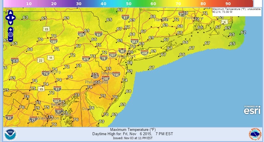
On Friday with winds going to southwest ahead of the next cold front we should see some breaks of sunshine return especially away from the coast where it may take longer to clear out. Temperatures should hit 70 again but that will be the last time in this stretch as the cold front will move through. Areas inland and well to the west may see some showers from this front but as has been the case so many times in the last few months, the showers will dry up long before they reach the coast.
The rainfall map below shows total rain for Thursday and Friday so the greater amounts will be well west. The amounts along the coast reflect what falls Thursday evening and most of those amounts are under a tenth of an inch. 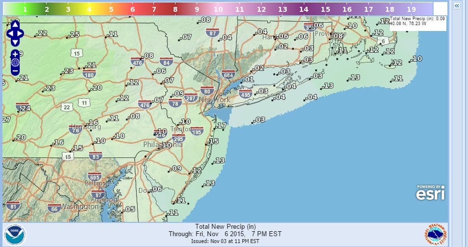
Once the front passes we return to normal temperatures for the season Saturday and Sunday with at least some sunshine on both weekend days. No rain of importance is in the forecast longer term until the middle of next week when another stronger front approaches from the west.
Yesterday’s long range discussion explains the pattern we are in and why it can’t get cold around here for more than a day or two.
Be sure to download my weather app and subscribe to my forecasts.


