European Weather Model Goes Blocky & Cold Long Range
European Weather Model Goes Blocky & Cold Long Range
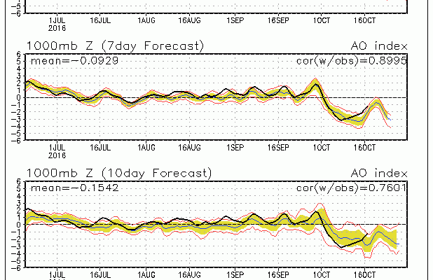
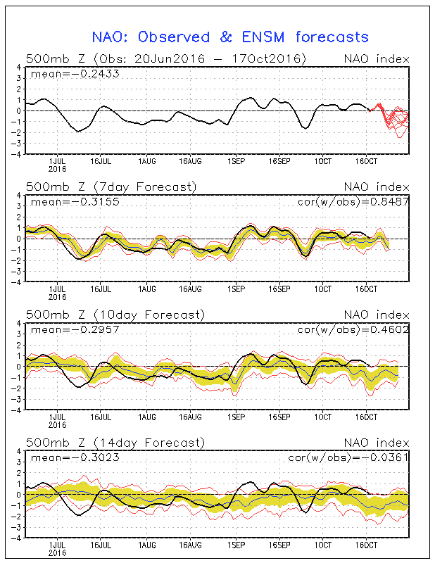
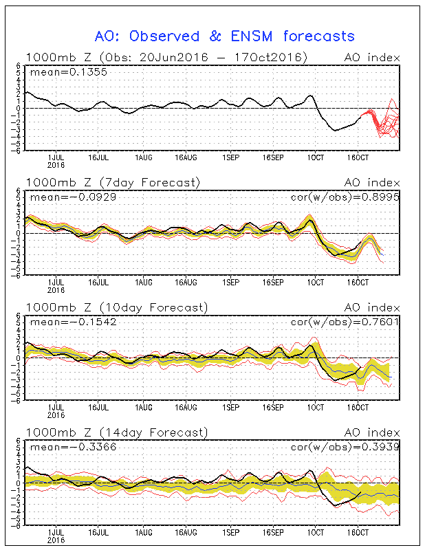
One of the things that I like about this time of year is watching patterns evolve and change over time. They often can prove useful in figuring out how the rest of the autumn and early winter might set up. One of the things I noticed is that the Arctic Oscillation which measures the potential for the southward displacement of cold air in the Arctic has been negative all month long and is forecast to go even more negative. This would favor the development of a colder weather pattern across the Eastern US. Also the North Atlantic Oscillation which watches the same concept from the northeast in Greenland and nearby has been only slightly positive to neutral all month long and is forecast to go negative as well for the end of the month.
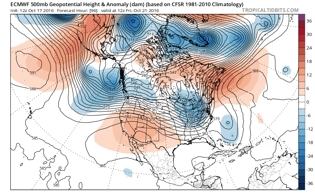
The European weather model today and the GFS weather model to a certain extent pounce on all this later in the period by developing a rather cold pattern across the Northeast & Midwest. The European develops a strong blocking high over and just east of Greenland which pins a vortex in Eastern Canada.
Now what this means for the long term obviously remains to be seen. The European model is suggesting now that the weekend coming up will basically be cold and dry as this vortex in Eastern Canada develops stronger than the other models and overwhelms the northeast with colder dry air. We have to wait and see if this plays out. Afterwards the question of the developing upper high is something to watch. Models usually love to do things like this only to back off over time. The reason I think this is important is that this could be the first solid sign of the semi-permanent ridge in the Southeast US breaking down and a setup of a different longer term pattern. In weak El Nino/La Nina years a negative AO/NAO index in October is a sign of a colder than average winter setting up. Obviously this is just one of many indicators to watch. Last year this did not work as the El Nino trumped everything but it might work this year all other things being equal. If this signal is correct, it may mean this last gasp of summer we are seeing this week, will indeed be the last gasp of summer.
MANY THANKS TO TROPICAL TIDBITS FOR THE WONDERFUL USE OF THE MAPS

MENTION JOE CIOFFI AND GET A 5% DISCOUNT
WINTER 2016-2017 PART 1 OCEAN WATER TEMPERATURES
WINTER 2016-2017 PART 2 ARCTIC SEA ICE AND SIBERIAN SNOW COVER
FiOS1 News Weather Forecast For Long Island
FiOS1 News Weather Forecast For New Jersey
FiOS1 News Weather Forecast For Hudson Valley
NATIONAL WEATHER SERVICE SNOW FORECASTS
LATEST JOESTRADAMUS ON THE LONG RANGE
Weather App

Don’t be without Meteorologist Joe Cioffi’s weather app. It is really a meteorologist app because you get my forecasts and my analysis and not some automated computer generated forecast based on the GFS model. This is why your app forecast changes every 6 hours. It is model driven with no human input at all. It gives you an icon, a temperature and no insight whatsoever.
It is a complete weather app to suit your forecast needs. All the weather information you need is right on your phone. Android or I-phone, use it to keep track of all the latest weather information and forecasts. This weather app is also free of advertising so you don’t have to worry about security issues with your device. An accurate forecast and no worries that your device is being compromised.
Use it in conjunction with my website and my facebook and twitter and you have complete weather coverage of all the latest weather and the long range outlook. The website has been redone and upgraded. Its easy to use and everything is archived so you can see how well Joe does or doesn’t do when it comes to forecasts and outlooks.
Just click on the google play button or the apple store button on the sidebar for my app which is on My Weather Concierge. Download the app for free. Subscribe to my forecasts on an ad free environment for just 99 cents a month.
Get my forecasts in the palm of your hand for less than the cost of a cup of Joe!
![]()