European Weather Model Bullish Storm Signal

Last night’s European model run was very bullish on the east coast storm signal for next week. Also the European model has a colder look than the other models as it builds a strong high over Eastern Canada and Quebec which should allow colder air to bleed further south and toward the coast. Of course at this stage of the game specifics are way too early. The European weather model and the GFS long range model seem to have similar ideas going with the GFS showing an even deeper low moving up the coast just offshore. So it will be the usual games of how important cold air will be. The last several storms have shown cold air to be more important as we get closer to the time frame.
European Weather Model Bullish Storm Signal
VIDEO ANALYSIS
Here are the two model looks for next Wednesday Evening. Both models have deep lows but the European has less of the northern stream getting involved and a more vigorous southern stream energy feature. This makes the high to the north more important on the European than on the GFS.
European weather model bullish storm signal European and GFS surface/jet stream Next Wednesday night 02242016
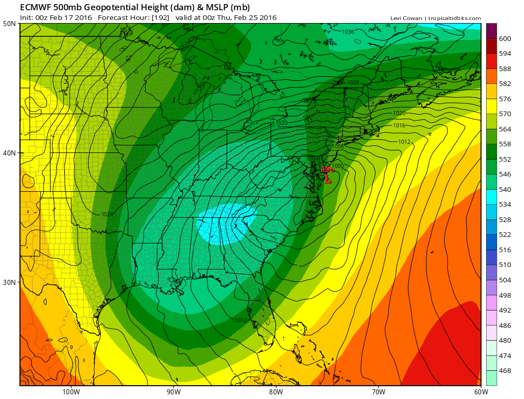
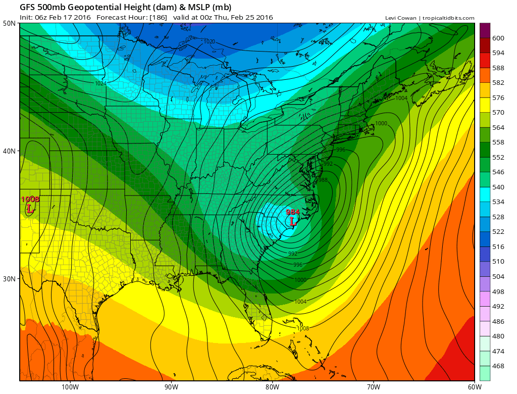
We will certainly have many more model runs to go on this so I come to no specific conclusions at this point other than the storm signal is there. Ensembles on the European were colder and further east. The day runs are beginning now so we shall see where they take us. Remember there is a lot of energy running around. Phasing, partial phase, or no phase will all make a huge difference in many directions.
NATIONAL WEATHER SERVICE SNOW FORECASTS
LATEST JOESTRADAMUS ON THE LONG RANGE
Weather App

Winter is INSANE! Don’t be without Meteorologist Joe Cioffi’s weather app. The difference between my app and other apps is that my forecast is on the app. Most weather apps are automated. The forecast you get is the GFS model which changes every 6 hours and offers absolutely no consistency whatsoever. It is a complete weather app to suit your forecast needs. All the weather information you need is right on your phone. Android or I-phone, use it to keep track of all the latest weather information and forecasts. This weather app is also free of advertising so you don’t have to worry about security issues with your device. An accurate forecast and no worries that your device is being compromised.
Use it in conjunction with my website and my facebook and twitter and you have complete weather coverage of all the latest weather and the long range outlook. The website has been redone and upgraded. Its easy to use and everything is archived so you can see how well Joe does or doesn’t do when it comes to forecasts and outlooks.
Just click on the google play button or the apple store button on the sidebar for my app which is onMy Weather Concierge. Download the app for free. Subscribe to my forecasts on an ad free environment for just 99 cents a month.
Get my forecasts in the palm of your hand for less than the cost of a cup of Joe!
![]()