
European Model Shows Inland Storm Track
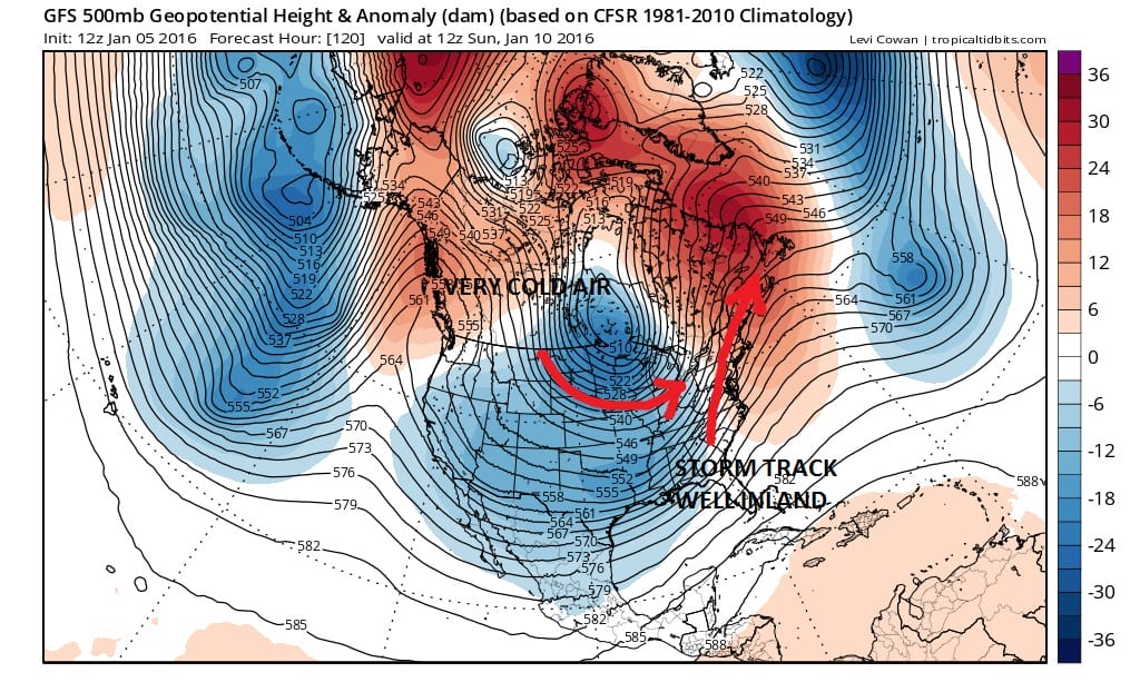
You can have all the indicators tell you one thing but in the end it is how the atmosphere lines up and with respect to the weekend event, the models were right about something happening but they were wrong in terms of timing and in terms of track. The European model has taken the lead on this and while the GFS is clueless over what is happening at the surface it does have a similar idea aloft.
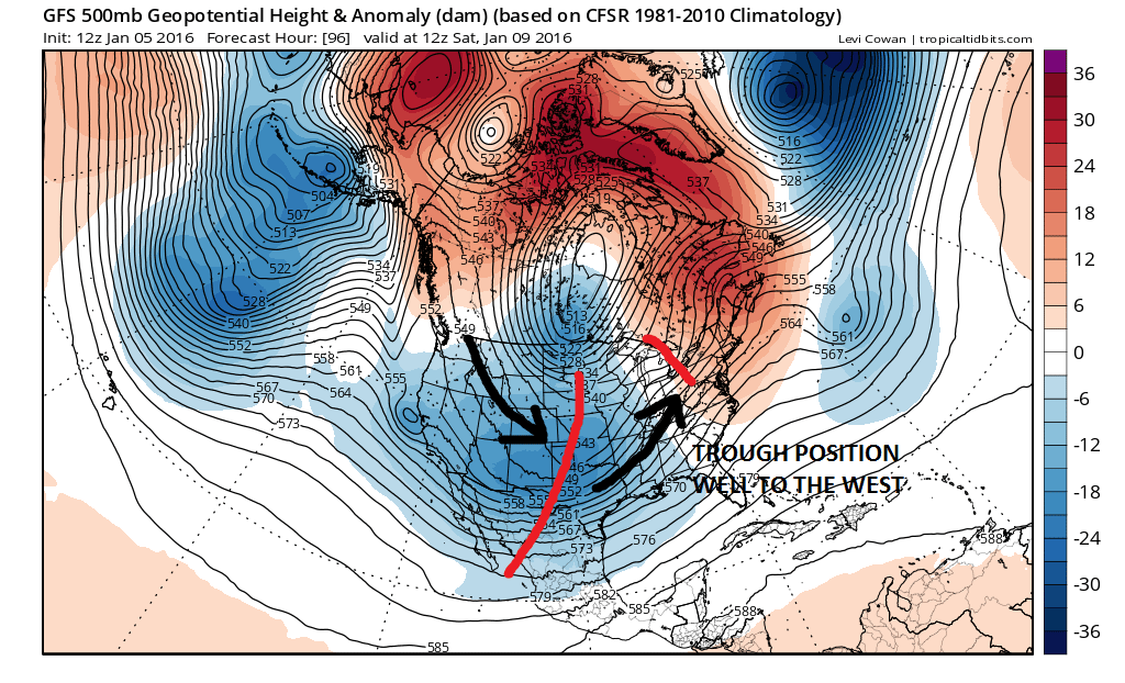
The GFS upper air at Saturday morning shows the broad trough setting up well to the west which favors an inland storm track. Even with an increasing amount of blocking that is developing across the North Atlantic and the rising pressures in the Arctic isn’t enough to create a coastal track. The ensemble models were timing out differently at the beginning of all this which would have allowed cold air to return first before any storm development but this is not going to be the case.
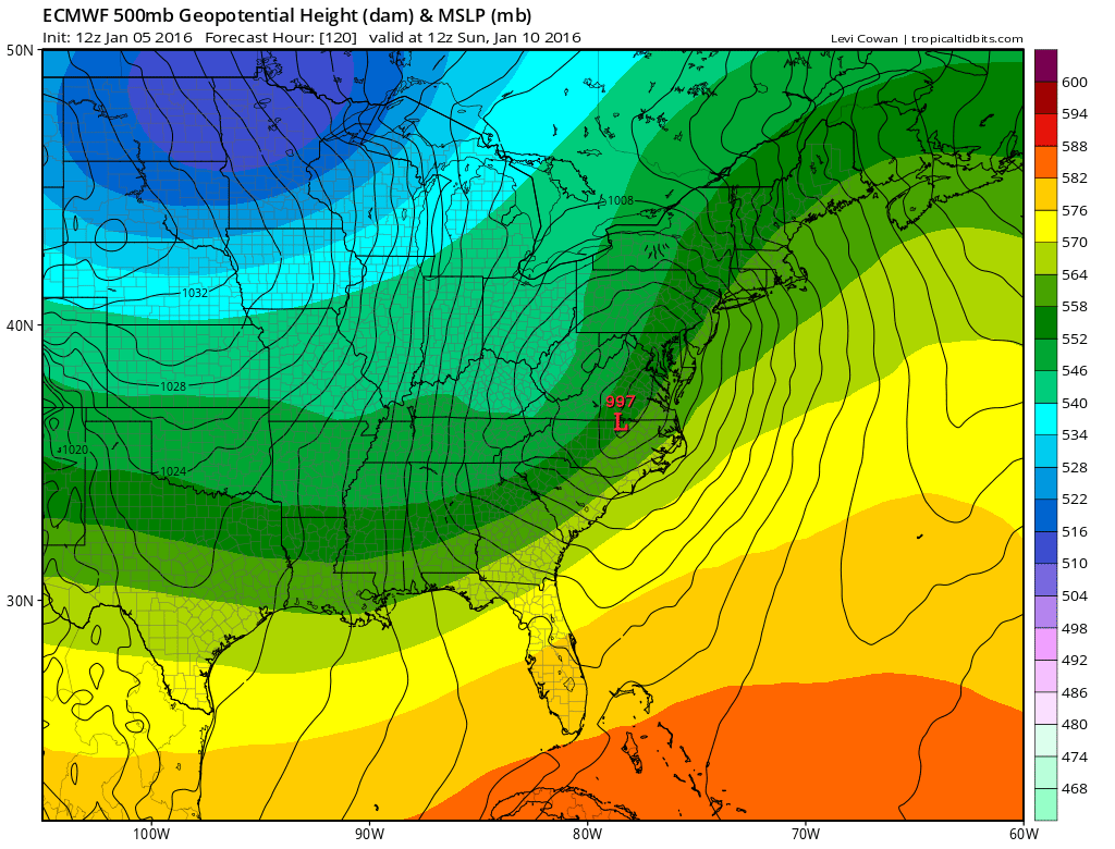
You can see where the low is on the European surface map with the upper air flow in the colors behind it. Colder air is where you have the blues. Warmer in the green and yellow. What this means from a practical standpoint is rain for Sunday and temperatures rising into the 50s before the low goes by. Monday and Tuesday will be colder as the pattern favors another shot of cold air coming into the Eastern US.
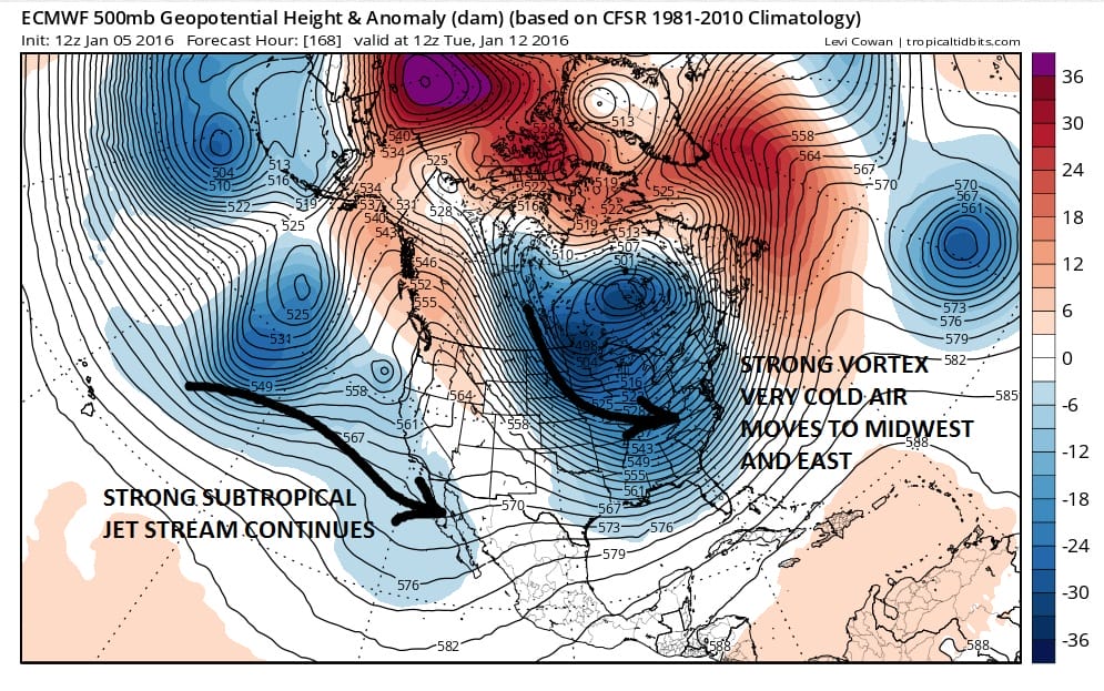
The overall pattern still suggests active weather down the road as the active tropical jet will continue to send systems into California. Eventually these will be moving across the southern stream. Remember that as always, lots of things have to line up right. You can have all the right ingredients and the right set up and they still have to somehow come together. The European model continues to outperform so we will rely on that more going forward for clues.
NATIONAL WEATHER SERVICE SNOW FORECASTS
LATEST JOESTRADAMUS ON THE LONG RANGE
Weather App

Winter is here! Don’t be without Meteorologist Joe Cioffi’s weather app. It is a complete weather app to suit your forecast needs. All the weather information you need is right on your phone. Android or I-phone, use it to keep track of all the latest weather information and forecasts. This weather app is also free of advertising so you don’t have to worry about security issues with your device. An accurate forecast and no worries that your device is being compromised.
Use it in conjunction with my website and my facebook and twitterand you have complete weather coverage of all the latest weather and the long range outlook. The website has been redone and upgraded. Its easy to use and everything is archived so you can see how well Joe does or doesn’t do when it comes to forecasts and outlooks.
Just click on the google play button or the apple store button on the sidebar for my app which is onMy Weather Concierge. Download the app for free. Subscribe to my forecasts on an ad free environment for just 99 cents a month.
Get my forecasts in the palm of your hand for less than the cost of a cup of Joe!


