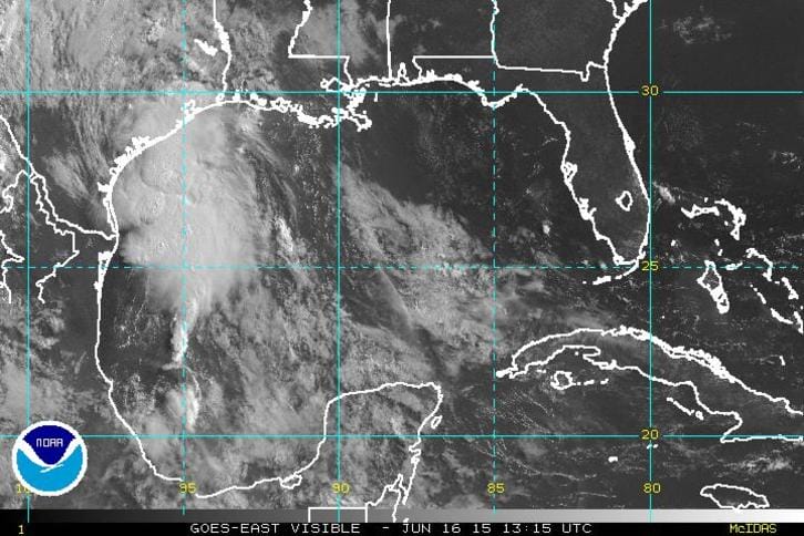
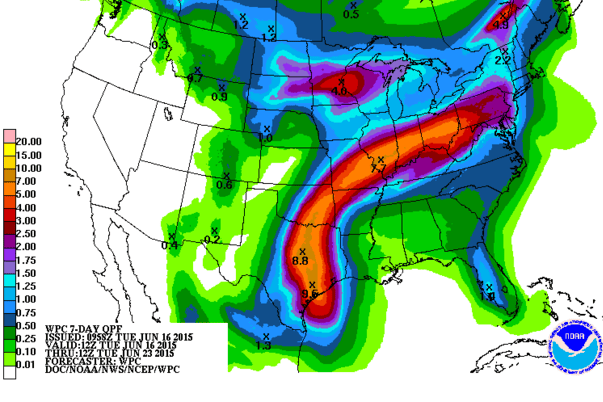
Tropical Storm Bill is hitting the Texas coast with wind and rain and it has strengthened some as it nears land. The storm will be moving inland soon and the satellite shows that this system has a ton of tropical moisture. This is going to bring considerable rain to northeast Texas where there will be flooding. Storms that usually move inland in Texas are almost never an issue up here down the road. Most of the time the easterly flow at that latitude plus the position of the summer ridge takes this moisture west or northwest forever. However we have a bit of a different set up aloft that is going to probably take that moisture northward and then northeastward and finally east northeastward to the Ohio Valley and then for parts of the Northeast. The European model is showing this very well today as it drives considerable rain here later Sunday into Monday of next week. Of particular concern would be if the rain gets into upstate NY where there has been damaging flooding this week, thanks to persistent thunderstorms.
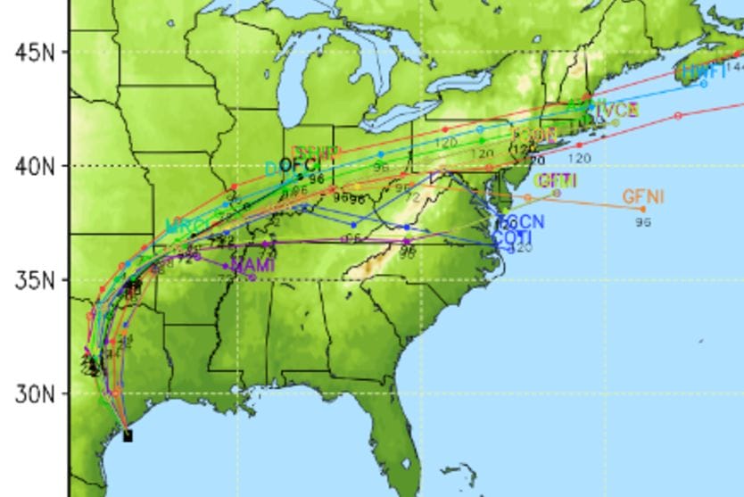
The strong westerly flow north of 35N just won’t go away and it is begin anchored by ridges on both coasts. By 96 hours which is Friday evening you can see below that trough in the middle Mississippi Valley anchored by the two ridges..one on each coast. The alley way is open for moisture to shoot up around the western edge of the east coast ridge right into those westerlies taking the rains from Bill eastward toward us.