
Euro Model Shows Coastal Low Midweek

MENTION JOE CIOFFI AND GET A 5% DISCOUNT
The Euro model this afternoon along with the other weather models continue to focus attention on the Middle Atlantic and Northeastern States for the midweek period with the possibility of a noreaster. The overnight Euro model was exceptionally deep with a coastal low by Thursday evening sitting just offshore which would imply strong noreaster conditions and the threat for some serious coastal flooding.
Euro Model Shows Coastal Low Midweek
Overnight and Day Run Euro Model for Thursday

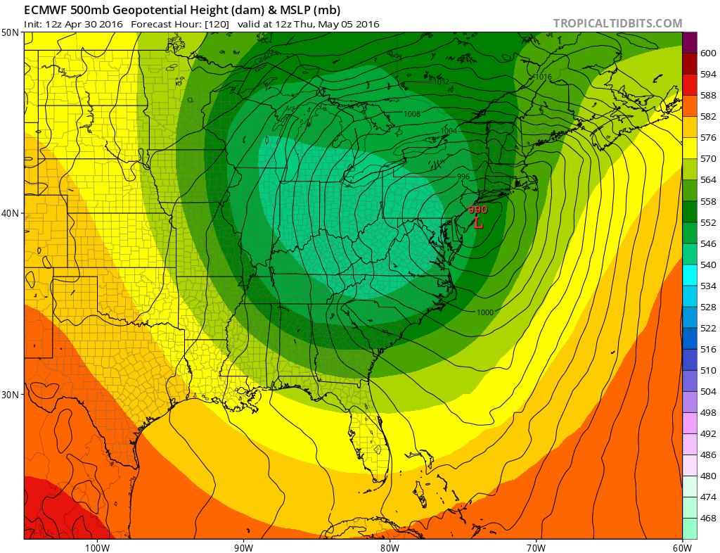
The maps above show the overnight run at the top and the day run underneath. There are 2 big differences. First off the day run is 12 hours faster and further northwest. It is also less deep at this stage. The issue is the position of the upper air storm. Today’s run does not dive the upper feature into the Southern Appalachians but instead keeps it further north into Southern Ohio/West Virginia. That shift is important because it does alter the coastal profile of the storm. Now this does not mean necessarily that either run is exactly correct and there is some compromise here that could be in order. Still it seems that a period of heavy rain and wind seem likely for the coast later Wednesday into Thursday (if you buy this timing).
All of this hinges really on the strength of the blocking in the atmosphere later this week. A stronger blocking signal would force the track to be further east like the overnight run. Both runs actually wind up hooking the surface low to the northwest eventually. The GFS model follows the Euro model rather closely in this idea though it seems to time things out about 24 hours slower than the Euro model.
Euro Model Shows Coastal Low Midweek
GFS MODEL FRIDAY
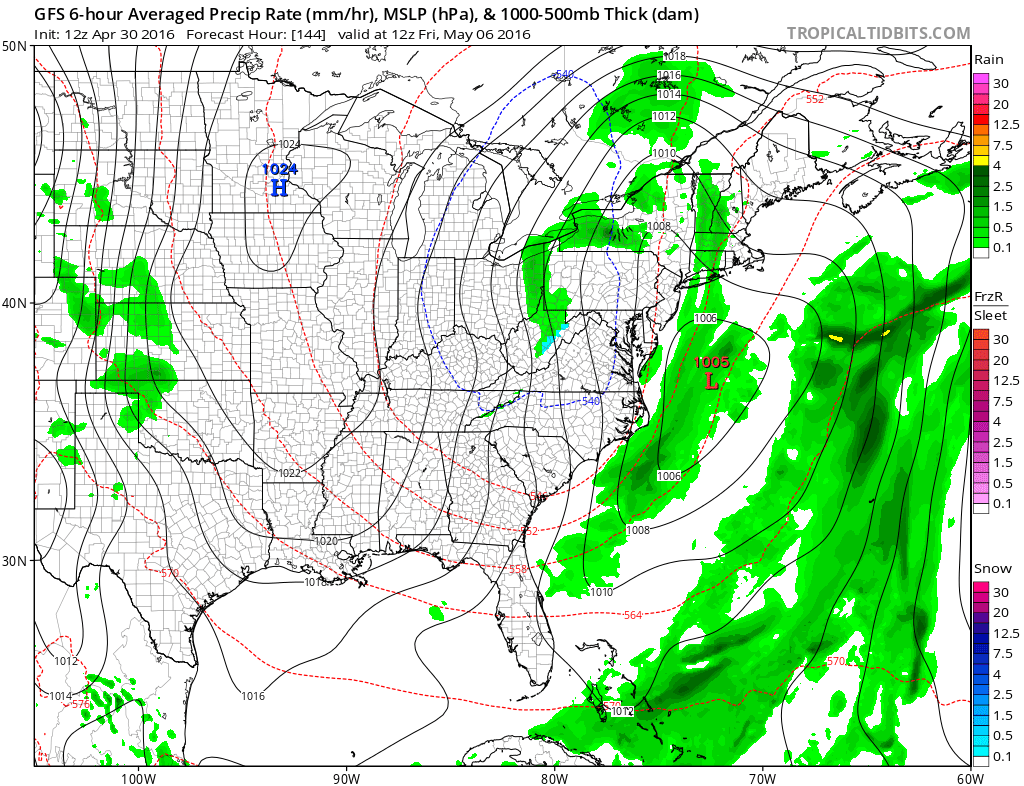
So what do we do from a forecast standpoint? I think it is safe to say that something is going to happen late this week in the east but there are still lots of questions regarding timing and depth. I think the threat for a noreaster is there. Add the full moon to the equation and there could be some serious coastal flooding issues if this plays out. But as we learned this past winter, models have had there ups and downs with development of storms in the east so there may be more model surprises coming.
FiOS1 News Weather Forecast For Long Island
FiOS1 News Weather Forecast For New Jersey
FiOS1 News Weather Forecast For Hudson Valley
NATIONAL WEATHER SERVICE SNOW FORECASTS
LATEST JOESTRADAMUS ON THE LONG RANGE

NOMINATED FOR AN APPY AWARD FOR BEST WEATHER APP!!
Weather App

Don’t be without Meteorologist Joe Cioffi’s weather app. It is really a meteorologist app because you get my forecasts and my analysis and not some automated computer generated forecast based on the GFS model. This is why your app forecast changes every 6 hours. It is model driven with no human input at all. It gives you an icon, a temperature and no insight whatsoever.
It is a complete weather app to suit your forecast needs. All the weather information you need is right on your phone. Android or I-phone, use it to keep track of all the latest weather information and forecasts. This weather app is also free of advertising so you don’t have to worry about security issues with your device. An accurate forecast and no worries that your device is being compromised.
Use it in conjunction with my website and my facebook and twitter and you have complete weather coverage of all the latest weather and the long range outlook. The website has been redone and upgraded. Its easy to use and everything is archived so you can see how well Joe does or doesn’t do when it comes to forecasts and outlooks.
Just click on the google play button or the apple store button on the sidebar for my app which is on My Weather Concierge. Download the app for free. Subscribe to my forecasts on an ad free environment for just 99 cents a month.
Get my forecasts in the palm of your hand for less than the cost of a cup of Joe!
![]()

