
Euro Model March Snow Threat

This afternoon’s run of the Euro model shows a few changes that lead to a more bullish view regarding a last chance shot at a March snowfall. The model seems to be reacting to a couple of things that are going on in the atmosphere.First off the North Atlantic Oscillation is weakly positive and is trending toward neutral through next week.
Euro Model March Snow Threat Long Term Indices

This is combing with the strengthening off the wall positive Pacific North America or P.N.A. pattern index which remains off the wall positive. This leads to two outcomes. The first with regards to the N.A.O is a storm track to the south rather than to the west. The second is that the PNA means a strong ridge in the west which allows storms to amplify as they reach the east coast.
The first change actually shows up with the lead weather system for the middle of this coming week. Rather than taking a deep storm to the west of the coast like last week’s, the Euro model is now showing a weaker system further southeast. The outcome with this is probably going to be rain that might change to snow in some areas north of the coast before precipitation ends.
Euro Model March Snow Threat Euro Model Forecast Tuesday & Wednesday
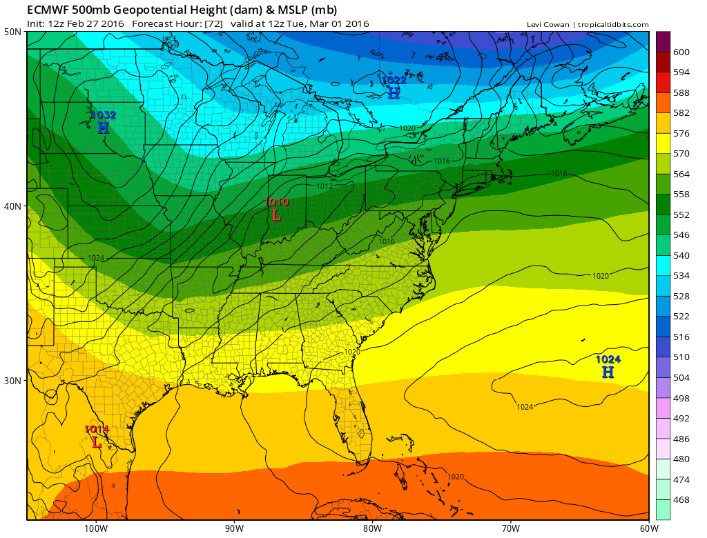
Im not particularly excited about this first weather system given how warm it will be ahead of it. However the fact that model is shying away from a deep storm to Eastern Canada is significant because it sets the stage for system number two. Less depth of the first might allow more room for the second.
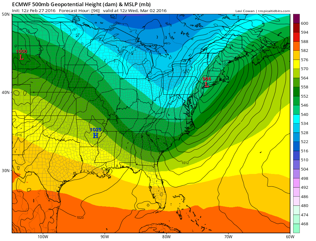
Euro Model March Snow Threat Euro Model Friday Night/Saturday Morning 03/05/2016
The upper air structure on the European is different from prior runs as the southern stream feature is lifting further north. It also shows interaction from the northern jet stream as a disturbance swings around and attempts to phase. The outcome is for a major storm when the low is offshore. The track overall on this run is further northwest and results in the northern snow shield to push into the Southern New England, the Hudson Valley and Northwest New Jersey.
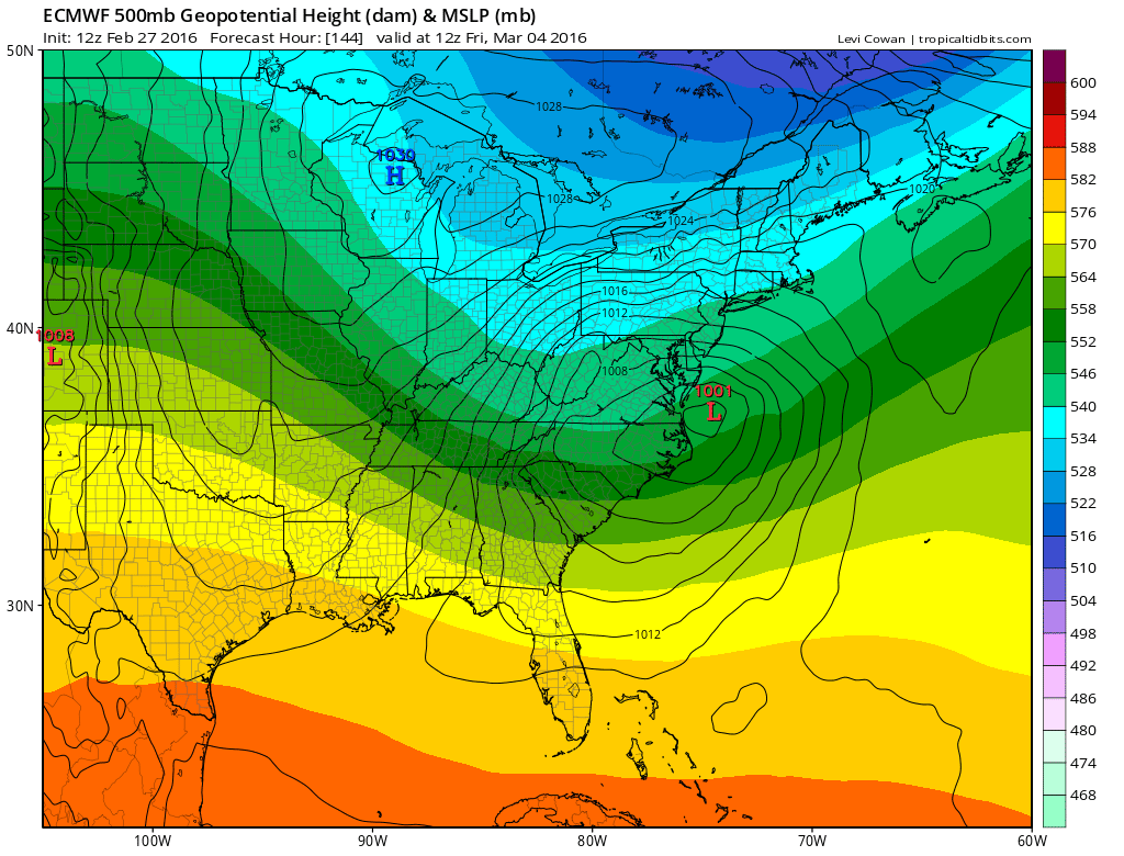
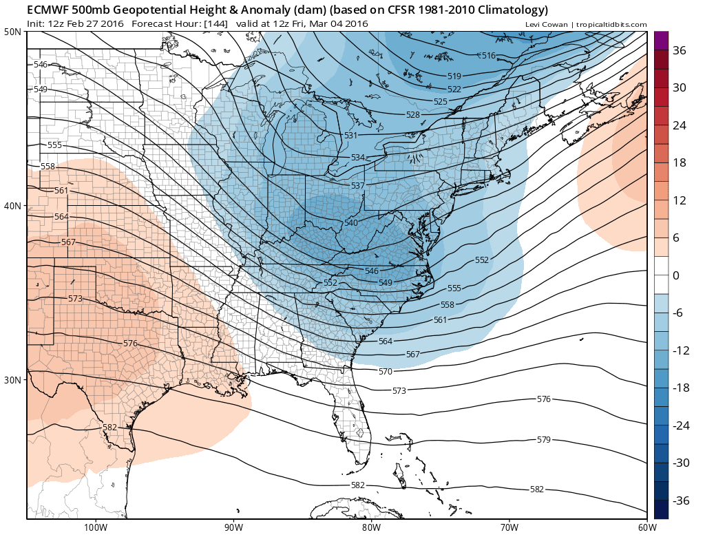
Euro Model March Snow Threat Euro Model 03/06/2016
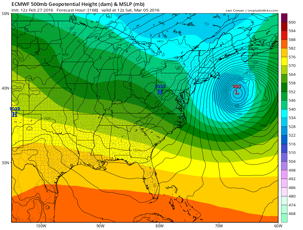
Now a literal interpetation of this run were it to play out exactly is that the immediate coast, Long Island and Southeast New England would get some accumulating snow but the bulk of the storm would still be offshore. Given that this is very early in the game and given that there has been a tendency for models to trend west over time, we will have to watch later runs to see if the trend to be further north continues. Obviously you can’t draw any definitive conclusions based on this one run alone. The Euro model has been leading the way here and the other weather models seem to be adjusting to this in their own way. Again as it the past storms of the last several weeks, timing and phasing of individual areas of energy will be key. The Euro does some sort of phase here but as we have seen in the past, that isn’t always what the final outcome is. The pattern at least is opening a door for one last gasp attempt before winter wraps up and calls it a day.
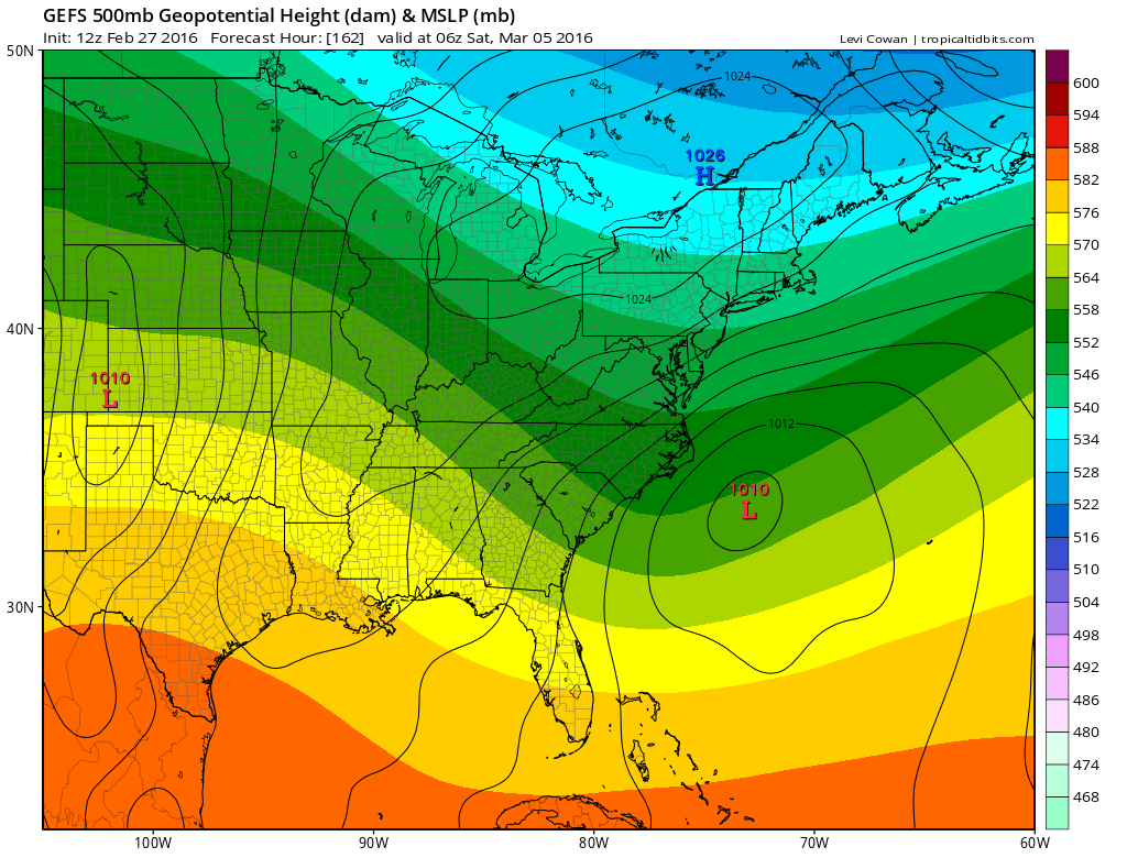
Euro Model March Snow Threat Ensemble Means Canadian Weather Model & GFS
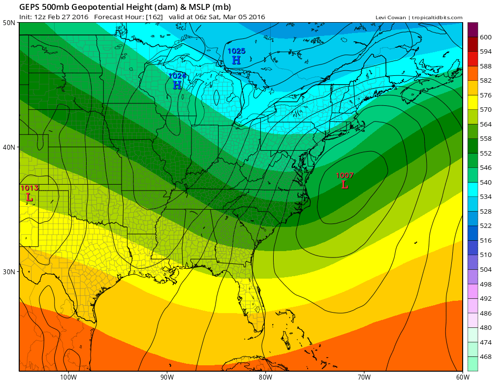
Weather model ensemble means above and below show the Canadian Weather Model ensemble lining up fairly well with the Euro model while the GFS ensemble means are more suppressed and further south.
OVERNIGHT MODEL VIDEO ANALYSIS. PLEASE JOIN ME ON MY YOU TUBE CHANNEL FOR LATEST WEATHER FORECAST VIDEOS.
FiOS1 News Weather Forecast For Long Island
FiOS1 News Weather Forecast For New Jersey
FiOS1 News Weather Forecast For Hudson Valley
NATIONAL WEATHER SERVICE SNOW FORECASTS
LATEST JOESTRADAMUS ON THE LONG RANGE
Weather App

Don’t be without Meteorologist Joe Cioffi’s weather app. It is really a meteorologist app because you get my forecasts and my analysis and not some automated computer generated forecast based on the GFS model. This is why your app forecast changes every 6 hours. It is model driven with no human input at all. It gives you an icon, a temperature and no insight whatsoever.
It is a complete weather app to suit your forecast needs. All the weather information you need is right on your phone. Android or I-phone, use it to keep track of all the latest weather information and forecasts. This weather app is also free of advertising so you don’t have to worry about security issues with your device. An accurate forecast and no worries that your device is being compromised.
Use it in conjunction with my website and my facebook and twitter and you have complete weather coverage of all the latest weather and the long range outlook. The website has been redone and upgraded. Its easy to use and everything is archived so you can see how well Joe does or doesn’t do when it comes to forecasts and outlooks.
Just click on the google play button or the apple store button on the sidebar for my app which is on My Weather Concierge. Download the app for free. Subscribe to my forecasts on an ad free environment for just 99 cents a month.
Get my forecasts in the palm of your hand for less than the cost of a cup of Joe!
![]()
