
Enjoy Today Because Gloom Doom Rain Begins Friday Lasts Into At Least Sunday

Enjoy Today Because Gloom Doom Rain Begins Friday Lasts Into At Least Sunday
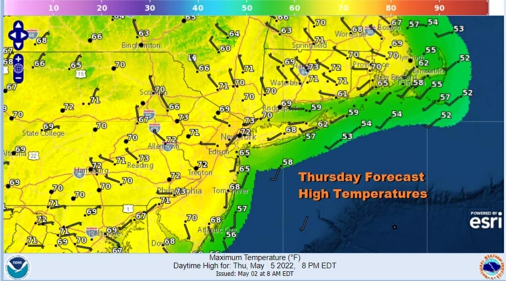
Before we get to the bad news let us focus on today which is the best weather day of the week. We have a satellite picture that shows mainly sunny skies in the Northeast and Middle Atlantic states, other than some leftover overnight low clouds which will disappear. We will have sunshine all day and temperatures will make it into the 70s this afternoon. Even near the coast temperatures will make it into the 60s. Do please spend some time outdoors because it may be days before we get anything close to this again. There are no issues on the radar nor will there be today and into tonight.
SATELLITE

WEATHER RADAR

Overnight clouds will increase from west to east and rain looks to come in faster and arrive before daybreak Friday. After it gets here, it will be rain Friday through much of Saturday. Over the two day time frame we are looking at a 1 to 2 inch rainfall spread out over two and a half days so I don’t think it should cause big issues. Winds will be from the east and once the rain gets in here, temperatures will settle into the 50s and possibly in some areas closer to 50 degrees. It is going to be a long stretch of gloomy wet weather.

I was holding out a little bit of hope that at least the rain would stop on Sunday and that maybe we could see some drying in from high pressure to the northeast. However the blocking pattern is strong and the upper air storm with this system is moving slower and slower and will be lingering along the East Coast into the first half of next week. Sunday at the very least will be cloudy all day with a northeast wind and temperature in the 50s. I also am now thinking that rain could still be an issue especially from NYC & Long Island southward through New Jersey and into the Coastal Mid Atlantic states.

This upper air storm is going to move off the Mid Atlantic coast and basically get left behind. There is nothing in the atmosphere to pick it up and take it northeast. Instead it is likely to drift for a few days. If anything it will drift slowly southward. The problem for next week is that we are going to be under the circulation of this upper air storm and that likely keeps us in clouds, and we will need to be watching for waves of rain coming in at times from the east as spokes rotate around the upper low. It is conceivable that gloom and doom could last into the middle of next week.
BE SURE TO DOWNLOAD THE FREE METEOROLOGIST JOE CIOFFI WEATHER APP &
ANGRY BEN’S FREE WEATHER APP “THE ANGRY WEATHERMAN!
MANY THANKS TO TROPICAL TIDBITS & F5 WEATHER FOR THE USE OF MAPS
Please note that with regards to any severe weather, tropical storms, or hurricanes, should a storm be threatening, please consult your local National Weather Service office or your local government officials about what action you should be taking to protect life and property.


