Eastern Pennsylvania Flash Flooding Moving East Wednesday
Eastern Pennsylvania Flash Flooding Moving East Wednesday
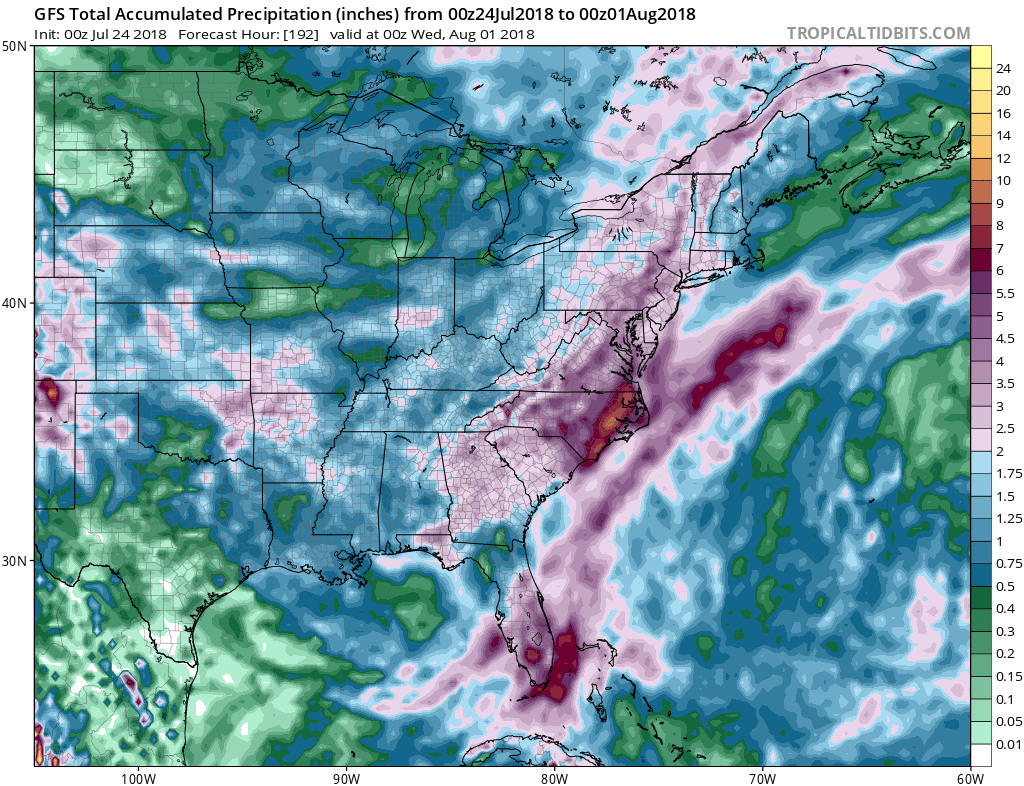
A new day brings the same old story with the concentration of downpours continuing to sit over the Eastern Half of Pennsylvania as well as areas to the north in Upstate NY and areas to the south down into Virginia and North Carolina. To the east of this large area of Flash Flood Watches & Flash Flood Warnings we sit in humidity and some breaks of sunshine this morning though there are some scattered downpours dotting the radar nearby. Like yesterday much of the downpour activity will be inland north and west of the coast. Tropical conditions means high humidity and temperatures into the 80s.
EASTERN SATELLITE
REGIONAL RADAR
Radars continue to show heavy bands of rain moving northward and this is going to compound the already saturated grounds from Eastern Virginia northward to Eastern Pennsylvania. Numerous flash flood and flood warnings/advisories are posted and more are likely today into tonight
LOCAL RADAR NEW YORK CITY
LOCAL RADAR PHILADELPHIA
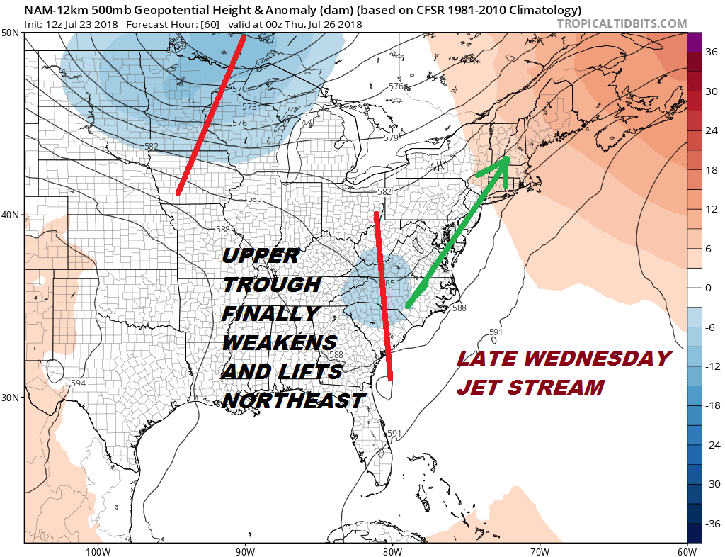
Wednesday sees a shift of all this to the east as the upper trough to the west begins to finally lift out to the northeast. This shifts and expands the rain to the east and it will mean rain from New Jersey to Southern New England and Long Island especially Wednesday afternoon into Wednesday night. Temperatures will be in the 70s and rainfall amounts will be in the 1 to 3 inch range. This opens the door for flash flooding.
Please note that with regards to any tropical storms or hurricanes, should a storm be threatening, please consult your local National Weather Service office or your local government officials about what action you should be taking to protect life and property.