Eastern Pennsylvania Flash Flooding Moving East Wednesday
Eastern Pennsylvania Flash Flooding Moving East Wednesday
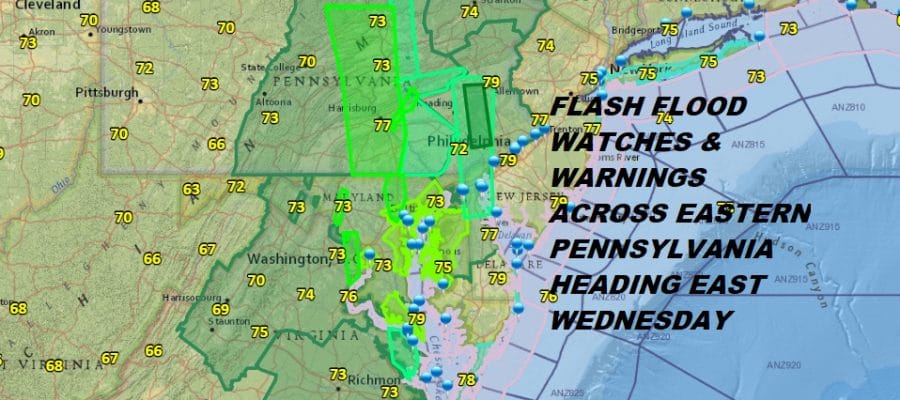
A new day brings the same old story with the concentration of downpours continuing to sit over the Eastern Half of Pennsylvania as well as areas to the north in Upstate NY and areas to the south down into Virginia and North Carolina. To the east of this large area of Flash Flood Watches & Flash Flood Warnings we sit in humidity and some breaks of sunshine this morning though there are some scattered downpours dotting the radar nearby. Like yesterday much of the downpour activity will be inland north and west of the coast. Tropical conditions means high humidity and temperatures into the 80s.
EASTERN SATELLITE

REGIONAL RADAR

Radars continue to show heavy bands of rain moving northward and this is going to compound the already saturated grounds from Eastern Virginia northward to Eastern Pennsylvania. Numerous flash flood and flood warnings/advisories are posted and more are likely today into tonight
LOCAL RADAR NEW YORK CITY

LOCAL RADAR PHILADELPHIA


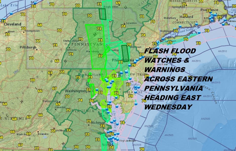
Wednesday sees a shift of all this to the east as the upper trough to the west begins to finally lift out to the northeast. This shifts and expands the rain to the east and it will mean rain from New Jersey to Southern New England and Long Island especially Wednesday afternoon into Wednesday night. Temperatures will be in the 70s and rainfall amounts will be in the 1 to 3 inch range. This opens the door for flash flooding.
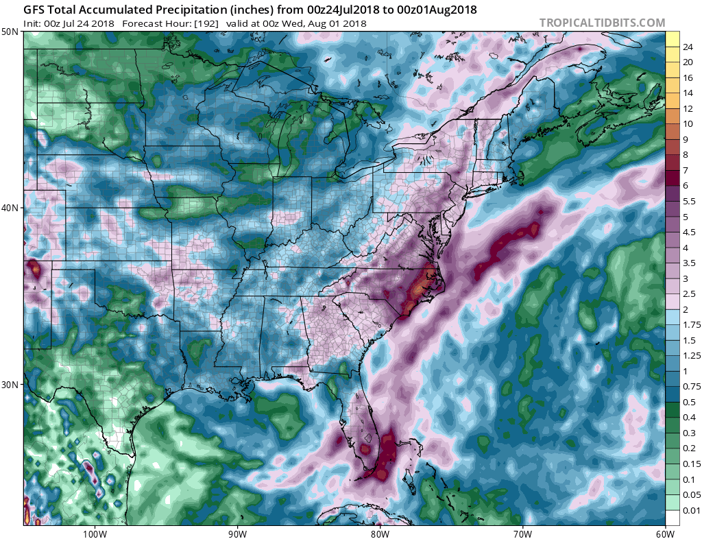
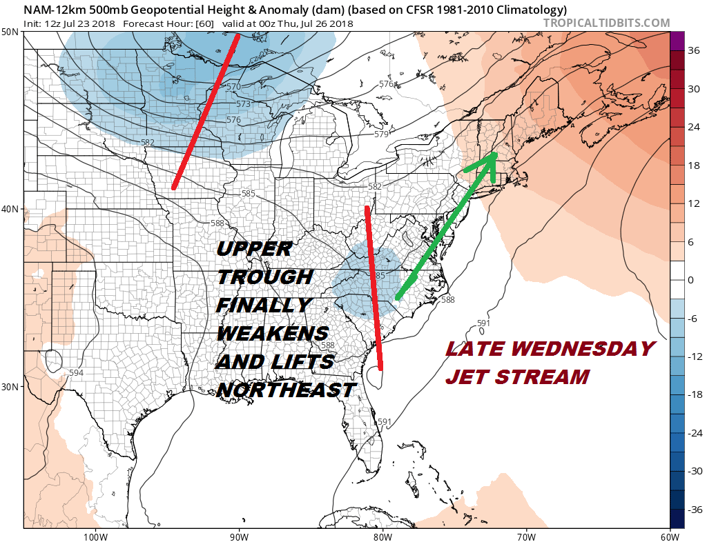 There is good news with all this as the jet stream finally adjusts enough to allow for some improvement Thursday and Friday. The upper trough to the west is gone (temporarily) and this should allow for more sunshine and fewer showers for Thursday and Friday though the threat for downpours or a thunderstorm doesn’t go away completely. It will be very warm and humid through the rest of the week with highs in the 80s Thursday and Friday. The weekend sees a continuation of this warm tropical air mass and the threat for downpours and thunderstorms as yet another trough drops into the Eastern US.
Please note that with regards to any tropical storms or hurricanes, should a storm be threatening, please consult your local National Weather Service office or your local government officials about what action you should be taking to protect life and property.
 GET JOE A CIGAR IF YOU LIKE

LATEST JOESTRADAMUS ON THE LONG RANGE


