Easter Weekend Dry Major Storm Brings
Heavy Rains Wind Thunderstorms Sunday Night Into Monday
The very chilly windy conditions will ease as we go through the day. Low pressure off to the Northeast is moving away now and that has allowed high pressure to the south to build in. Gusty winds will ease this afternoon. We should enjoy a fair amount of sunshine. Temperatures which had a tough time yesterday breaking 50 in many places should reach into the mid and upper 50s late this afternoon. Once the wind dies off it will feel much better outside.
SATELLITE

The satellite picture shows mostly clear skies though we do see some patchy cloud cover here and there. There are no issues regarding precipitation and the radar should be quiet all day long.
REGIONAL RADAR

Tonight will be mostly clear for most of the night though some clouds will start to roll in late tonight or early Easter Sunday morning. Most lows will be in the 30s except lower 40s in warmer urban settings. Easter Sunday will be rain free with increasing and thickening clouds. Highs away from the ocean will reach the 60s. A south south east wind will develop as the day wears on but the winds won’t pick up until later Sunday night as a major storm heads from the Southern Plains to the Great Lakes.

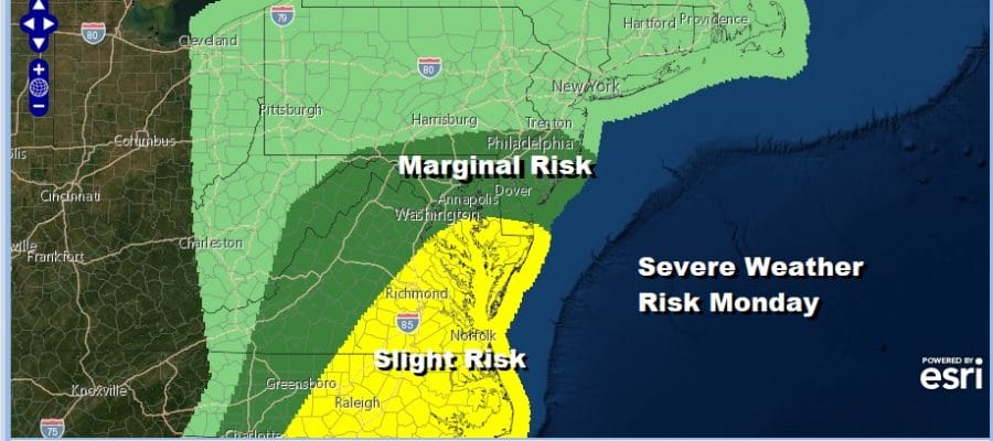
This storm is impressive and a powerhouse. It will produce severe weather today across Texas and the Southern Plains however the main concern will be Sunday and Sunday night across the Gulf States and into the East Coast on Monday. The Storm Prediction Center shows a large area of moderate risk for severe thunderstorms and a 15% chance for tornadoes Sunday across the Gulf States and this will likely be a widespread serious severe weather outbreak.
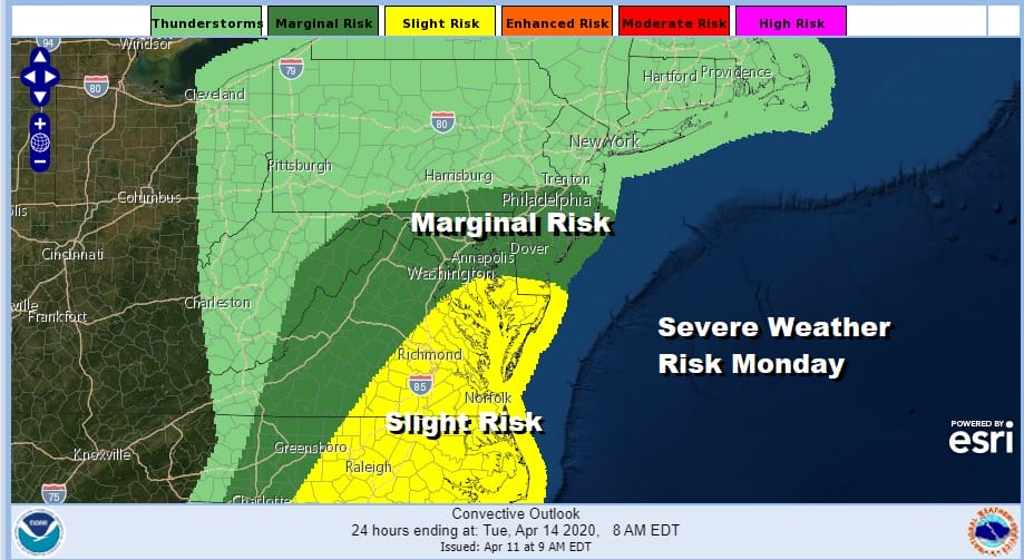
For our area rain will develop Sunday night from late evening to after midnight from south to north and continue into Monday afternoon. The NAM model loop above shows clearly how this wrapped of storm system will try to bring warm and and thunderstorms into the mix on Monday. The Storm Prediction Center has a marginal risk of severe weather reaching into the southern half of New Jersey. I think there is a fair chance that the risk area will be extended further north, much like we saw on Thursday.
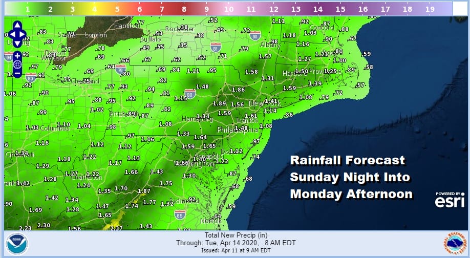
Rainfall will be a generous 1 to 2 inches across the entire area from Virginia to Southern New England and areas in between though thunderstorms will drive local amounts higher in some places.
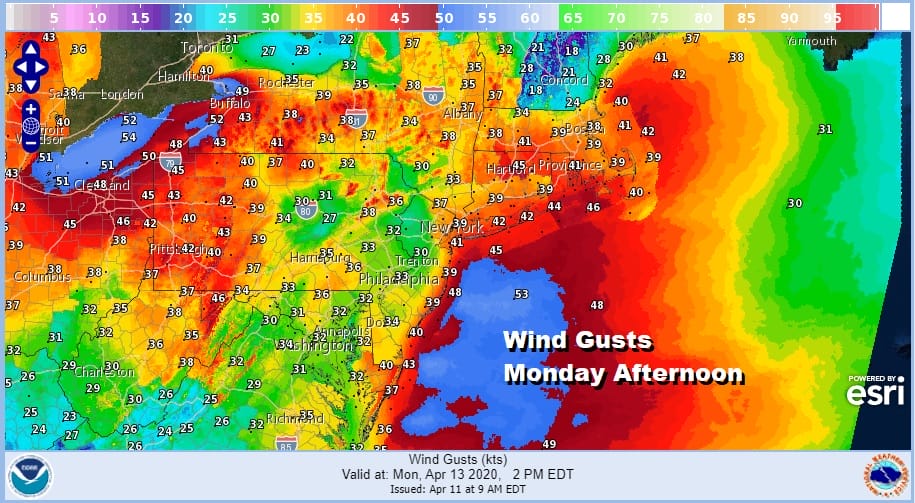
Wind is going to be a big issue Monday first from the south and later from the southwest and west as a cold front approaches. This may create some tidal concerns along south facing shorelines of Southern New England and Long Island though we are past last weeks full moon. Weather conditions will improve somewhat Tuesday into Wednesday though it will remain chilly for this time of year.
BE SURE TO DOWNLOAD THE FREE METEOROLOGIST JOE CIOFFI WEATHER APP &
ANGRY BEN’S FREE WEATHER APP “THE ANGRY WEATHERMAN!
MANY THANKS TO TROPICAL TIDBITS FOR THE USE OF MAPS
Please note that with regards to any severe weather, tropical storms, or hurricanes, should a storm be threatening, please consult your local National Weather Service office or your local government officials about what action you should be taking to protect life and property.


