USE THE COUPON CODE “summer2026” AND GET 10 PERCENT OFF ON ANY PURCHASE
Dry With Warmer Temperatures Into Saturday
Tropical Storm Isaias Heads For Central Gulf States
After what was the coldest morning since early May, we are going to see temperatures bounce back closer to average today. Satellite and radars are nice and quiet not showing much. There is a cold front approaching from the northwest but all the clouds with that are running east across Northern New England. All that means for is is a wind shift back to the northwest and another dry air mass that will build in for the remainder of the week and the start of the weekend. Skies today will be mostly sunny with highs in the mid to to upper 60s. Nothing more than a few passing clouds tonight with lows in the upper 40s to mid 50s.
SATELLITE WITH LIGHTNING STRIKES
WEATHER RADAR
Another high pressure area builds in for Thursday into Saturday however the air with this high is no where near as cool as what we just experienced. We will have mostly sunny skies both Thursday and Friday. High temperatures both days will reach into the 70s with a northwest wind and not a drop of rain in the forecast.
This is a holiday weekend with Monday being Columbus Day. We see no weather issues for Saturday which will a day with sunshine and highs again reaching into the 70s. Our weather for Sunday hinges on the developments with Tropical Storm Isaias which is in the Gulf and heading for the Central Gulf Coast. Landfall seems likely late Friday night/early Saturday morning. It is likely to become a hurricane before landfall.
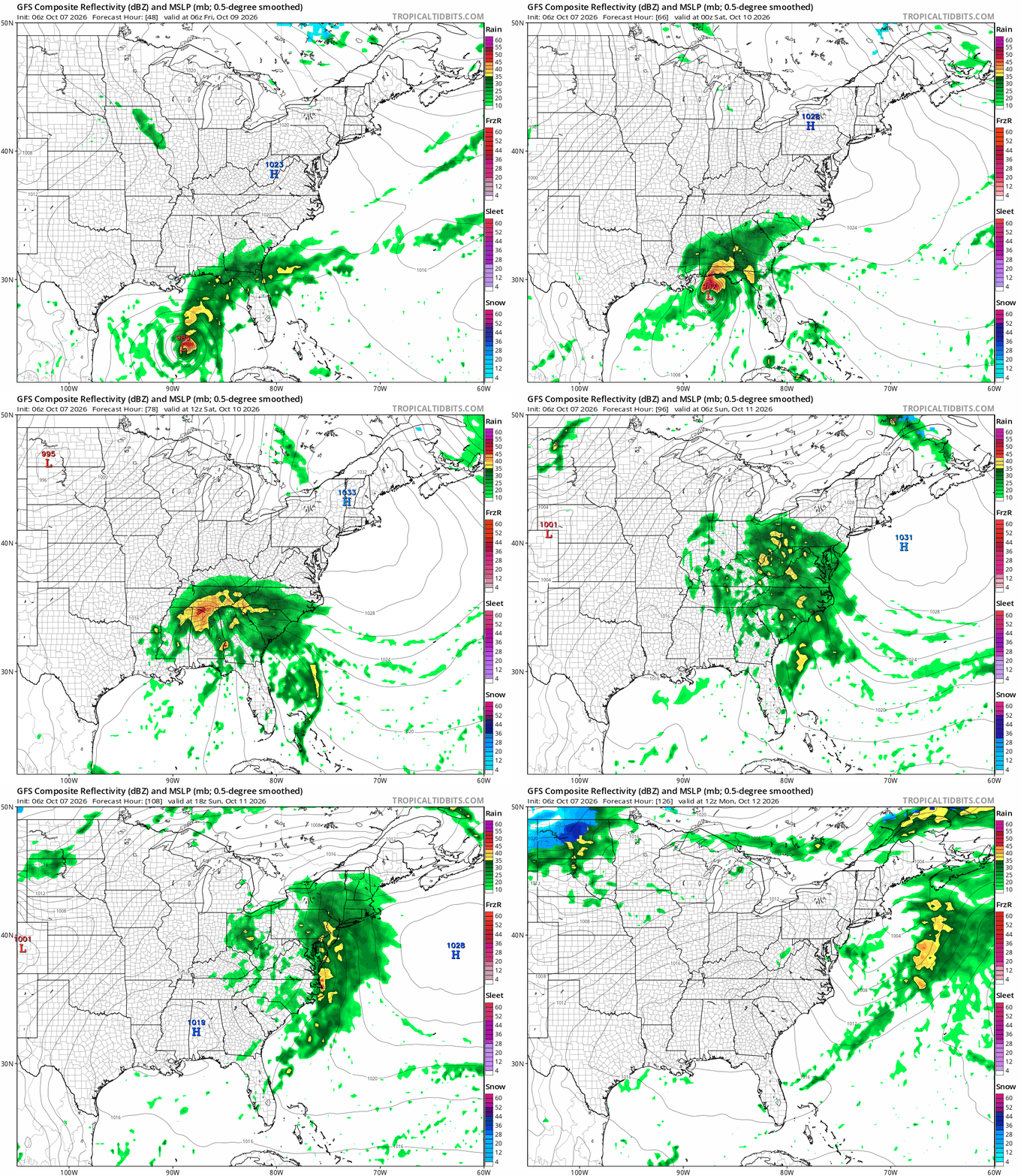
The track of Isaias is likely to be northward into the Ohio Valley and then turning eastward, spreading rain up and down the East Coast Sunday. Timing of rain arrival will depend on the time of landfall but it seems that rain will be overspreading Eastern Pennsylvania to Southern New England during the day Sunday. The system likely merges with a developing frontal system so at this stage, we think rainfall will be manageable. We will need to see if the core of this system survives the trip to determine whether rain might be heavier. Either way the rain should exit to the east during Sunday night bringing drier weather in for Monday Columbus Day.
MANY THANKS TO TROPICAL TIDBITS FOR THE USE OF MAPS
Please note that with regards to any severe weather, tropical storms, or hurricanes, should a storm be threatening, please consult your local National Weather Service office or your local government officials about what action you should be taking to protect life and property.