This is a sponsored post written by me on behalf of Urgent.ly for IZEA. All opinions are 100% mine.
Dry Weather Returns Storm Issues Weekend
Urgently

The Summer Driving is fast approaching. Don’t be without Urgent.ly
We’re an on demand service. You don’t need to join a club to use us,
and keep paying for a service you never use.
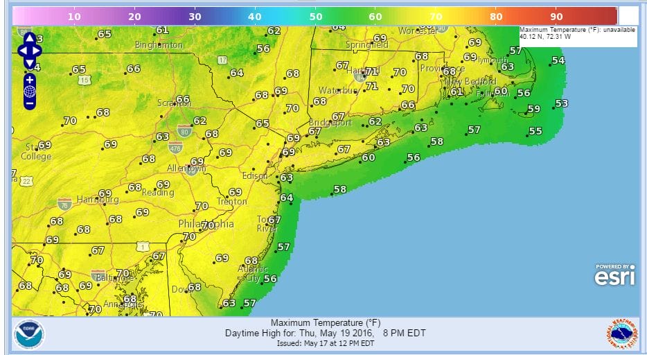
Dry weather returns for the rest of this week once the area of rain to the south clear the coastline later tonight and Wednesday. Weather models show high pressure building in for the rest of the week which means that we should see developing sunshine during the day Wednesday. Thursday and Friday look very good with sunshine both days and temperatures close to normal with highs reaching into the upper 60s and lower 70s both days.
Dry Weather Returns
Thursday’s Forecast High Temperatures
Models are on track for rain developing this weekend as low pressure moves up the coast. Rain looks to arrive during the day Saturday and last into Sunday. The upper air pattern remains very dynamic for next week as a strong upper air storm is forecast to park itself right along the east coast. This is going to mean rain and wind
GFS WEATHER MODEL SATURDAY EVENING

GFS WEATHER MODEL TUESDAY MORNING
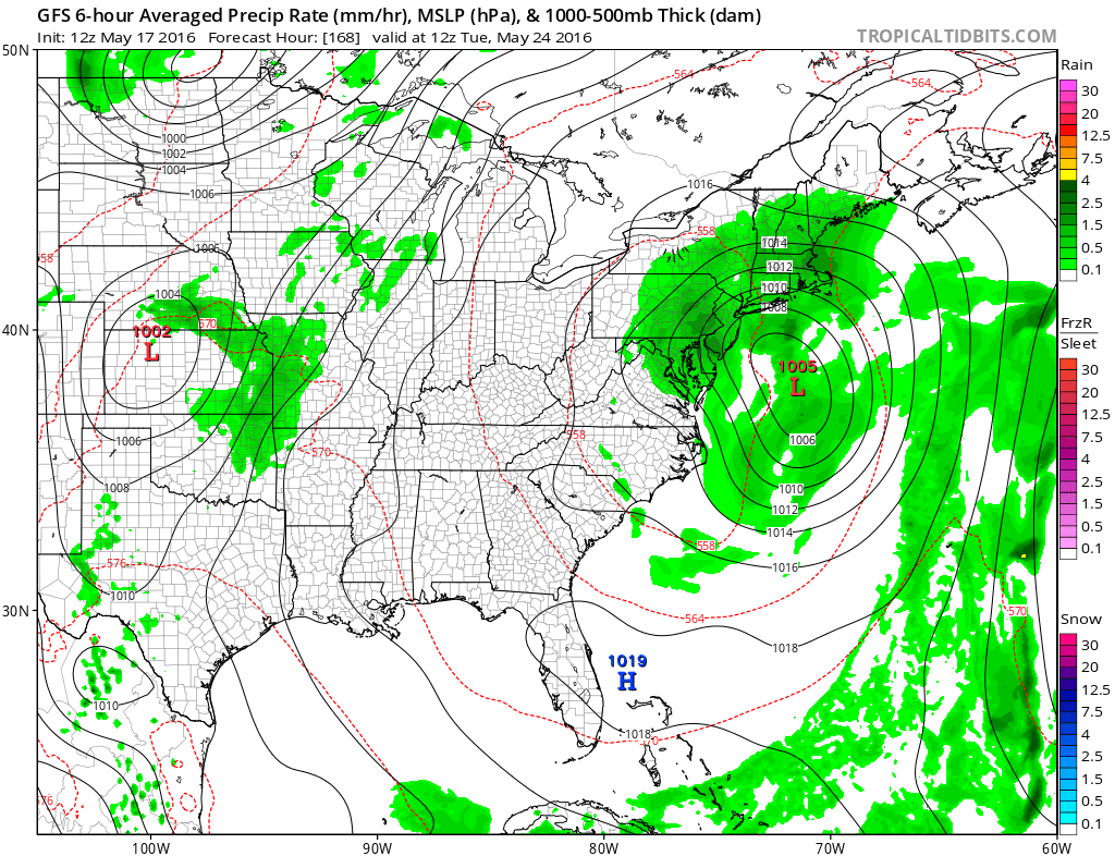
We also have a full moon Saturday night so this will be effecting tides into early next week. Coastal flooding could become an issue with this as we move through the weekend and into next week. We will have more on this later today when all the weather models have completed their run cycles. Today’s GFS weather model run remains fairly consistent with previous model runs. To read more about the developing weather situation for the weekend and next week check last night’s Joestradamus post which addressed the strong upper air issues developing in the eastern United States.
