Dry Very Cool Air Arrives Tonight Lasts Through Friday
Warmer Over the Weekend No Rain In Sight
Our dry weather pattern goes into high gear over the next several days. Building high pressure in Eastern Canada and New England will be bringing down some very cool air. To the south we have Hurricane Humberto passing north of Bermuda and then Hurricane Imelda will follow. These storms are helping to pull down cooler air. Today will be very warm though with sunshine. Highs will reach the upper 70s to around 80 but the wind direction turns northeast and we will see winds pick up over the next few days, gusting to 30 mph or more at times near the coast. Skies tonight will be mostly clear. By morning lows will be in the 50s along the coast and in urban areas but inland areas will be in the 40s.
SATELLITE WITH LIGHTNING STRIKES
WEATHER RADAR
Wednesday is going to be a very cool day with lots of sunshine and it will be breezy especially near the coast. High temperatures Wednesday will be a good 10 to 15 degrees lower than today. Most highs will be in the mid to upper 60s. Then even cooler air comes in tonight and by Thursday morning, lows will be in the low 50s near the coast. Inland areas will be in the 40s. North of Interstate 84 in the Hudson Valley and Connecticut we will see the first 30s of the Autumn season.
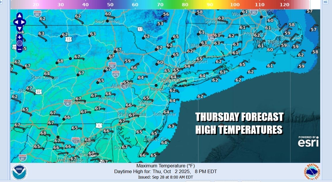
Thursday is going to be the coolest day of the week with a northeast wind and lots of sunshine. Highs Thursday will be mostly in the low to middle 60s and then we go back down into the 50s coast and urban areas and 40s inland. Friday begins a warm up. High pressure settles southward into the Middle Atlantic states and our winds will turn more westerly. That will allow things to warm up slightly. Friday highs with lots of sunshine will reach the mid to upper 60s and some warm spots will reach 70 or so.
The large high is going to hold firm to our south over the weekend and the mostly west wind will allow temperatures to warm further. Saturday will be mainly sunny with highs in the low to mid 70s. Sunday will be mostly sunny with high temperatures reaching the upper 70s to around or just over 80 degrees in some places. No rain is forecast through the weekend and through the first half of next week. The next front of consequence may not come until next Thursday with a chance for showers.
BE SURE TO DOWNLOAD THE FREE METEOROLOGIST JOE CIOFFI WEATHER APP &
ANGRY BEN’S FREE WEATHER APP “THE ANGRY WEATHERMAN!
MANY THANKS TO TROPICAL TIDBITS FOR THE USE OF MAPS
Please note that with regards to any severe weather, tropical storms, or hurricanes, should a storm be threatening, please consult your local National Weather Service office or your local government officials about what action you should be taking to protect life and property.