Dry Streak Ends Heavy Rain Flash Flood Risk Tonight Wednesday Morning
WEATHER IN 5 TUESDAY 9/29/2020
JOE & JOE WEATHER SHOW MONDAY 9/28/2020 7PM
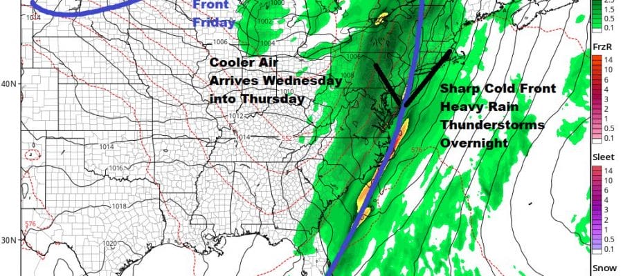
The streak of 18 days in a row of no rain in most of the area comes to an end today and if not during the day it will come to an end tonight. A cold front is approaching that is slowing to a crawl when it reaches the coast. A strong upper trough will be lifting northward up the coastal plain and strengthening. Tropical moisture will be drawn into the mix and the result will be rain and some thunderstorms. The bulk of this will come overnight into Wednesday morning.
SATELLITE

REGIONAL RADAR

In the meantime we have the southerly flow today which for now is not showing much on the radar. The frontal rains to the west are headed mostly northeast for now. The tropical rain from the south is only beginning to reach the view of the regional radar. Later today some scattered showers will be popping up on the local radars. Temperatures today will be in the mid 70s to near 80 and the humidity will be high.
LOCAL RADAR NEW YORK CITY

LOCAL RADAR PHILADELPHIA


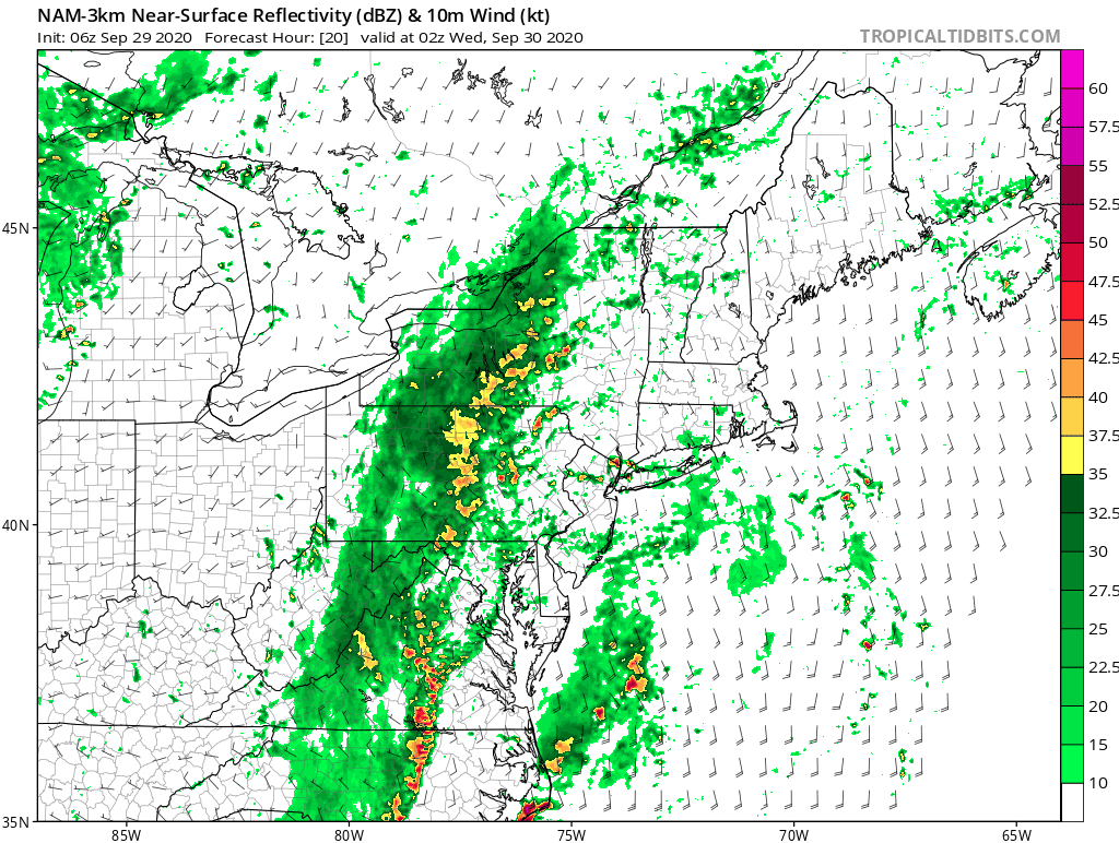
Showery rains will develop late this evening and then become heavy at times overnight with some thunderstorms possible. In fact I believe we could see some severe weather out of this. Midnight to 7am will likely be the worst of it for the coastal areas. The Nam model radar loop below shows impressive convective development as this cold front moves through.
Everything comes to an end from west to east plus or minus a couple of hours of 8am on Wednesday. Weather conditions should slowly improve after that with leftover clouds and some sun developing later in the day. Highs will be in the upper 60s and lower 70s.
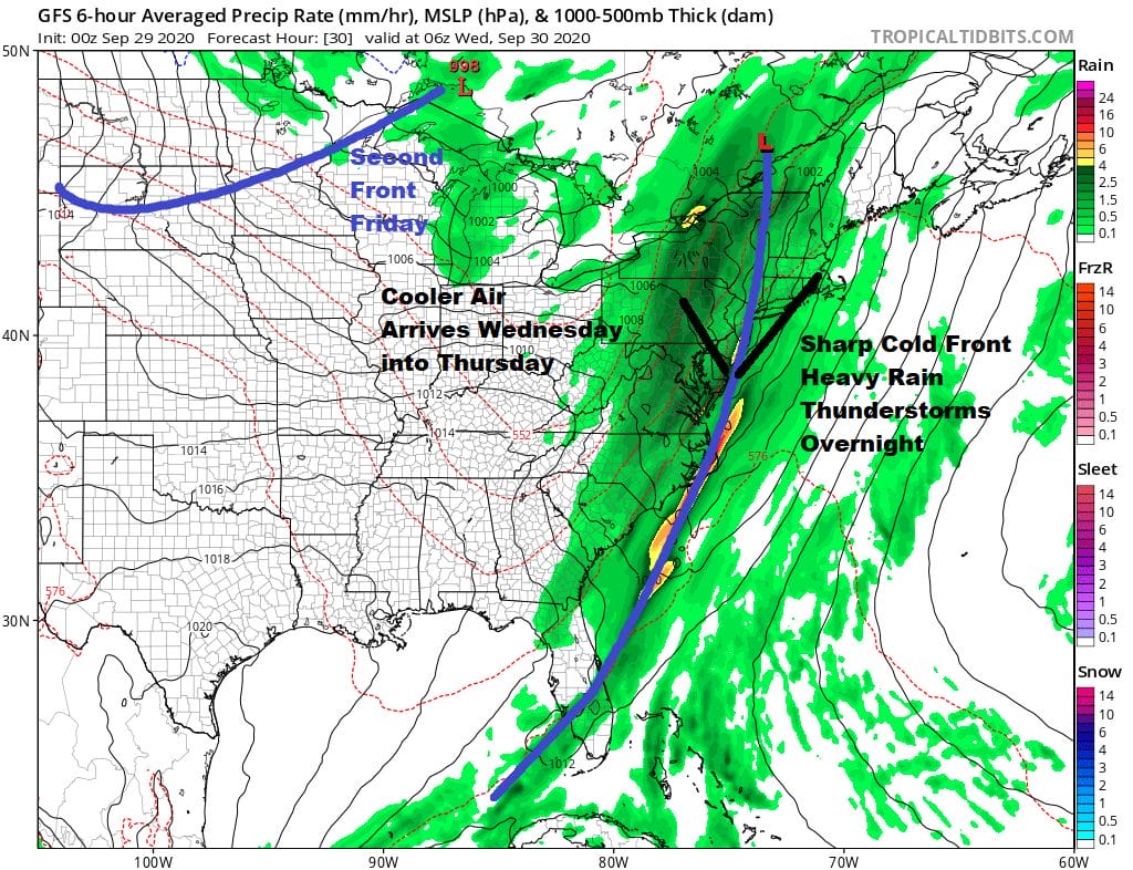
Wednesday’s cold front is only the beginning as we have another cold front behind it with a stronger longer lasting shot of cool air. Thursday should be a decent day of sunshine and highs will be in the upper 60s to some lower 70S. Friday the second front arrives with a developing wave and that probably means some rain or showers with temperatures in the 60s.
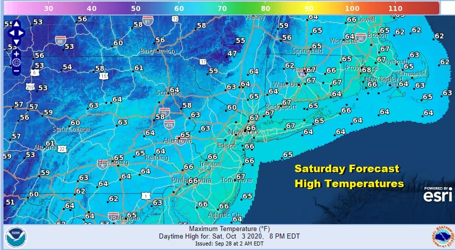
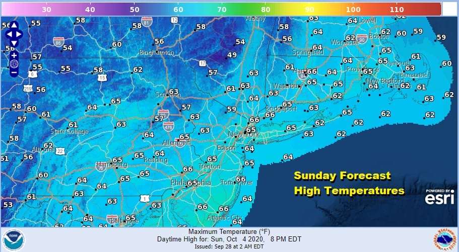
This coming weekend will be dry and rather cool. We should see some sunshine both Saturday and Sunday though Sunday could also bring some arriving clouds. Highs both days will be just in the low to mid 60s with most nighttime lows in the 40s.
The active pattern continues with another system arriving with some rain for later Sunday night or Monday of next week. At least we are making up for the long dry streak we just went through.
BE SURE TO DOWNLOAD THE FREE METEOROLOGIST JOE CIOFFI WEATHER APP &
ANGRY BEN’S FREE WEATHER APP “THE ANGRY WEATHERMAN!
MANY THANKS TO TROPICAL TIDBITS FOR THE USE OF MAPS
Please note that with regards to any severe weather, tropical storms, or hurricanes, should a storm be threatening, please consult your local National Weather Service office or your local government officials about what action you should be taking to protect life and property.


