
I want to state right off the bat that we are in model speculation mode and in no way am I making any kind of forecast. However I think we should be starting to think about the possibility that there could be some weather problems later this week and into the weekend with a coastal storm of some kind producing noreaster conditions.
We are beginning to get a sense that if we are going have drought busting rains, we may wind up doing it in a big way. This is an extremely complex puzzle and as always with these things they can be all over the place. Let’s review where we have come from. This is the upper air map from an earlier run of models and we mentioned that the key to all this is the low cutting off to the south with blocking across Eastern Canada. Thanks to Tropical Tidbits for the wonderful maps.


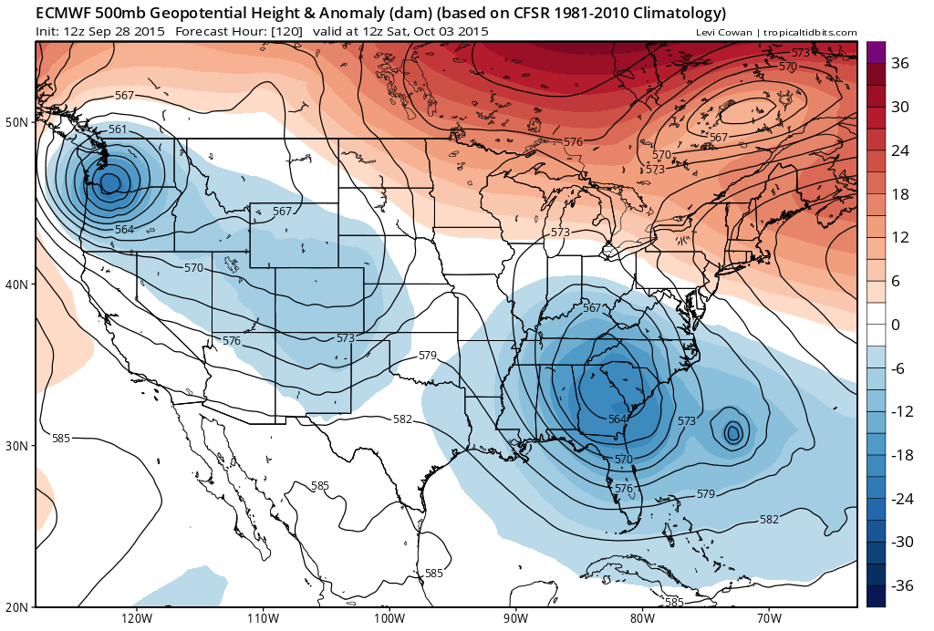
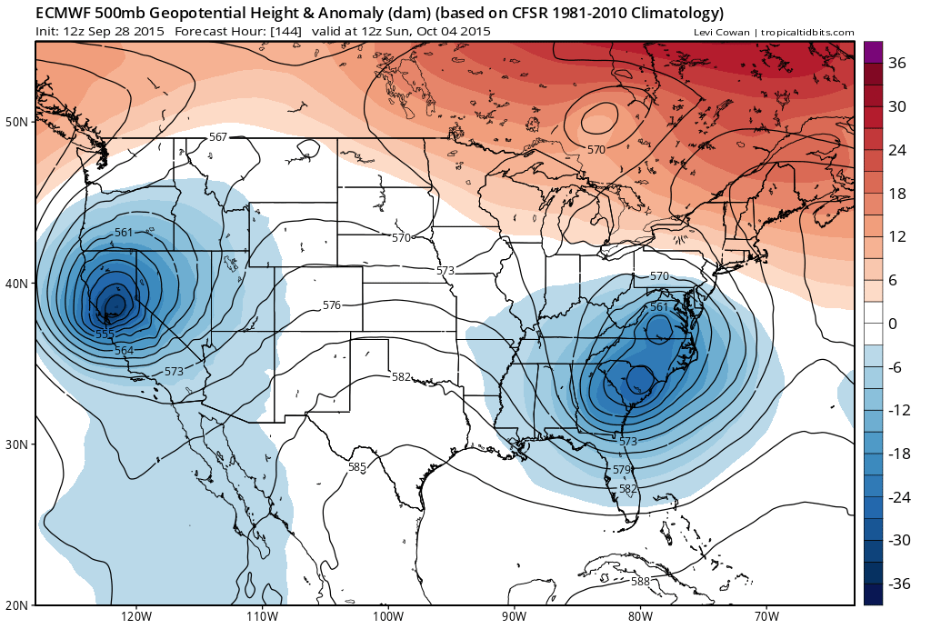
The important part of this equation is the bottom part of that trough and whether it vigorously cuts off. This will be the steering mechanism for any tropical system that develops in the Bahamas. Today’s European is the most aggressive of all the models as it vigorously cuts off the southern half of that trough and steers any tropical storm northward and then westward into Coastal Virginia! The result here would be noreaster conditions here late Friday through late Saturday. Now it seems to me that at this point we need to probably start paying closer attention to what is going to evolve as the week goes on. The European appears overly extreme with how it develops the upper air pattern. Still it cannot be completely discounted. Below is the 96 hour European from today showing the upper air jet stream pattern and you can see how it forms a strong trough in the southern branch of the jet stream axis from the Tennessee Valley into the northeast Gulf of Mexico.

I think that given all the models that we have seen today, and the increasing likelihood that we will have a tropical storm on the map late this afternoon or evening, I think that we probably need to start paying close attention to this over the next few days. In the mean time we should emphasize that the first rains with the arriving cold front will arrive Tuesday night and last into at least part of Wednesday and that could give us a solid 1 to 2 inches of much needed rain. After Wednesday the onshore flow develops with the big high building to the north setting the stage for something to happen. We should also point out that if there is no tropical development of consequence which is always possible, we could still be dealing with a fairly strong noreaster non tropical low that moves up the coast.
Be sure to download my app and subsrcribe to my forecasts. The app is free and a subscription is just 99 cents a month. The app is free of advertising and there are no security or tracking issues.