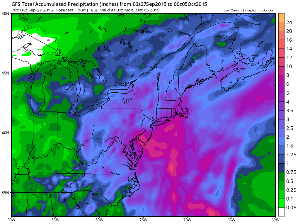
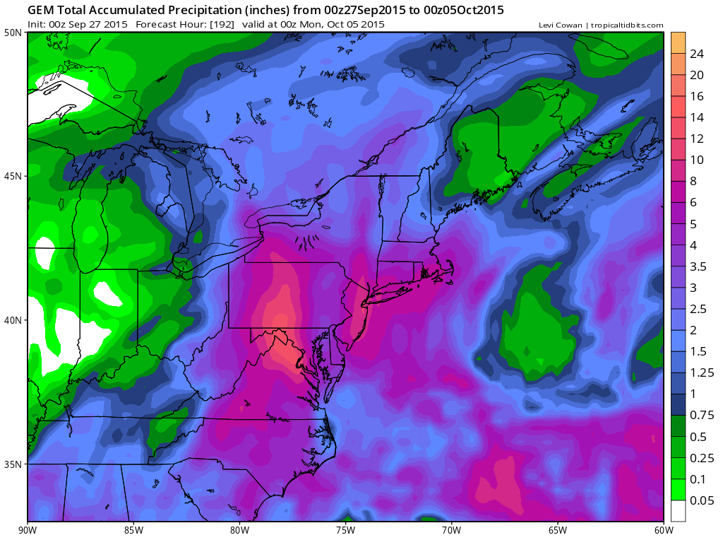
JOESTRADAMUS noticed yesterday that there was a lot of uncertainty regarding this coming week and this morning he sees that all three global models show drought breaking rains this week. Now I would just say right off the bat that we should take these amounts and cut them in half which btw still says 2 to 3 inches at least for everyone.
Back to this week. Tuesday a cold front comes through and there will be a wave developing on the coast to enhance some of the showers with that front so Tuesday looks like some places could see a decent soaking. Beyond Tuesday all the models focus on various dynamics in the east that we have not see for months. This map of the upper air is for Wednesday evening.
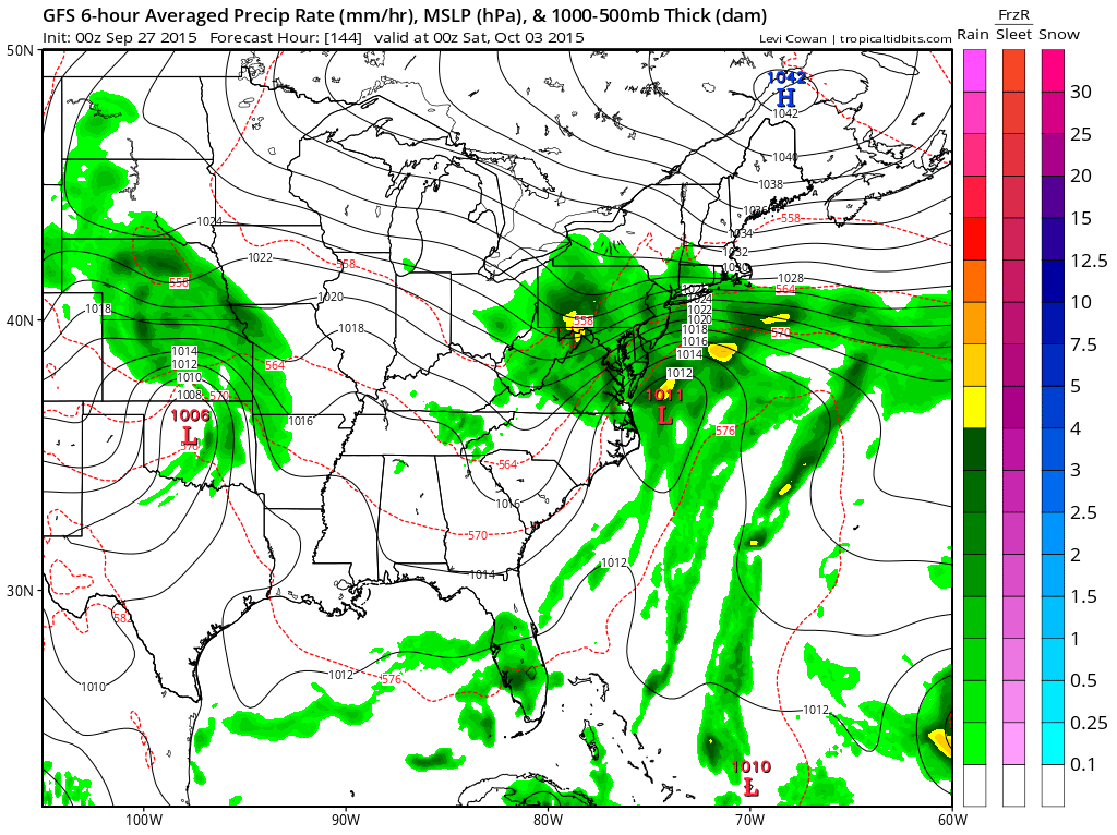
We had a similar set up this weekend where this upper trough was much weaker and wound up falling apart. This time it appears the opposite will happen where this trough gets strengthened with more energy coming into the east. 48 hours after this
This is for Friday evening of this coming week. All the models seem to have some variation of this idea. The Canadian has a deeper and more left solution that actually results in more rain here while the European and GFS are more coastal but the models are all left of previous runs. Certainly they all suggest nor’easter conditions developing during this week with a prolonged onshore flow beginning Wednesday and lasting into next weekend along with the potential for coastal flooding and beach erosion especially coming off the high tide cycle and a full moon.
With weather changing be sure to download my app and subscribe to my forecasts. The app is free and the subscription is just 99 cents a month. The app is free of advertising and there are no security or tracking issues.