Drought breaking rain, tropical depression 11 and a possible noreaster threat all are in the cards this week. The development of the tropical depression has complicated the forecast outlook somewhat. Today is the 15th day without any rain and while there could be an isolated shower in one or two spots, today should be the last day of the streak.
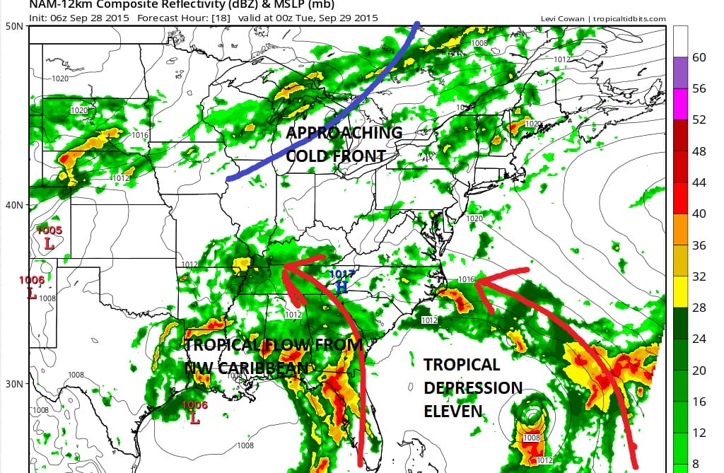
Three players are on the scene this morning. We have the cold front to the west which doesn’t get here until tomorrow night. We have an upper trough in the Western Gulf of Mexico which is pulling up tropical moisture from the northwest Caribbean. And we have new tropical depression 11 that is east of the Bahamas. The arrows are showing how the upper flow in the atmosphere is drawing moisture toward the US. Right now the players are separate features.
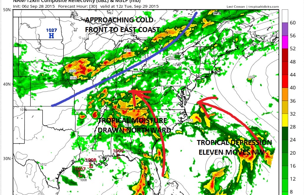
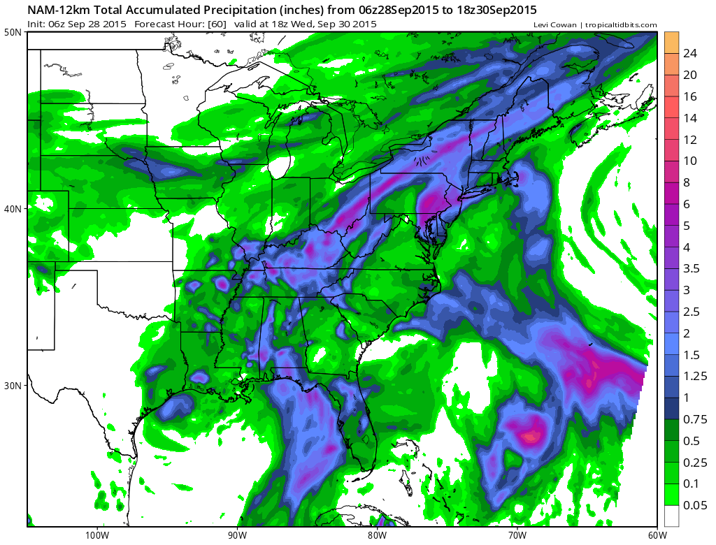
With regards to the nor’easter threat late this week, the overall look has changed somewhat since yesterday. Models stall the front along the coast and come out with different ideas on how this plays. Tropical Depression 11 does complicate matters somewhat as it is forecast to move northward up the coast later in the week. The European seems to key on this and bring it slowly up the coast. This model produces 2 to 8 inch rains from Eastern Pennsylvania to Southeastern New England over the next 7 days.
As weather conditions deteriorate this week, be sure to download my weather app and subscribe to my forecasts. The app is free and a subscription is just 99 cents a month. The app is free of advertising and there are no security or tracking issues.