Dorian Finally Moving NW Toward Florida
Tropical Storm Fernand Forms Gulf of Mexico
A Hurricane Warning has been issued from Savannah River to Edisto Beach, South Carolina, and from South Santee River, South Carolina, to Surf City, North Carolina. The Hurricane Watch has been extended north of Duck, North Carolina to the North Carolina/Virginia border. A Tropical Storm Watch has been issued from the North Carolina/Virginia border northward to Chincoteague, Virginia, and for the Chesapeake Bay from Smith Point southward. The Hurricane Warning has been changed to a Tropical Storm Warning from Sebastian Inlet to Jupiter Inlet, Florida. The Tropical Storm Warning has been discontinued south of Jupiter Inlet.
We have a lot going on this evening so we will start with Hurricane Dorian which has finally started moving to the northwest this afternoon and slowly away from Grand Bahama island though hurricane conditions continue there with winds over 75 mph still being reported on what few observations are available. While you can see the cloud filled center the eye disappeared this morning. We have seen considerable weakening after the long duration stall over the Bahamas and the up-welling of colder ocean water. This has brought Dorian down to 110 mph on the winds and up on the pressure to 959 mb. Dorian is a category 2 hurricane. The core of the hurricane is still there. I would expect to see little change in strength going forward. How far west does Dorian get will be the big question regarding Florida impacts. Tidal flooding is likely and it will be extensive up and down the East Coast. Some rain and gales will occur along the immediate coast in parts of the warning area. Weather conditions however just inland won’t be too bad; gusty with some squalls at times but nothing unmanageable.
SATELLITE
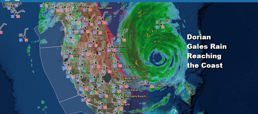
We are now able to see the center on the Melbourne Florida radar as it has now come into range. A wall of rain is visible from just east of Melbourne southward to West Palm Beach. The center is moving very slowly and we will be watching it for any westward jog. Gales are now being reported over the Floriday coast from Jupiter Inlet northward along with heavy rains. The eye will pass very close to the Florida coast and too close for comfort. the Jacksonville radar is at the moment on the northern fringe with some squalls coming inland. Gradually we will see Dorian make an appearance here probably later tonight and certainly on Wednesday.
LOCAL RADAR MELBOURNE FL
LOCAL RADAR JACKSONVILLE FL 
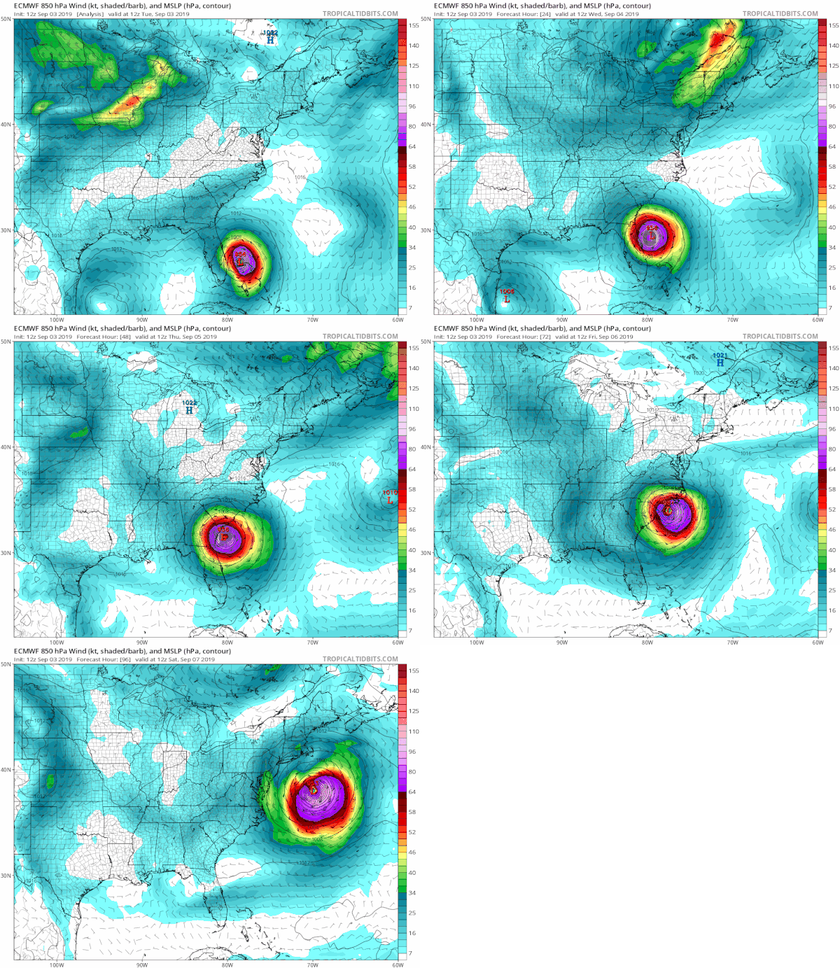
From here we will be just watching radars to see how close it gets to Florida which of course will impact how close it gets to the Southeast Coast. Afternoon weather models are all very close. Below is the European from today which is a little left of the overnight and brings Dorian very close to the South Carolina coast from Charleston northeastward to onshore somewhere between Wilmington and Hatteras in North Carolina on Thursday.
Warnings are likely to be extended further north into North Carolina based on what we see here. From North Carolina you can see that the hurricane continues northeastward passing well south and east of New Jersey and Long Island. Even the fringe gales stay away from those shorelines. We could see tropical storm conditions in Southeastern Virginia and Chesapeake Bay as well as the southern part of the Delmarva Peninsula late Thursday and Thursday night. Tidal flooding is a big concern here from Florida to North Carolina given the track, and the higher than normal tides off the weekend new moon.
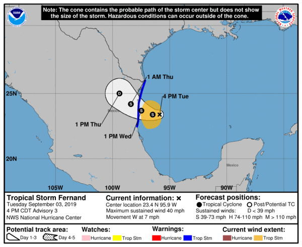
TROPICAL STORM FERNAND FORMS IN THE WESTERN GULF OF MEXICO, NO THREAT TO THE US
We have the seasons 6th tropical storm, Fernand that has formed in the Gulf of Mexico. This formed from an upper low that was over Florida a few days ago and helped create the excellent outflow pattern for Dorian. Fernand is off the coast of Northeast Mexico and poses no threat to the US though some showers on the northern fringe of this might reach South Texas when the storm makes landfall. The storm should make landfall Wednesday night or early Thursday as a tropical storm well to the south of Brownsville. Texas.
MANY THANKS TO TROPICAL TIDBITS FOR THE USE OF MAPS
Please note that with regards to any tropical storms or hurricanes, should a storm be threatening, please consult your local National Weather Service office or your local government officials about what action you should be taking to protect life and property.


