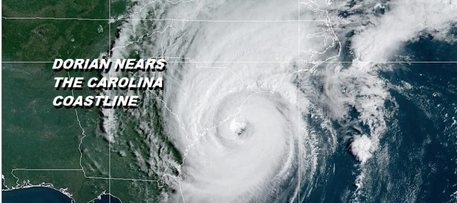
Dorian Eye East of Charleston South of Myrtle Beach Tornadoes 115 MPH
Dorian is getting very close to the South Carolina coast as the western edge of the eyewall is nearing the shore line. Aircraft near the storm has been measuring winds of 100 knots on the east side of the eye wall with tropical storm force winds west of the eye and that has been the part that his been straddling the South Carolina coast line so far. High clouds have reached our area from Eastern Pennsylvania to Southern New England masking some of the sunshine away. Meanwhile weather conditions continue to deteriorate in Eastern North Carolina with the hurricane likely to make some sort of landfall along the coast this evening and over night. They eye of Dorian will be straddling the coastline all the way up through the Outer Banks into Friday.

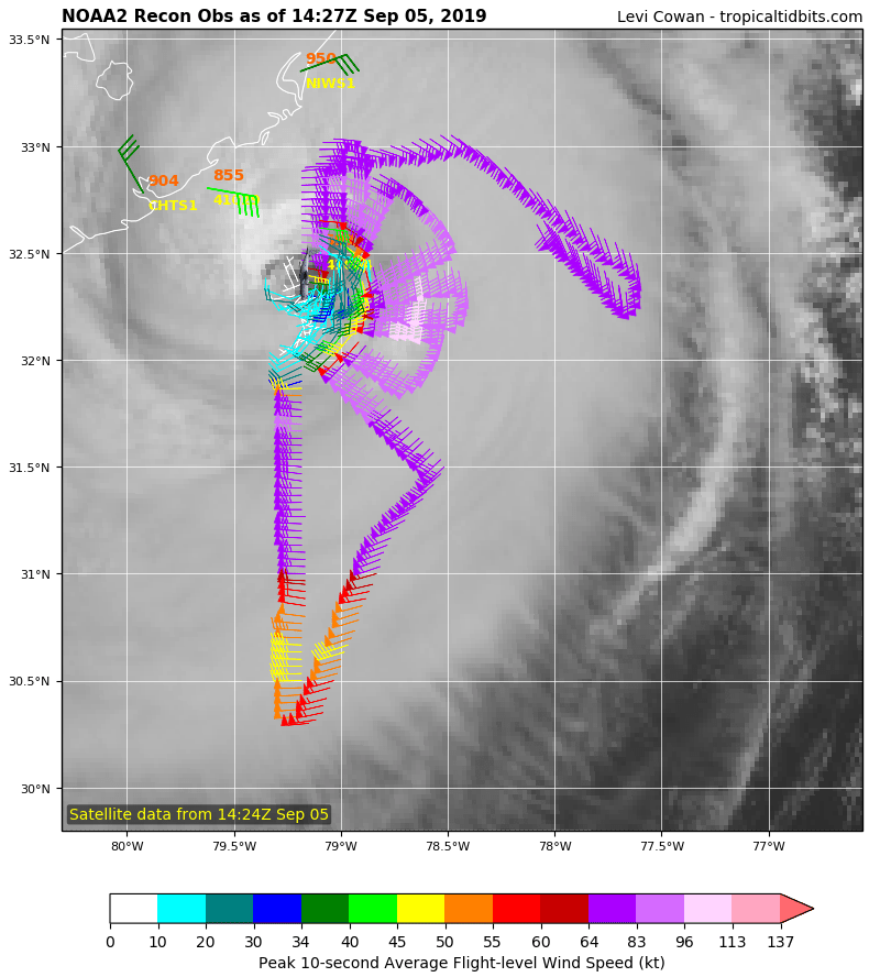
The National Hurricane Center’s official forecast remains unchanged. Dorian will make a gradual transition to a powerful post tropical cyclone that will impact Nova Scotia & New Foundland with heavy rains and strong winds of 50 mph or on Saturday. The eye of Dorian continues to be well defined on the satellite picture below with a closed eye wall around it.
SATELLITE

Two local radar views from Charleston SC, and Wilmington SC, show the eyewall clearly with bands of heavy rains and thunderstorms sweeping inland. Convection continues to wrap around the eyewall as Dorian is a category 2 strength of 110 mph. The Wilmington North Carolina radar has seen and continues to see numerous tornado warnings overnight and this morning and there will likely be more tornado warnings this afternoon into tonight.
LOCAL RADAR CHARLESTON SC

LOCAL RADAR WILMINGTON NC

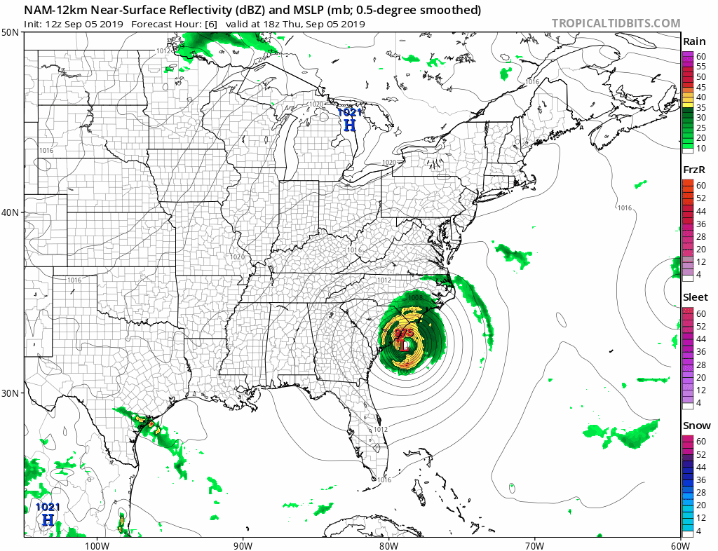
There are no important changes in the outcome here as Dorian will straddle the North Carolina coast into Friday and then begin to accelerate to the northeast Friday night and Saturday. Dorian passes well to the south and east of New Jersey and Long Island. Except for perhaps some fringe rain making it for a few hours along the New Jersey and the East End of Long Island, Dorian has no impact here except over the coastal waters which will be roughed up. Fringe gales could get close to the shoreline here but stay mostly offshore. The latest NAM model keeps all the rain and wind offshore.
One big positive is the dry air that the hurricane pulls southward into the Northeast this weekend and into next week. It looks like other than clouds we have dry weather for the next 5 or 6 days with seasonal temperatures and low humidity.
MANY THANKS TO TROPICAL TIDBITS FOR THE USE OF MAPS
Please note that with regards to any tropical storms or hurricanes, should a storm be threatening, please consult your local National Weather Service office or your local government officials about what action you should be taking to protect life and property.