
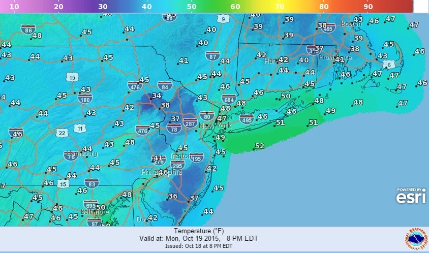
 Most temperatures are running even or a few degrees lower than they were at this time last night across the forecast areas from Eastern Pennsylvania through Southern New England. How low it gets tonight will depend on 2 factors. The first is the wind and if it drops off to calm or at least under 5 mph which it should do after midnight. More importantly are clouds and whether they completely get out of the way. Assuming both things happen these are the forecast lows for Monday morning.
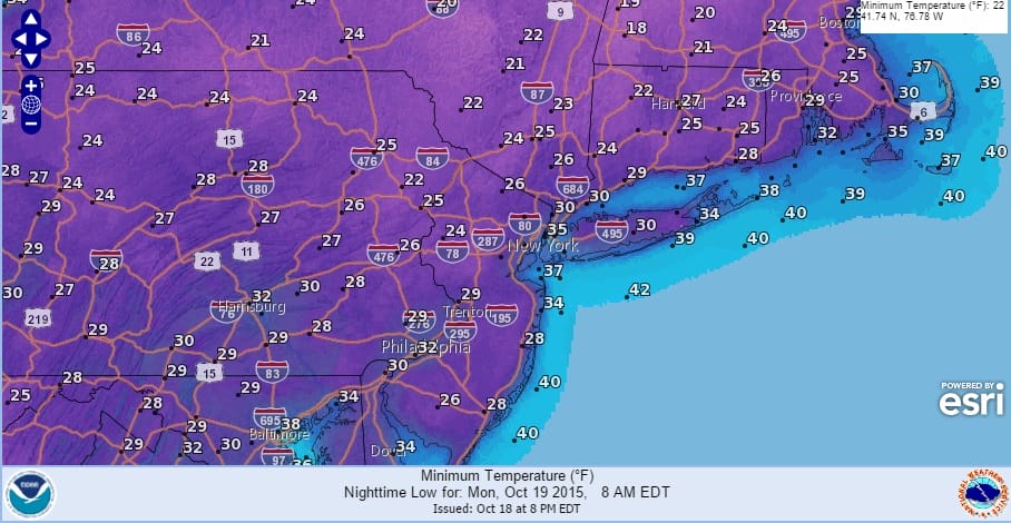
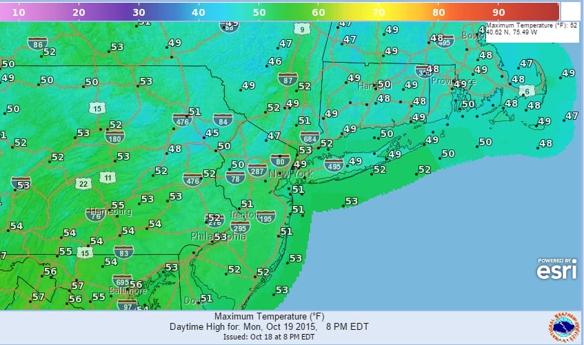
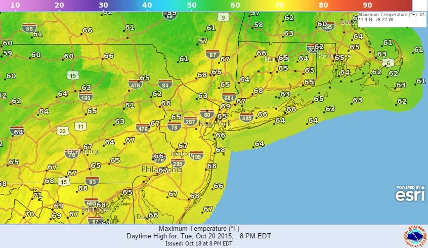
Urban areas around New York City are forecast to hold just above 32 while Philadelphia is forecast to be at 32 or below. This will be the last cold morning of the stretch as warmer air and clouds Monday night will probably keep temperatures from falling. In fact they may hold steady or even rise a little during the overnight which would set us up for a warm Tuesday with clouds and some sun and temperatures back into the 60s.
 As far as the longer range JOESTRADAMUS is having a very rough time with models over the last week which can’t seem to decide what the pattern is going to be as they all seem to be flipping in all different directions every 6 to 12 hours making forecasting a very difficult ordeal. In case you missed it some areas did experience ocean effect snow showers combining with the very cold air aloft causing people to see snow flurries with tempertures in the mid to upper 40s! Some areas in Northeastern Pennsylvania saw graupal over two days which are basically frozen crystalized snowflakes or often referred to as soft hail. At least once the cold air pulls out we are done with it for at least a week if not longer.
Don’t forget to download my app for android or I Phone. The app is free and you can subscribe to my forecasts for just a buck a month!