USE THE COUPON CODE “summer2026” AND GET 10 PERCENT OFF ON ANY PURCHASE
Cooler Conditions & A Cold Night Ahead But Daytime Sunshine Continues
Our wonderful mostly cloud free weather streak enters its ninth day. Overnight we had a cold front pass which was really nothing more than a wind shift line as winds went from west to north and today they will go northeast. Another high pressure area with chilly Canadian air builds into Eastern Canada and New England. We will benefit with lots of sunshine and highs this afternoon will be mostly in the upper 50s and lower 60s.
A number of people have pointed out to me that for many inland areas and even some along the coast, we have seen many nights of clear skies and light winds leading to frosty conditions the next morning. To me it seems we are back to a more normalized autumn pattern and this has been going on for the last couple of years. Tonight will be another such night of clear skies and light winds and Wednesday morning lows will be in the 30s and even some 20s in cold spots. Warmer urban centers will bottom in the lower 40s.
SATELLITE WITH LIGHTNING STRIKES
WEATHER RADAR
The current high pressure cell will begin to slide out to the east Wednesday. Sunshine continues and temperatures will rebound off the morning lows and head to the low and middle 60s for highs. The warm up is going to continue Thursday ahead of another weak cold front that will fall apart before it gets here. Thursday will be a mostly sunny day and highs will reach the upper 60s to near 70 degrees in most places.
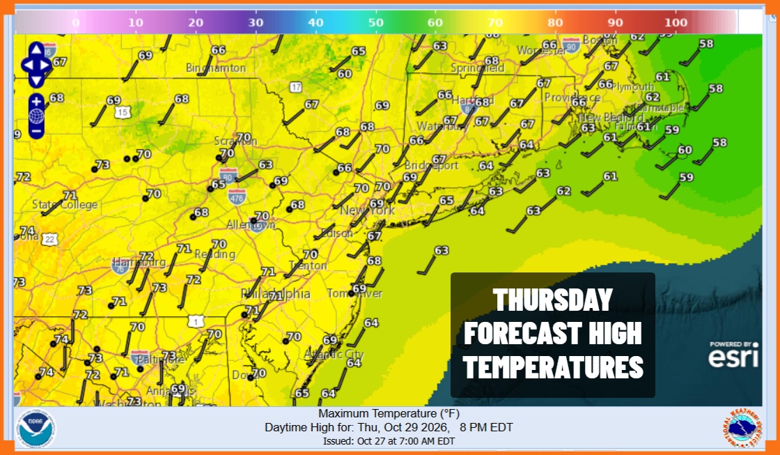
We seem to have run out of cool air masses from Canada at least for the time being. We don’t see anything preventing us from having a nice Friday and a nice weekend for Halloween. Of course a reminder that clocks go back an hour Sunday. We will see rather warm temperatures Friday with highs in the low to mid 70s. Over the weekend we expect to see sunshine for both Saturday and Sunday with highs in the upper 60s and lower 70s. We may have to wait until the middle of next week for the next chance of rain.
MANY THANKS TO TROPICAL TIDBITS FOR THE USE OF MAPS
Please note that with regards to any severe weather, tropical storms, or hurricanes, should a storm be threatening, please consult your local National Weather Service office or your local government officials about what action you should be taking to protect life and property.