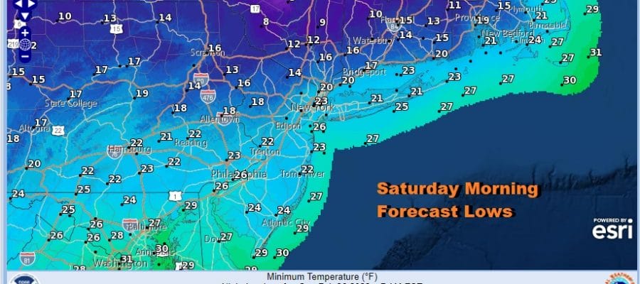
Colder Tonight Saturday Warmer Sunday More Cold Air Early Next Week

Colder Tonight Saturday Warmer Sunday More Cold Air Early Next Week

Our freezing rain, sleet, and rain event is now over with and weather conditions will continue to improve this evening and tonight. Skies will clear and colder air behind this storm system will move in and send temperatures down into the teens and lower 20s by morning. Any standing moisture around will freeze so exercise some caution if you are out on roads. The cold air will be with us on Saturday though we will have sunshine.

Temperatures Saturday won’t be be rising much though in spite of sunshine. Highs will be in the low to mid 30s. The core of this cold air mass will be moving out for Sunday but another cold front is on the way. Meanwhile the drying aloft continues as the satellite shows clouds decreasing with each passing hour and the radar is quiet now with no precipitation to worry about through Saturday night.
SATELLITE

WEATHER RADAR

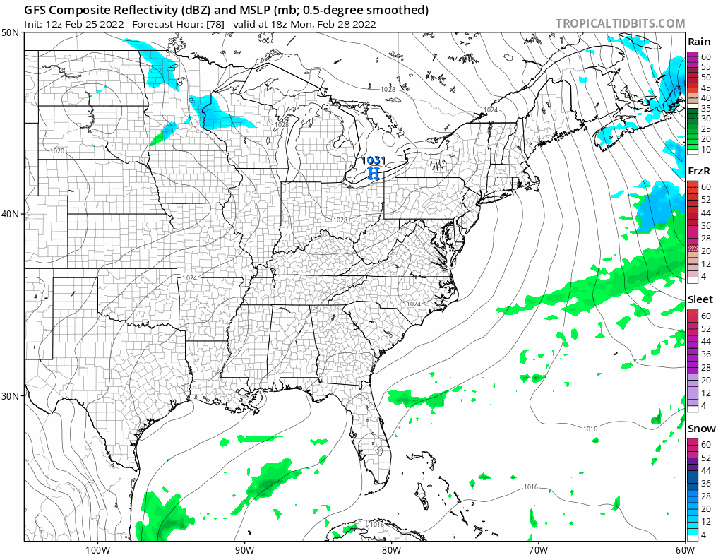
Sunday starts out with some sunshine but clouds will move in during the afternoon ahead of a cold front dropping southeast from the northwest. Moisture is limited but there is a little upper air energy with this front. We should warm up into the 40s however before the front arrives. We will through in the chance for a rain shower late in the afternoon when the front passes and another chance for a snow shower or two when the upper trough goes by in the evening. There is the chance for a brief heavier snow squall when the upper trough passes.
Next week will be a dry one for the most part with weak systems coming through Tuesday and again Thursday. There won’t be much with either one with the Atlantic and the Gulf of Mexico shut off for awhile Monday will be cold and sunny with highs in the 30s. Tuesday look for clouds and the risk for a rain or snow shower with temperatures back into the 40s. Then another quick cold shot on Wednesday. Another weak system and arrives Thursday with clouds and the chance for a little rain or snow and then another dry cold high builds in behind that one. March seems to be coming in quietly but history tells us that it many not stay that way.
BE SURE TO DOWNLOAD THE FREE METEOROLOGIST JOE CIOFFI WEATHER APP &
ANGRY BEN’S FREE WEATHER APP “THE ANGRY WEATHERMAN!
MANY THANKS TO TROPICAL TIDBITS & F5 WEATHER FOR THE USE OF MAPS
Please note that with regards to any severe weather, tropical storms, or hurricanes, should a storm be threatening, please consult your local National Weather Service office or your local government officials about what action you should be taking to protect life and property.


