Colder Air Into The Weekend
Colder Air Into The Weekend
Through the weekend we are going to be relatively calm other than the colder temperatures for Friday and Saturday. Sunday’s weather system is going to be weak and will produce nothing more than a few clouds and maybe a passing snow shower. No issues regarding Super Bowl Sunday so if you are party bound or hosting, getting to and from wherever you are headed, you should be fine.
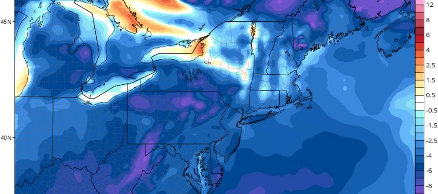
Colder Air Temperature Departure From Normal Saturday Morning
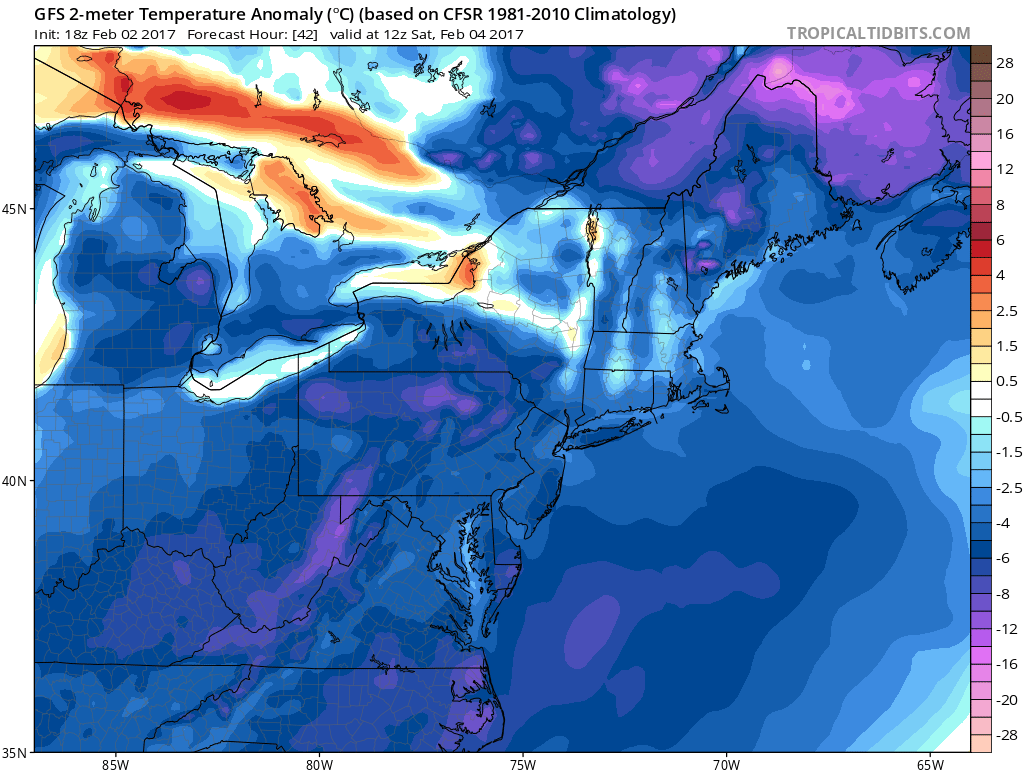
The satellite loop shows just some patchy clouds which will be thinning out as temperatures drop into the mid teens to lower 20s by morning in most places.
SATELLITE LOOP

REGIONAL RADAR

Radars are showing some scattered snow showers around but they aren’t going to amount to much if anything at all. The snow showers will disappear off the radar in a few hours.
LOCAL RADAR NEW YORK CITY

LOCAL RADAR PHILADELPHIA


Saturday we will see sunshine but it will be still be cold with highs in the low to mid 30s. Sunday temperatures will moderate and we will see a few clouds and maybe a passing snow or rain shower if at all as temperatures reach into the 40s again. A cold front passes and Monday looks dry ahead of rather stormy conditions that are setting up for Tuesday and Wednesday. When precipitation arrives late Monday night or early Tuesday it could start as some snow or sleet but the bulk will be rain and also wind will be an issue come later Tuesday night and Wednesday ahead of a strong cold front. This storm is tracking to our west and temperatures might rise into the 50s next Wednesday before colder air follows behind it.
SNOW REMOVAL COMPANIES FOR YOUR WINTER NEEDS
LONG ISLAND ROCKLAND COUNTY Connecticut

![]()

ROCKLAND COUNTY TRI STATE SNOW REMOVAL JOHNSTOWN PA


FiOS1 News Weather Forecast For Long Island
FiOS1 News Weather Forecast For New Jersey
FiOS1 News Weather Forecast For Hudson Valley
NATIONAL WEATHER SERVICE SNOW FORECASTS
LATEST JOESTRADAMUS ON THE LONG RANGE
Weather App

Don’t be without Meteorologist Joe Cioffi’s weather app. It is really a meteorologist app because you get my forecasts and my analysis and not some automated computer generated forecast based on the GFS model. This is why your app forecast changes every 6 hours. It is model driven with no human input at all. It gives you an icon, a temperature and no insight whatsoever.
It is a complete weather app to suit your forecast needs. All the weather information you need is right on your phone. Android or I-phone, use it to keep track of all the latest weather information and forecasts. This weather app is also free of advertising so you don’t have to worry about security issues with your device. An accurate forecast and no worries that your device is being compromised.
Use it in conjunction with my website and my facebook and twitter and you have complete weather coverage of all the latest weather and the long range outlook. The website has been redone and upgraded. Its easy to use and everything is archived so you can see how well Joe does or doesn’t do when it comes to forecasts and outlooks.
Just click on the google play button or the apple store button on the sidebar for my app which is on My Weather Concierge. Download the app for free. Subscribe to my forecasts on an ad free environment for just 99 cents a month.
Get my forecasts in the palm of your hand for less than the cost of a cup of Joe!


