Cold Weather Continues Chance of Snow
Ahead of Arctic Front Friday
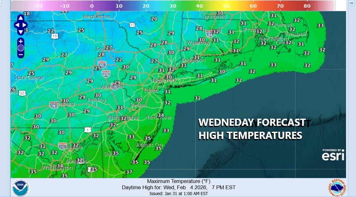
We continue to “enjoy” moderating temperatures though enjoy is in quotes because it is still cold and temperatures are still running below average. A weather system passed to our south and east overnight and this leaves us with a nice weather day with no worse than partly sunny skies. Temperatures will top out generally in the lower 30s this afternoon. Average highs this time of year are in the upper 30s to around 40 degrees. That is better than the days last week where we struggled to get out of the teens. Radars are quiet today and will remain so through the first part of Friday.
SATELLITE WITH LIGHTNING STRIKES
WEATHER RADAR
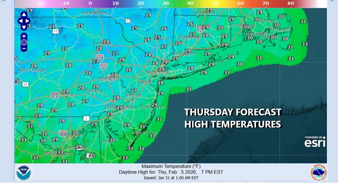
We do have a cold night ahead of us under clear skies. Thursday morning lows will be generally in the teens but inland areas will drop to the single digits. Thursday is looking like a nice day but on the cold side with sunshine. Temperatures Thursday afternoon will be a shade lower than today with highs in the upper 20s and lower 30s, and then down to the teens and single digits by Friday morning.
An arctic cold front will be approaching Friday so look for increasing clouds with most highs in the upper 20s to near 30 degrees. The front will come through and a low will develop offshore to the southeast of Long Island. There is a strong upper trough that accompanies this arctic front. Between the front and the low offshore plus the strength of the trough will likely set off a period of snow or snow showers Friday night into Saturday morning.
There might be enough energy with these systems that we could see anywhere from a coating to an inch or so in most places. Some odd spots could wind up with a bit more. The coastal development is too far offshore to create bigger snow issues but it will turn brutally cold. Depending on the timing of the frontal boundary, Saturday morning lows will be in the single digits and low teens and hold at those levels for the daytime Saturday. Couple that with a howling wind and we are talking wind chills in the -10 or lower range. The arctic cold shot continues into early next week before abating somewhat. No major storms are in the cards for the time being. We could see some snow Tuesday as a warm front sets up to our south and west.
BE SURE TO DOWNLOAD THE FREE METEOROLOGIST JOE CIOFFI WEATHER APP &
ANGRY BEN’S FREE WEATHER APP “THE ANGRY WEATHERMAN!
MANY THANKS TO TROPICAL TIDBITS FOR THE USE OF MAPS
Please note that with regards to any severe weather, tropical storms, or hurricanes, should a storm be threatening, please consult your local National Weather Service office or your local government officials about what action you should be taking to protect life and property.