Cold Night Ahead Dry Through The Weekend Through Wednesday

Weather in 5/Joe & Joe Weather Show Latest Podcast
Cold Night Ahead Dry Through The Weekend Through Wednesday
Our rain and wind storm is now pulling away to the east and the satellite shows the back edge of the bright white clouds are on the coast and moving east. Meanwhile an upper trough is moving through this evening with leftover clouds but as the night advances we will see skies clear. The winds have shifted to the northwest and that is starting to bring in colder air.
SATELLITE

By morning lows will be in the upper teens to mid 20s. Saturday is Boxing Day and if you think back to 10 years ago, we had the famous and historical Boxing Day snowstorm that produced 20 to 30 inches of snow across many areas from Eastern Pennsylvania to Southern New England. There is no such storm this weekend. We should have a dry cold weekend of sunshine Saturday with highs just back into the 30s. Saturday night into Sunday morning will be another cold night with lows in the upper teens to mid 20s Sunday looks to be a nice day of sunshine. Highs will be in the 30s.

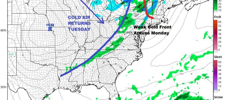
Monday sees another approaching cold front however all the energy with this passes to our north. There isn’t much precipitation with this so we are forecasting a mix of sun and clouds with highs in the 40s. We are going to leave any mention of showers out of the forecast. Behind the front is another shot of colder air for Tuesday and Wednesday. Both days we will have some sunshine with highs in the 30s and nighttime lows in the 20s.

New Years Eve and New Years Day looks like a repeat performance of what we just went through. If the timing remains the same we could see it play out the same way with increasing clouds and wind for Thursday with showers and some heavy rain Thursday night into Friday New Years Day. At first glance this system looks a little weaker than what we just went through but we will focus more on this in the coming days. We hope you had a lovely Christmas despite the weather and that you all have a nice weekend.
BE SURE TO DOWNLOAD THE FREE METEOROLOGIST JOE CIOFFI WEATHER APP &
ANGRY BEN’S FREE WEATHER APP “THE ANGRY WEATHERMAN!
MANY THANKS TO TROPICAL TIDBITS FOR THE USE OF MAPS
Please note that with regards to any severe weather, tropical storms, or hurricanes, should a storm be threatening, please consult your local National Weather Service office or your local government officials about what action you should be taking to protect life and property.


